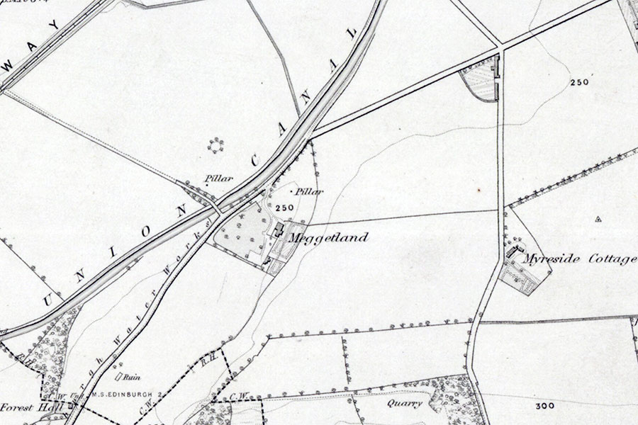
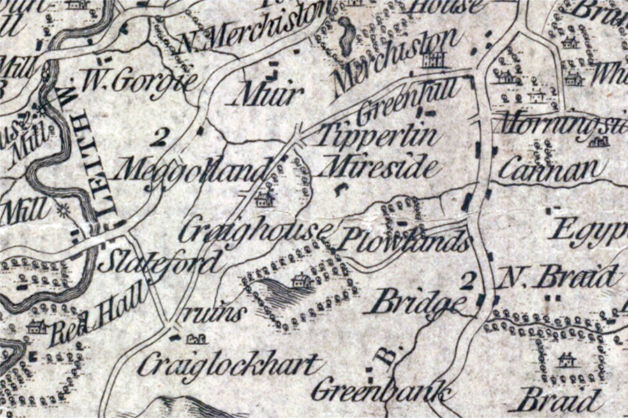
Meggetland
Ordnance Survey, 1852
Meggetland was an “ancient mansion” on the western edge of the Burgh Muir which was demolished in the 19th century.
Little seems to be known about Meggetland’s early history. It isn’t marked on Hendrik Hondius’ maps of 1630 and 1636, based on Timothy Pont’s late 16th century maps, nor does it seem to be marked on Gordon’s map of c.1636 – 1652 or Blaeu’s map of 1654. The first map I can find it on is Adair’s map of c.1682 where it is shown as Meggatland on a road from Merchiston Castle to Craiglockhart Castle (i.e. what is now Colinton Road), marked with the same tower symbol as neighbouring castles.
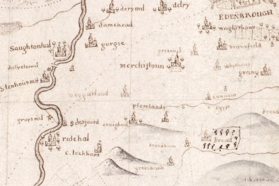
John Adair, c.1682
The origin of the name is unclear. It’s earliest recorded appearance is seemingly in the The Register of the Great Seal of Scotland in 1654 as Meggitland, with variations of the spelling appearing throughout the 17th and 18th centuries. It may have been named after someone with the surname Megget (or one of its variations) which occurs in various records of the 16th and 17th centuries.
The name may also refer to the local topography, with “mig-et” meaning “bogginess”. The house was built on the western edge of the Burgh Muir, with the nearby Myreside also suggesting a boggy area, on slightly raised ground.
Another possibility is that it was named after the Meggetland on the edge of the ancient royal forest of Ettrick in the Borders, the colloquial name for the Megget valley. That Meggetland was the ancient seat of the Meggets of that Ilk, owned by the Cockburn family in the 13th century and granted to Sir James Douglas by Robert the Bruce as part of Ettrick Forest in 1324. It returned to the crown upon the forfeiture of the Earl of Douglas in 1455, and passed to the Hays of Yester soon after. Meggetland remained in the Hay family until 1686 when John Hay, 2nd Earl of Tweeddale, sold it to William Douglas, 1st Duke of Queensberry, to settle debts. The property passed down to the Earl’s descendants the Earls of Wemyss and March.
It’s conceivable that one of these families may have brought the name to a newer property situated on what was then the western edge of the Burgh Muir outside Edinburgh, but it’s perhaps more likely that the name came from its location in a boggy area or from its owner.
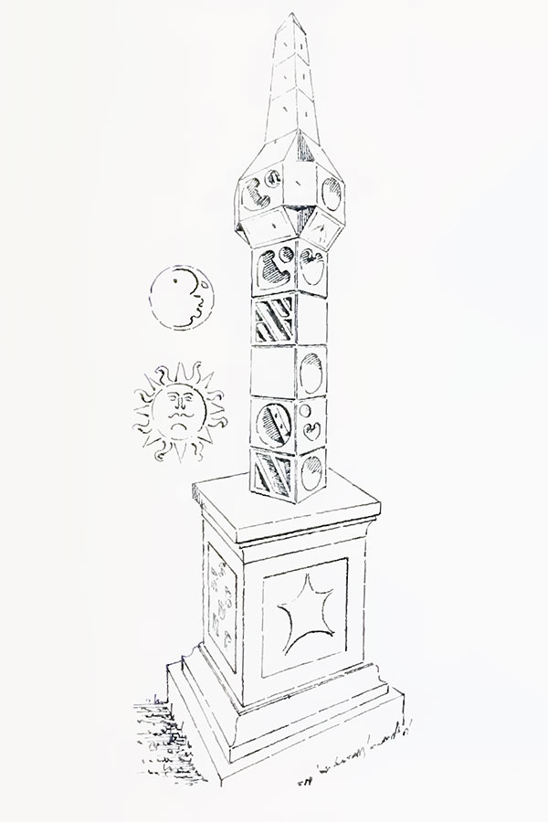
I have been unable to find any architectural descriptions of what was known as Meggetland House, however a tall, ornately-carved sundial which stood in the grounds to the north of the house was probably 17th century in date and is stylistically similar to examples found at Lochgoilhead, Barnbougle and Barnton. It is decorated with several representations of the sun, moon and a star and also features the initials RB and DHP (the last initial is indistinct and it may actually be DHR or DHB).
David MacGibbon and Thomas Ross, Edinburgh, 1892
A William Rutherford of Meggatland was buried in Greyfriars Kirkyard in 1672 leading to the intriguing possibility that the obscured initial on the sundial is an R for Rutherford. In 1676 a merchant named John Henderson was described as “the young laird of Meggetland”, dying in 1699. A James Brown of Megatland is mentioned in 1708 and a James Brown of Meggitland is referred to in 1710 and 1715 when he was described a tenant of Saughton-Milnes or Stonhope-milnes.
After seemingly passing through several families in the late 17th century the Sivwright family (also recorded as Sivewright, Seivewright and Sievewright) seem to have owned Meggetland for a longer period in the 18th century. A David Seivewright of Meggetland is referred to in 1732, while in the mid-18th century it was owned by Thomas Sievewright or Sivwright, a merchant. Later still another Mr Sievewright is described as being the late owner of “South-house and Meggetland”.
In 1773 the property appeared on Andrew and Mostyn Armstrong’s map as Meggotland, illustrated with the same symbol used for other castles in the vicinity.
Andrew and Mostyn Armstrong, 1773
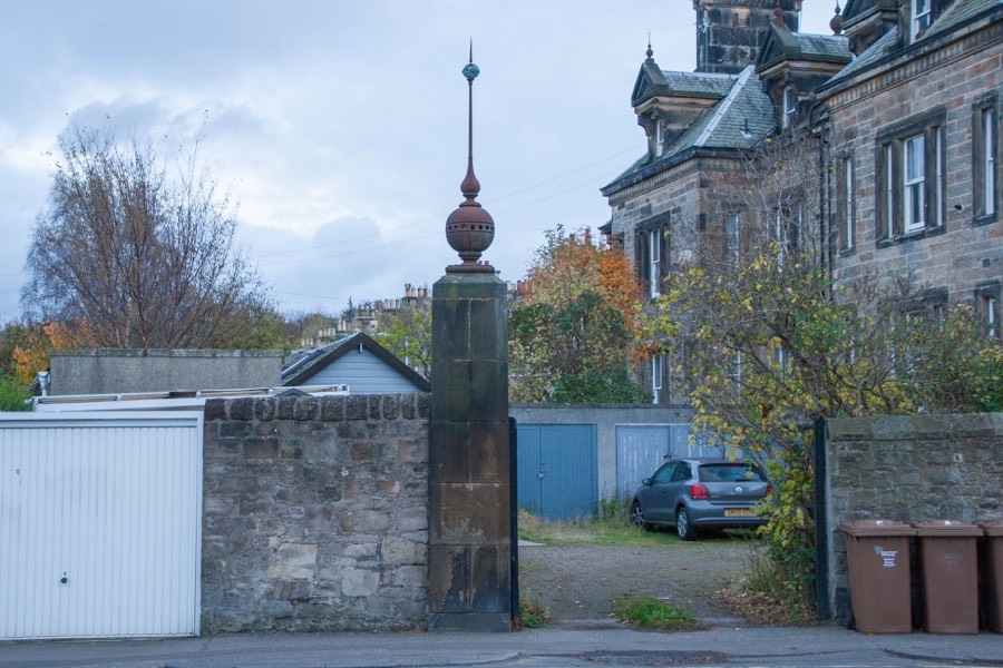
During the first quarter of the 19th century the Union Canal, which was completed in 1822, was built through the estate. This led to a stone pillar belonging to Meggetland becoming marooned in a field on the opposite of the canal. What function this stone pillar served is unknown however it may have been one of a pair of gateposts marking a distance entrance to the estate.
Jessica Duncan, better known as Jessie Piazzi Smyth after marrying the Astronomer Royal for Scotland Charles Piazzi Smyth, moved to Meggetland House with her mother Jannet in 1844. Following her marriage in 1855 she and her husband travelled extensively making astronomical observations and by 1864 the house seems to have been lived in by a John Cunningham, a seedsman. These residents may have been tenants as a Bedall Sivwright of Southhouse and Meggetland is referred to in 1874.
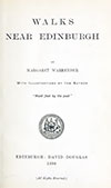
Several late 19th century sources refer to the ancient mansion of Meggetland having been demolished, some time before 1883. For example in the late 19th century book “Walks near Edinburgh” a walking route from Colinton towards Edinburgh past Craiglockhart Castle is described thus:
Half a mile farther on, where the Union Canal comes close to the road on the left, we look across it and see a solitary gate-pillar standing in a field. This, and a curious old pillar sun-dial on the opposite side of the road, are all that remain of the ancient mansion of Meggetland”
Walks near Edinburgh
Margaret Warrender, Edinburgh, 1890
However Meggetland appears on later maps. The late 19th century sources are very definitive about the house having been demolished which must mean that either its inclusion on the later maps is a mistake or perhaps that the original Meggetland was replaced by a later house of the same name. This latter scenario seems unlikely as there is no mention of a new house. Meggetland is marked on the Ordnance Survey’s 25 inch to the mile maps of 1895, 1908, 1914 and 1933. The pillar across the canal is shown on the 1895, 1908 and 1914 maps but not on the 1933 map when the land had been developed into sports pitches for the University and a pavilion constructed. The sundial is shown on the 1908 and 1914 maps but not on the 1895 or 1933 maps.
A slightly different picture emerges when consulting Bartholomew’s plans of Edinburgh published for the Post Office. Meggetland is marked on the late 19th and early 20th century maps until its disappearance on the 1932-33 when the plot’s boundary and the driveway are illustrated but the house itself has gone. The following year’s edition shows new houses built within the plot, along Colinton Road and the newly-created Meggetland Terrace which approximately follows the boundary of the 19th century plot, and outlines of plots for houses that appear on the next edition.
The sundial from Meggetland was acquired by Sir William Burrell and taken to Hutton Castle, later moving to the Burrell Collection in Glasgow following Sir William’s death in 1958.
The pillar, an impressively tall structure, seems to have been moved to the Colinton Road entrance to a 19th century villa at 1 Lockharton Gardens, and is crowned with a decorative metal finial. The finial matches similar details on the top of the villa’s window pediments so is most likely a Victorian addition.
It is difficult to draw a definitive conclusion from the available evidence. The early maps are not always comprehensive so Meggetland not being depicted on them doesn’t necessarily suggest that a building hadn’t yet been built. The depiction on Adair’s map and also that on the Armstrongs’ map suggests that Meggetland may well have been a castle or tower house. The existence of an ornate probable 17th century sun dial indicates a property of some status, and built at that time on the edge of the relative wilds of the Burgh Muir it is likely to have been defensive in nature. In the absence of any stronger evidence it needs to be considered a “possible”.
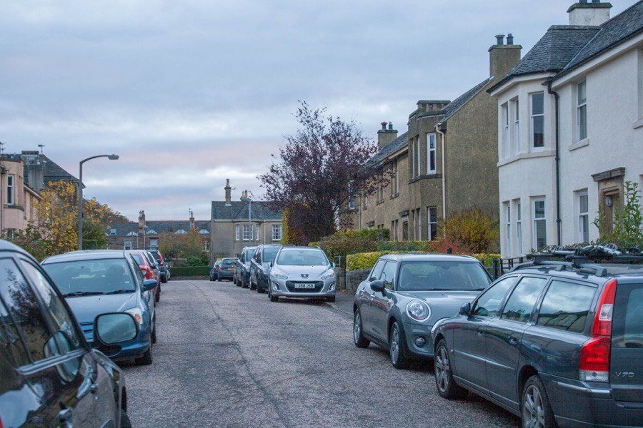
The name lives on in the streets Meggetland Terrace, North Meggetland, Meggetland Wind and Meggetland View. The “ancient mansion” of Meggetland stood just in front of where 18 and 20 Meggetland Terrace now stand.


Alternative names for Meggetland
Megatland; Megetland; Meggatland; Meggetland House; Meggitland; Meggotland; Meghetland
Where is Meggetland?
Meggetland is in the parish of Edinburgh and the county of Midlothian.
Grid reference:NT 23221 71118
Lat / long:55.9269857,-3.2303131