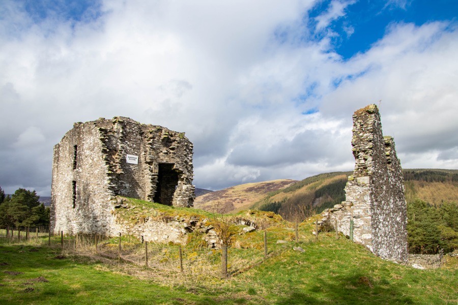
Elibank Castle is a ruined late 16th century tower house which sits within contemporary terraced gardens.
Elibank was originally known as Eliburn and in 1511 James IV granted a charter of the lands and forests of Aleburne to Catherine Douglas, the widow of John Liddale, and their son, also John. The charter obliged them “to build upon their property an adequate house of stone and lime, with a hall, chamber, barn, cattle-shed, stable, dovecot, garden, orchards and beehives”. This would suggest that the Liddells built the first castle here.
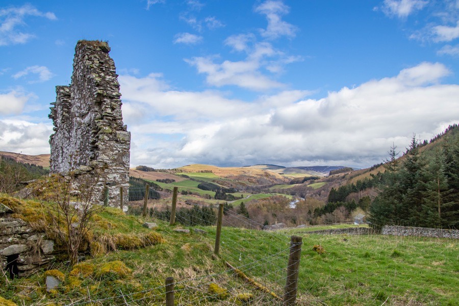
The castle stands on the lower slope of the north-east side of Elibank Law with commanding views to the north-west and south-east along the Tweed valley.
It sits on a roughly square artificial plateau excavated into the hillside to the south-west with the ground on the other three sides having been built up. This platform may post-date the Liddells’ castle, the original form of which is not known. It may have been a free-standing rectangular tower at the north-west corner of the plot.
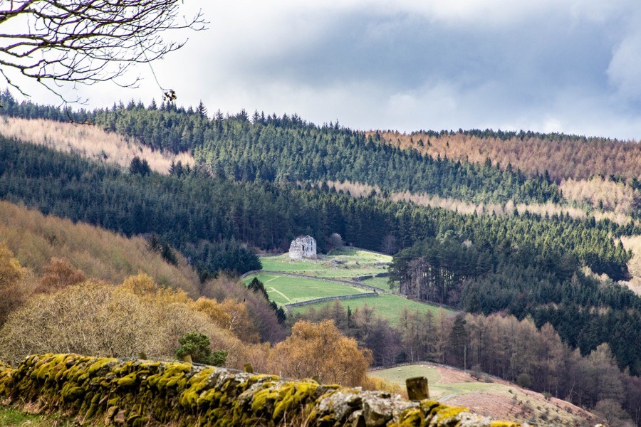
It was one of a series of towers along the Tweed valley, each of which was visible from the next. Elibank would signal to Holylee, Holylee to Scrogbank, Scrogbank to Caberston, Caberston to Bold, Bold to Purvishill and then on to a continuing chain from Innerleithen to the north-west.
The signal would then pass along to Traquair, Grieston, Ormiston, Cardrona, Nether Horsburgh, Horsbrugh, Haystoun, Peebles and on to Neidpath. From Neidpath it would continue to Caverhill, Barns, Lyne, Easter Happrew, Easter Dawyck, Hillhouse, West Dawyck, Dreva and on to Tinnis.
In 1594 or 1595 Sir Gideon Murray of Glenpoit, the son of Sir Andrew Murray of Blackbarony, acquired Eliburn from John Liddell, renamed it Elibank and extensively remodelled the castle.
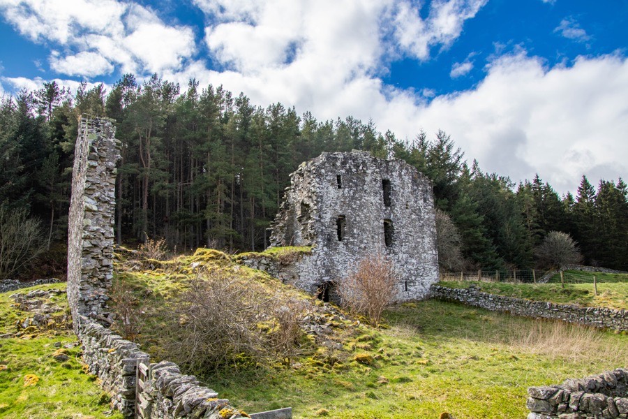
The main block of the castle is aligned approximately north-west to south-east and measures around 21m north-west to south-east by around 6.9m south-west to north-east. A small square wing measuring around 7.6m by 7.6m projects to the east from the south end of the main block to form an L-plan building.
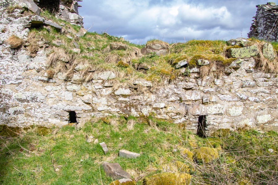
The basement of the main block is vaulted and divided into two chambers accessed via a low doorway in the middle of the north-east wall.
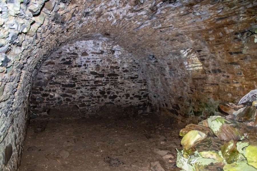
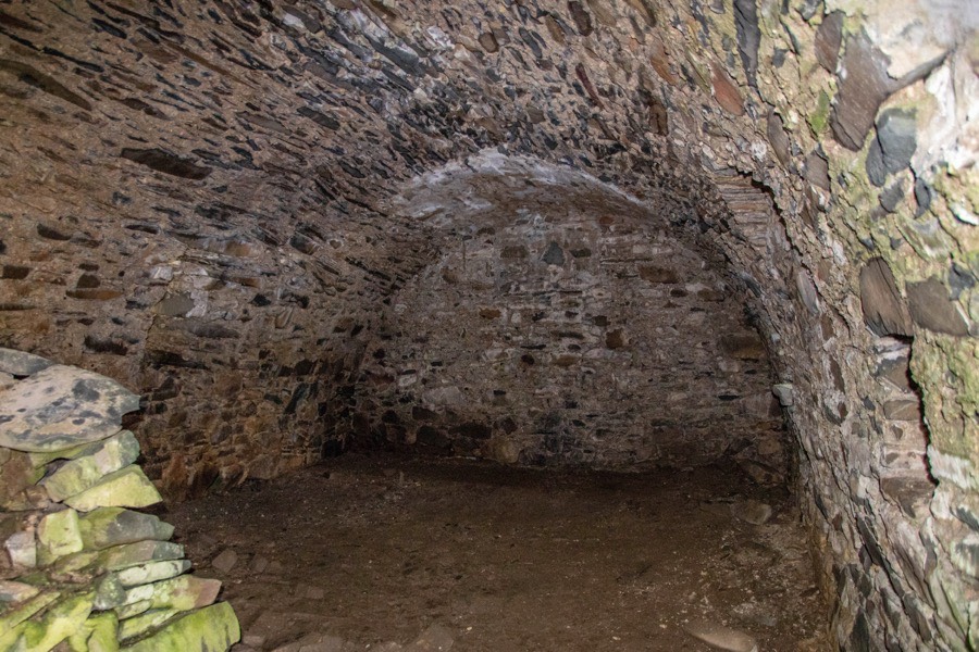
A separate vault beyond the southernmost vault was accessed via the now collapsed vaulted basement of the smaller projecting wing. The vaulted chambers in the main block are lit by arrow-slit windows on both the north-east and south-west long walls of the castle. The northernmost vault has one window in each wall while the southernmost has two in each wall.
At the north end of the main block a tower is largely intact to second floor level, and this may represent the oldest part of the castle built by the Liddells. The first floor level is vaulted and was entered via a doorway in the south-east wall which probably connected it to a main hall in the rest of the block, now fallen. A spiral staircase leads up from the To the south-west of the doorway are the remains of a fireplace.
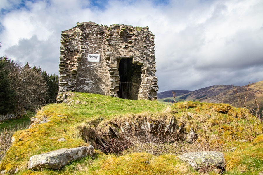
The tower has a tall, narrow window on each of its external sides at first floor level, that is the north-west, north-east and south-west walls, and a small fireplace on the north-west wall. The second floor level features the same window arrangement but the fireplace is on the south-east wall.
The only other part of the castle to stand above ground floor level is the south-east gable of the square projecting wing, which has a window at second floor level. Rubble from the upper storeys of the main block has now fallen into the re-entrant angle.
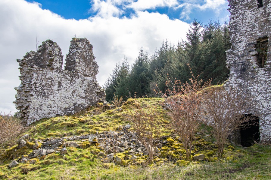
Relatively modern low rubble-built walls now extend from the north-east corner of the main block and the south-east corner of the projecting wing, but these are thought to correspond with the layout of original walls enclosing a courtyard. At the north-east corner these walls form a square offshoot which is believed to mark the position of an original gateway into the courtyard.
To the north and east of the castle the slopes of the hill were terraced and landscaped to create elaborate gardens befitting the status of Sir Gideon, and a walled lane leading to the castle. Sir Gideon’s son, Patrick, was created a Baronet, of Elibank, in the Baronetage of Nova Scotia in 1628 and in 1643 was created Lord Elibank. Elibank remained in the Murray family but by 1772 it was in ruins.


Alternative names for Elibank Castle
Aleburne; Aliburn; Elibank Tower; Eliburn; Elybanck