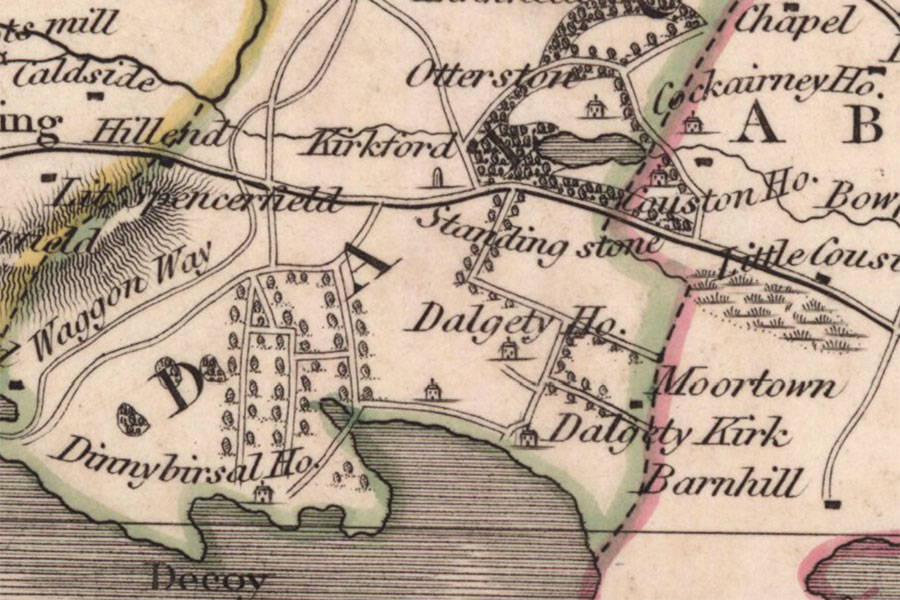

John Thomson, Edinburgh, 1827map image courtesy of NLS
Dalgety House was in existence in the late 16th century but whether or not it was a defensible building is unclear, so for now I have listed it as a possible castle.
The first mention of the lands of Dalgety seems to be in the 12th century when William I gave them to Cormacus, the Bishop of Dunkeld. This would have been some time between the King’s ascension to the throne in 1165 and the Bishop’s death in 1177. There was a church at Dalgety by at least 1178, dedicated to St. Bridget and later transferred into the possession of Inchcolm Abbey.
Whether or not the church possessed the wider lands of Dalgety at this time is unclear, however around 1220 Richard, son of Hugh de Camera, granted an oxgang of land in the territory of Fordell to the Abbey. The donated land was described as being between Dalgety and Leuchat so it’s possible that he also owned Dalgety at that time.
The lands of Dalgathy and Dalgathee are mentioned in charters of 1464 and 1482 when James III granted them to his cousin William Abernethy, 2nd Lord Saltoun. Dalgety was still held by William’s nephew, Alexander Abernethy, 4th Lord Saltoun, in the first quarter of the 16th century.
In 1593 Sir Alexander Seton, later 1st Lord Fyvie, bought Dalgety from the Abernethy family and “repaired and beautifyed with gardens”, “extended and ornamented it”. This would suggest that the house existed before 1593 which makes it more likely that it had defensive features but certainly doesn’t confirm it.
The house stood in an elevated position above St. Bridget’s Kirk looking out across the River Forth to Barnbougle Castle. It is marked as a tower on Blaeu’s mid-17th century map as Dalgotie, inland to the north-east of Leuchat and north of Dalgethy Kirk (St. Bridget’s Kirk).
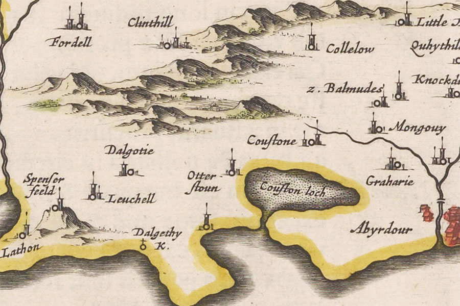
Joan Blaeu, Amsterdam, 1654map image courtesy of NLS
Dalgety House was the favourite residence of Sir Alexander, who was appointed Lord Chancellor of Scotland in 1604 and was created the 1st Earl of Dunfermline in 1605. Whether Sir Alexander was responsible for building Dalgety House or it already existed by this time is not known, and neither is the form it took however it was described as the “Manor place of Dalgatie” in a writ of 1611.
Sir Alexander had married Lilias Drummond, the daughter of Patrick Drummond, 3rd Lord Drummond. Lilias died at Dalgety in 1601. In the same year Sir Alexander married his second wife, Grizel Leslie, the daughter of James Leslie, Master of Rothes. Their youngest daughter, Jean, later married John Hay, 8th Lord Yester.
Around 1607 Sir Alexander married his third wife, Margaret Hay, the sister of his son-in-law the aforementioned John Hay. Sir Alexander granted his new wife “in liferent the lands of Dalgatie and Dunduf, in the shire of Fife” along with other properties and “an annual rent of 1000 merks from the lordships of Fyvie and Urquhart“.
In 1622 Sir Alexander died at Pinkie House following an illness. Three days after his death his body was transported by boat across the Forth to Dalgety House and he was buried in his vault at St. Bridget’s Kirk.
Sir Alexander was succeeded as Earl of Dunfermline by Charles Seton, his son from his marriage to Margaret Hay, daughter of James Hay, 7th Lord Hay of Yester. Charles was a Royalist and fled Scotland in 1649 following the execution of Charles I but returned the following year with Charles II. He was succeeded in turn by his eldest son Alexander Seton.
In 1677 a Yorkshireman named Thomas Kirk travelled through Scotland keeping a journal as he went. On the 6th of June he visited Aberdour Castle and….
From thence to my Lord Dunfermling’s house at Dogetty, a mile further. The garden and walks here are likewise in very good order. The house is little and very low, having no chambers in it, though the few rooms there are, are in indifferent good order.
Thomas Kirk, 1677
Later that year Alexander died without issue and was succeeded by his brother James Seton whose estates and titles were forfeited in 1690 following his involvement in the Jacobite rising of 1689. Later Dalgety was described as “the dwelling of the Lord Yester” suggesting that it perhaps passed to the Hay branch of the family following Seton’s forfeiture.
The exact location of the site of Dalgety House is difficult to ascertain with any certainty as it depends on the accuracy of old maps, something for which they are not always known. Roy’s Military Survey of Scotland published in the mid-18th century shows Delgatty as a U-plan house at the centre of a landscaped estate with the house just to the west of the road which runs north from St. Bridget’s Kirk. It appears to be to the west of what could be interpreted as a walled garden and would possibly be located somewhere between Inchmickery Road and Dalgety Gardens today.
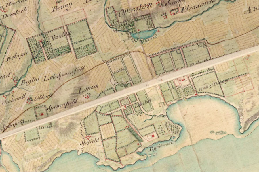
William Roy, 1747 – 1752map image courtesy of NLS
By 1760 Dalgety was the property of Francis Stuart, 9th Earl of Moray, having presumably been absorbed into the Donibristle estate. Dalgety House is marked on John Thomson’s map of 1827 but with few clues as to its exact location. On Sharp, Greenwood & Fowler’s map of 1828 however what appears to be the main house is shown to the east of a walled garden with a second slightly smaller building within the garden itself to the south-west.
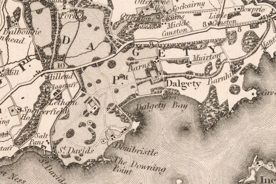
Sharp, Greenwood & Fowler, London, 1828map image courtesy of NLS
By the time of the Ordnance Survey’s map of the area in 1856 Dalgety House isn’t labelled but Dalgety Gardens are, with a substantial house shown within the gardens near the entrance on the east side corresponding with the smaller building shown on Sharp, Greenwood & Fowler’s earlier map. A smaller building is shown just to the north-east of the entrance outside the gardens and later editions of the Ordnance Survey maps identify this as a doocot.
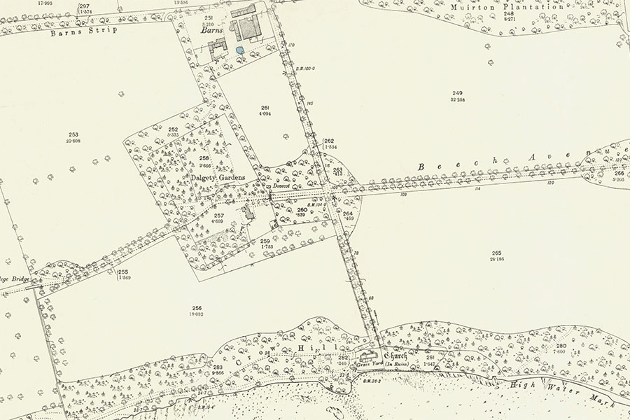
Ordnance Survey, 1896map image courtesy of NLS
This lectern doocot has been attributed to the 18th century although it certainly shared stylistic similarities with other 17th century lectern doocots so may in fact have been contemporary with the Seton house. It has been associated with Donibristle House although an association with Dalgety House seems much more likely given the proximity of its location. The doocot was demolished in May 1965 during the building of the new town of Dalgety Bay.
Writing in 1884 Francis Groome stated that “of Seton’s favourite residence, Dalgety House, not so much as a stone remains”. The same house visible on the Ordnance Survey map of 1856 is shown on Ordnance Survey maps right up until 1960 which would suggest that this was not Dalgety House if Groome was correct. However the position of this building seems to correspond with that marked on Roy’s and Sharp, Greenwood & Fowler’s maps, so perhaps it was built on the site of the old Dalgety House.
The later house was presumably demolished some time after 1960 and before 1965 when the doocot was removed, and the current location of the house’s site would appear to be towards the east end of Dalgety House View.
Alternative names for Dalgety House
Dalgady; Dalgathe; Dalgathee; Dalgathie; Dalgathin; Dalgathy; Dalgathye; Dalgathyn; Dalgati; Dalgatie; Dalgaty; Dalgatye; Dalgetty; Dalgothie; Dalgotie; Dawgathie; Delgathie; Delgatie; Delgatty; Dogetty; Galgatie


