
Craigentinny Castle is a much-altered building, but appears to date back to the 16th century, although who built it is not clear.
In the 16th century Craigentinny was owned by the Logans of Restalrig, however towards the end of the century Sir Robert Logan of Restalrig ran into financial difficulties and began selling off some of the family’s properties.
In 1604 Sir Robert split the barony of Restalrig into three parts – Lochend or Easter Restalrig, Calton or Wester Restalrig, and Craigentinny. Craignetinny was sold to an Edinburgh merchant named James Nisbet, the eldest son of Henry Nisbet, a former Provost of Edinburgh.
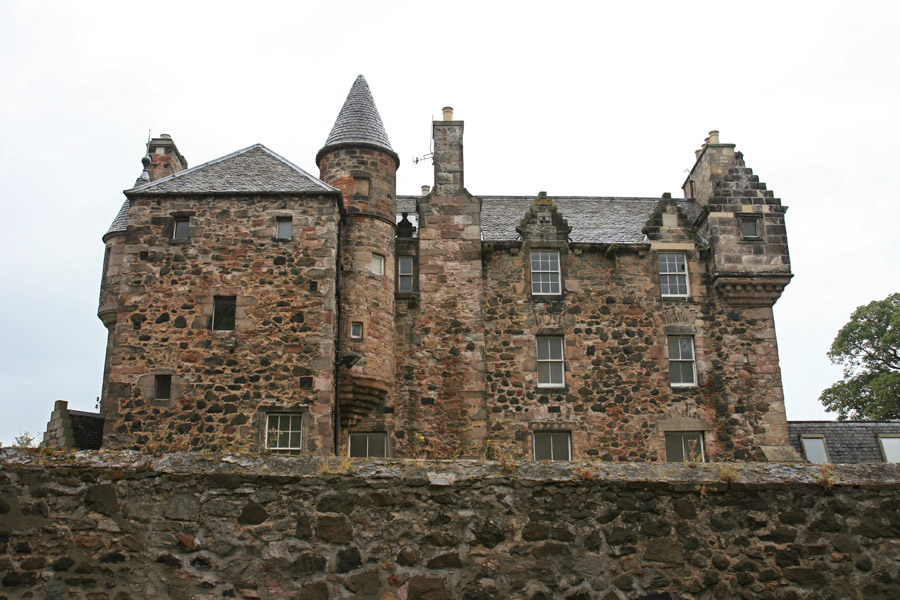
Parts of Craigentinny Castle would appear to be older than 17th century so it may well have been the Logans who built the first castle here. The oldest part of the castle is a square tower now forming the south-west corner of the property, rising to a height of three storeys and a garret. The main entrance is at the bottom of this tower, and opens out onto a wide stair which gives access to the first floor.

Whether the tower was a free-standing keep or built on an L-plan is unclear, but it now projects from a larger wing running approximately west-south-west by east-north-east, which was possibly added in the 17th century. In the re-entrant angle to the east is a corbelled-out round tower at second floor level, and rising above the level of the roof.
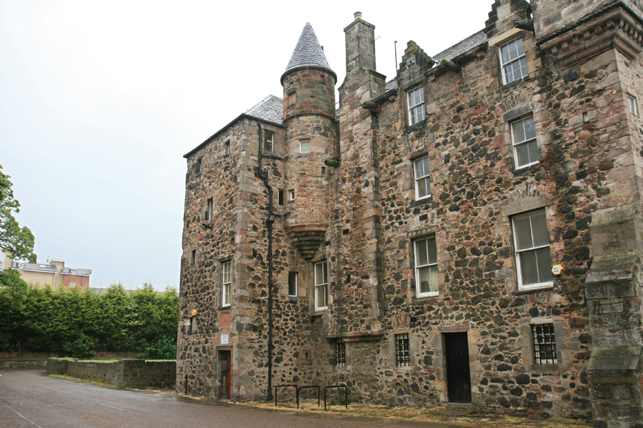
The main east wing has three small windows at ground level, and another doorway. On this south elevation is a large chimney, slightly protruding from the wall from first floor height upwards. This may have been for a kitchen on the ground floor of the main block.
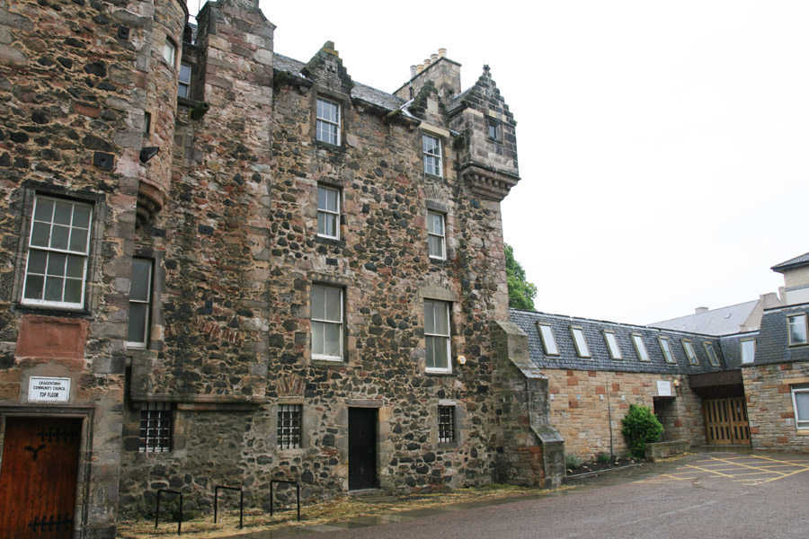
Craigentinny passed to James’s son, Sir Henry Nisbet of Craigentinny, and upon Sir Henry’s death in 1667 it passed to his son, Sir Patrick Nisbet of Craigentinny. In 1672 Sir Patrick exchanged Craigentinny with his cousin, Alexander Nisbet, for the estate of Dean. Craigentinny Castle remained in the Nisbet family for the following 90 years.
In 1762 the castle was sold by John Scott-Nisbet, the last Nisbet of Craigentinny, to William Miller, a seed merchant from Edinburgh. Miller’s father, also William Miller, had previously bought the lands of Philliside (also known as Phillyside or now Fillyside) to the north of the Craigentinny estate, and left money for his son to buy Craigentinny Castle. The younger William Miller remodelled the interior and added a new entrance to the north side at first floor level.
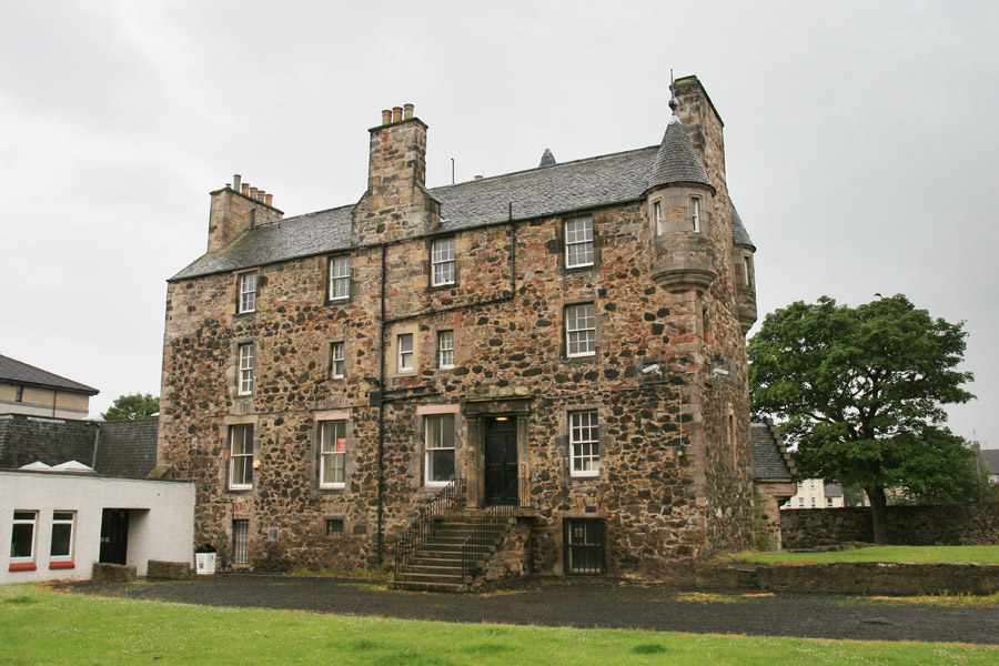
Interestingly the stair case to this new entrance doesn’t appear on what looks like an early 20th century newspaper photograph of the castle, although the carved door surround can just be seen, suggesting perhaps that this entrance fell out of use.
Craigentinny is shown as a substantial building on Knox’s 1816 map of Edinburgh.
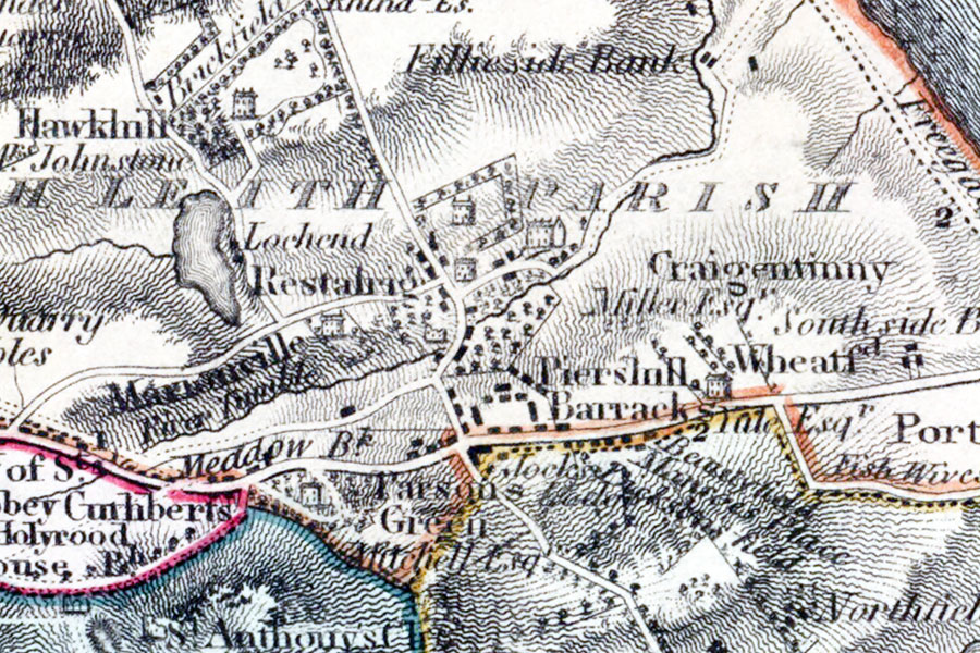
James Knox, Edinburgh, 1816map image courtesy of NLS
By the early 19th century Craigentinny had passed to Miller’s grandson, the eccentric William Henry Miller, who was known for being a book collector and also a Member of Parliament for Newcastle-under-Lyme. Following his death, unmarried, at Craigentinny in 1848, Miller’s will stipulated that Craigentinny was to be left, along with substantial debts, to two unmarried sisters by the name of Marsh, seemingly unrelated to him.
The sisters’ newly-acquired debts were settled by a relation of Miller’s, Samuel Christy, who had been named next in line to the sisters in the will. Following their deaths Craigentinny was inherited by Christy who changed his surname to Christie-Miller.
In 1852 Christie-Miller commissioned David Rhind to make Scots Baronial additions to Craigentinny House, the stables and the coach house. To the west of the square tower the main block continues for a short distance, and is topped off with a pair of corbelled turrets with conical roofs flanking a wide chimney, all of which must be the work of Rhind.

Craigentinny is marked on the Ordnance Survey map of 1853 with extensive gardens to the north and west, and a long projecting wing to the east which was added by Rhind.
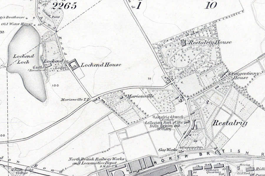
Ordnance Survey, 1853map image courtesy of NLS
In 1931 the City Corporation of Edinburgh made a compulsory purchase of 62 acres of the Craigentinny estate from the Christie-Millers for housing, with council housing forming the area of Restalrig around the castle and private housing to the east forming the area of Craigentinny. The Castle was left empty and was under threat of demolition until it was bought in 1937 by the City Corporation and converted into a community centre.
In 1942 the east end of Craigentinny House was hit by two German bombs, which inevitably caused substantial damage. They destroyed Rhind’s east wing, and a tall round tower which stood at the north-east corner of the existing block, plus a small round tower which was only one storey in height.
It’s worth mentioning at this point a strange round tower at ground level, and a single storey in height, in the smaller re-entrant angle to the west of the main door. It has a corbelled-out square top to it, with crow-stepped gables and pitched roof. It looks very out of place in its current position, and originally I thought it looked like the caphouse of a round stair tower which may have been relocated following the bomb damage.

However a similarly-shaped roof can be seen in the same position in a print from Cassell’s Old and New Edinburgh from 1881, so it would appear to be a Rhind addition.
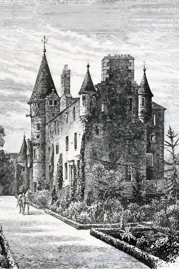
I have seen one reference suggesting that it was a west wing built by Rhind that was destroyed during the Second World War, and that the low walls to the west of the house are the remains of the foundations of this wing. However from the image in Old and New Edinburgh it would appear that these are just raised flower beds, and that it was just a mistake confusing east and west.
The City Corporation continued to own the castle after the War, and was also used by their successors Lothian Regional Council, who in 1978 built a simple, soulless, modern extension onto the east gable, spoiling the overall look of the castle considerably.
Today the castle is used by the City of Edinburgh Council as Craigentinny Community Education Centre serving the communities of Lochend, Restalrig and Craigentinny. The rooms in the castle now contain a youth club, office, art room, training studio, games room, disco and lounge.
Alternative names for Craigentinny Castle
Craigantinnie; Craigentinnie; Craigentinny House; Craigintinnie; Craigintinny; Crigintinnie


