
Wedderburn Castle, of which nothing now remains, was originally known as the castle of Easter Powrie.
The lands of Easter Powrie, along with those of Wester Powrie and the barony of Ogilvie in Glamis parish, were granted to Gilbert, son of Gille Brigte, the Earl of Angus, by William the Lion some time in the late 12th century. The family took the name Ogilvy, and the Ogilvy family would own Easter Powrie until the 16th century, when the property passed to the last male Ogilvy heir.
Exactly when the first castle was built at Easter Powrie is unclear, however it is likely that it was built by the Ogilvies, probably in 12th or 13th centuries, and added to or rebuilt in later centuries. It appears on Pont’s late 16th century map of “Lower Angus and Perthshire east of the Tay” as “E. Poury”, along with a drawing of the castle as a tall tower flanked by what looks like a courtyard entrance.
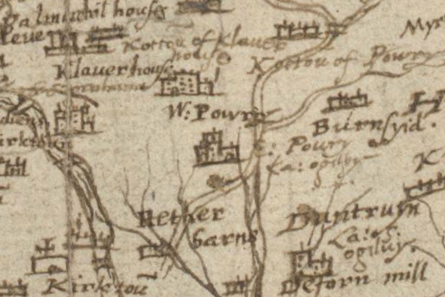
The last male Ogilvy heir was another Gilbert Ogilvy, who sold the barony of Ogilvy and Easter Powrie to James Durham of Pitkerro, son of Alexander, the sixth baron of Grange of Monifieth, in 1593.
The Durham family don’t appear to have owned Easter Powrie for long, selling the lands to a Dougald McPherson who sold them onto Alexander Wedderburn, the Provost of Dundee, in 1662. Robert Edward’s map of 1678 shows “Easter Poure” Castle within a walled enclosure.
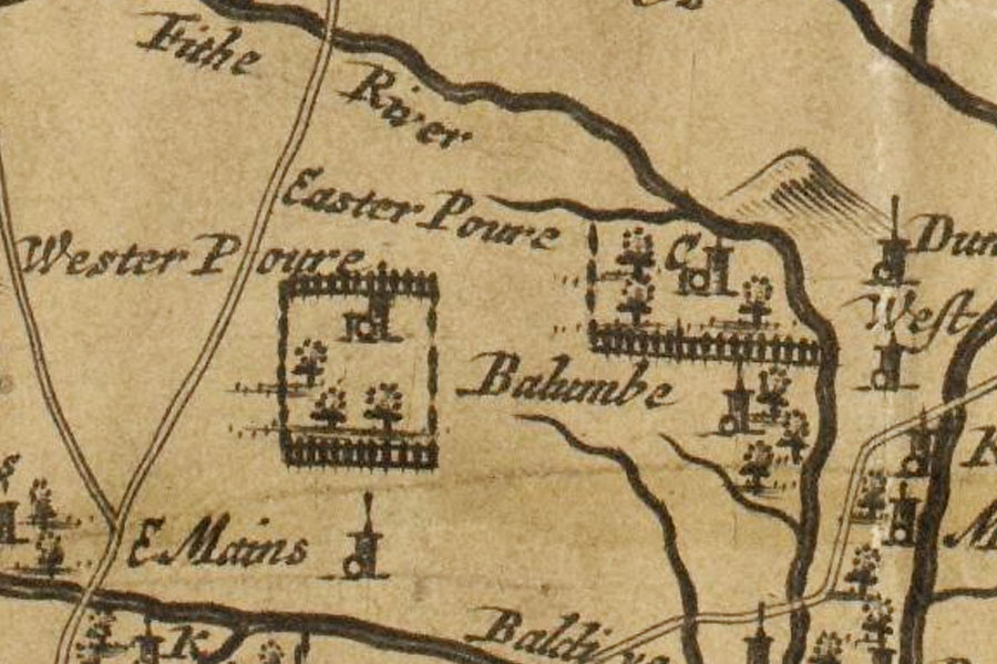
In 1708 the Wedderburns obtained a Crown charter erecting the lands of Easter Powrie into the barony of Wedderburn, and Easter Powrie Castle was renamed Wedderburn Castle.
The male line of the Wedderburns of what was Easter Powrie became extinct in 1761 upon the death of David Wedderburn of Wedderburn, and the estates passed to another branch, the Scrymgeour-Wedderburn family.
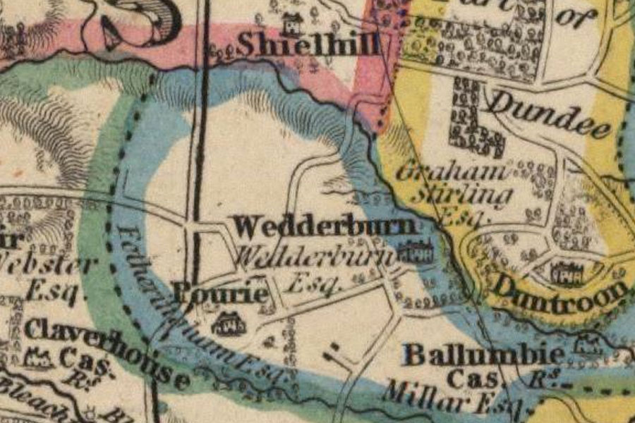
James Knox’s map of 1850 still shows Wedderburn as a substantial building, and still possessed by the Wedderburn family.
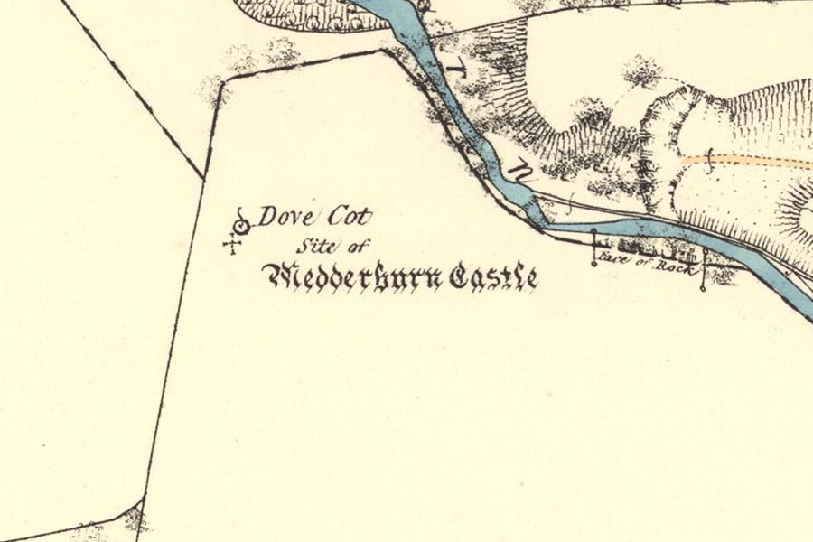
However by the second half of the 19th century the castle had been demolished, although the position of the castle is marked on the Ordnance Survey 25 Inch map which was surveyed in 1858 and published in 1865 (see the image at the top of the page).
All that is left on the site now is a ruined dovecot, just to the north east of where the castle once stood. Whether or not the dovecot is contemporary with the castle or has been built later using stones from the castle is unclear.
It is circular in form, with a diameter of around 9 metres, and rises to a height of around 4.5 metres although it is now roofless.
Several dressed stones from the castle were built into the farm buildings at Barns of Wedderburn. Interestingly one of the stones, which appears to be a pediment from above a window, has the letters “S” and “D” carved in the bottom two corners of the triangle, while the top corner has broken off and is missing. At the centre of the pediment is a shield containing wavy lines, surmounted by a crown.
It’s tempting to suggest that the missing letter is “J”, with “SJD” standing for “Sir John Durham”, although the Durhams appear not to have possessed Wedderburn Castle for long.
NB: Not to be confused with Wedderburn Castle in Berwickshire.
Alternative names for Wedderburn Castle
East Powrie; Easter Poure; Easter Poury; Easter Powrie; Pourie


