Tullibardine Castle was an old castle belonging to the Murray family but was completely demolished in the 19th century.
The lands of Tullibardine seem to have been an early possession of the Earls of Strathearn. In the 13th century Conal or Conghal, son of Duncan, son of Malise, received from Robert, Earl of Strathearn, the villa of Catherlavenach which was also known as Tullibardine. Conal married Ada, daughter of Ralf or Radulf, and they had two daughters and co-heiresses, Muriella or Muriel and Maria or Mary. Muriel married Malise, Earl of Strathearn, taking with her half of Tullibardine, “the lands of Buchanty, &c., being the half of Finach” and part of Lethendy. The corresponding halves of these lands went to Maria.
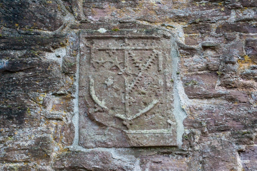
In 1284 Maria granted her half of Tullibardine to her niece, Ada, the daughter of Muriel and Malise, who was married to Sir William Murray and so Tullibardine passed into the Murray family. The Murrays were most likely responsible for building a castle here. Exactly when the first castle was built is not known, however it definitely pre-dated the nearby Tullibardine Chapel which was built in 1446 by Sir David Murray of Dumbarton. On the north transept of the chapel are a pair of heraldic panels carved with coats of arms which have the appearance of perhaps being inserted at a later date. Whether or not they are original to the chapel or perhaps came from the castle I have not yet been able to ascertain.

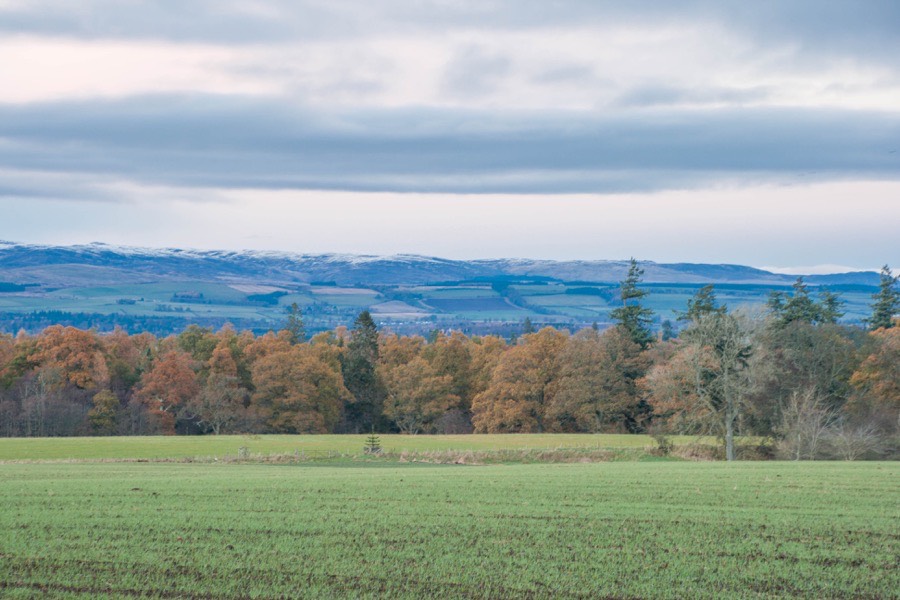
The castle stood on a slight rise around 400 metres north of the chapel and around 150 metres west of the Tullibardine Chair Tree, a huge ancient oak tree in the Birks of Tullibardine.
In 1444 Sir David Murray received a charter of various lands from James II which were incorporated into the barony of Tullibardine. By 1450 Sir David was Bailie of the Earldom of Strathearn and Keeper of Methven Castle. Following Sir David’s death in 1451 or 1452 he was succeeded by his son, William Murray, who like his father was Bailie of the Earldom of Strathearn but also Shield Bearer to the King, Sheriff of Perth and Keeper of Doune Castle (from 1456 to 1458).

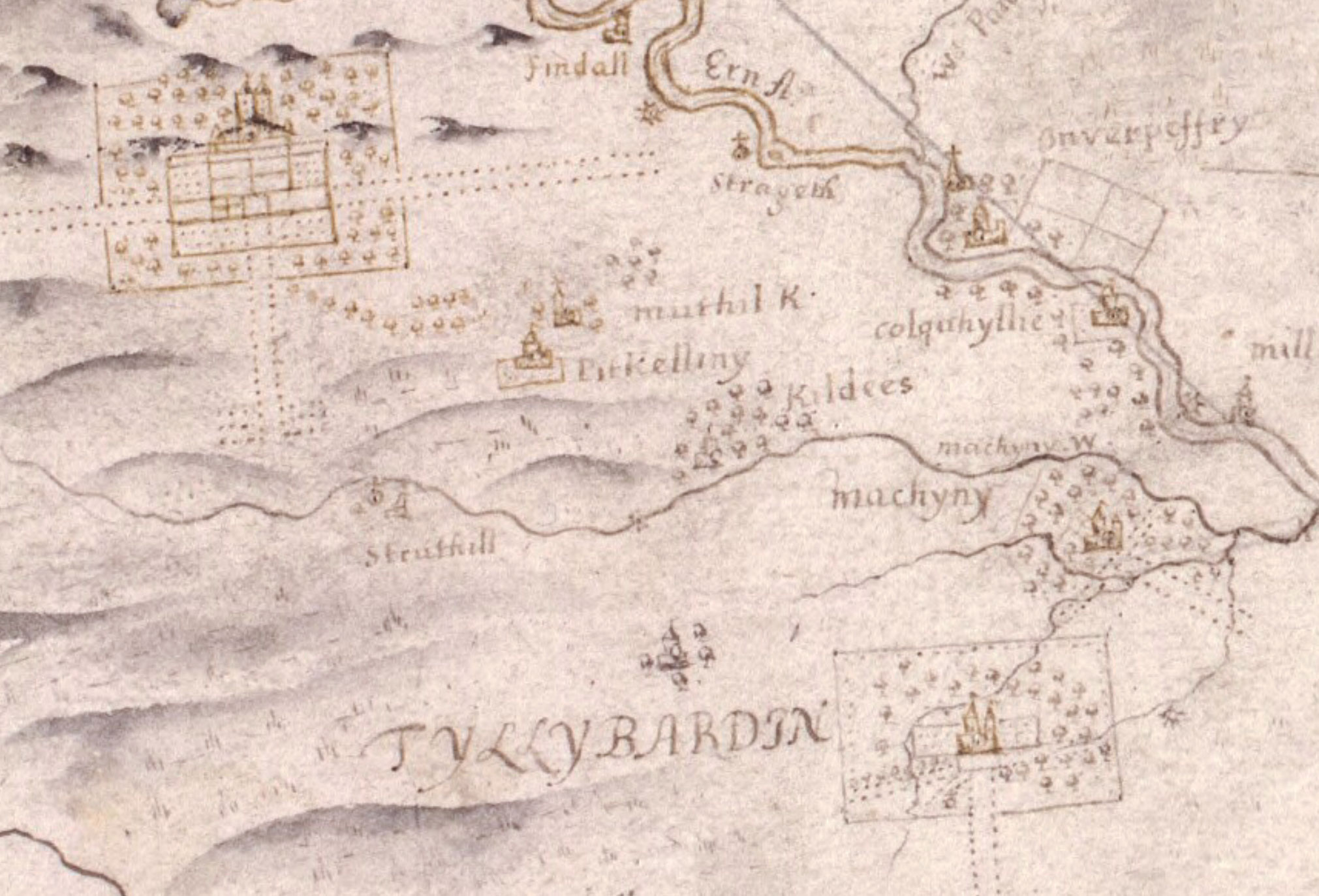
Timothy Pont, c.1583 – 1596image courtesy of NLS
John Adair, 1683image courtesy of NLS
In the early 17th century Sir Mungo Murray of Drumcairn, son of John Murray, 1st Earl of Tullibardine, married Anne Murray, daughter of Sir Andrew Murray of Balvaird and Arngask and niece of Sir David Murray of Gospertie, 1st Viscount of Stormont. Sir Mungo became the 2nd Viscount of Stormont in 1631 and in 1633 was confirmed as the keeper of Huntingtower Castle. At a similar time Margaret Murray, daughter of Sir William Murray of Tullibardine, married Sir Robert Bruce of Clackmannan.
In the mid-17th century the Murrays of Tullibardine became the owners of Huntingtower Castle although the exact sequence of ownership around this time is unclear. The Chronicles of the families of Atholl and Tullibardine states that in 1649 James Murray, 4th Earl of Tullibardine, acquired the barony of Huntingtower from Anne, Viscountess of Stormont. However Anne, second wife of the 2nd Viscount, died in 1643. Upon the death of William Murray, 1st Earl of Dysart and Lord Huntingtower, in 1655 his titles and estates seem to have passed to his eldest daughter, Elizabeth, as she became Countess of Dysart and Lady Huntingtower. What is clear is that Huntingtower did end up with the Tullibardine branch of the family at this time.
Other sources state that the castle was sold, presumably by the Countess of Dysart, to James Murray, 4th Earl of Tullibardine, in 1663. The 4th Earl of Tullibardine married secondly in 1664 his cousin, Lady Anne Murray, fourth daughter of Sir John Murray, 1st Earl of Atholl. The Earl of Atholl was the son of William Murray, 2nd Earl of Tullibardine, and Lady Dorothea Stewart, grand-daughter of the 1st Earl of Gowrie and Dorothea Stewart. He died in 1670 and his titles reverted to his brother-in-law, John, 2nd Earl of Atholl, who became the 5th Earl of Tullibardine and inherited Huntingtower and Tullibardine along with other properties.
In 1703 John Murray was created 1st Duke of Atholl by Queen Anne. He was succeeded by his son, James Murray, 2nd Duke of Atholl, who had plans for a grand new mansion drawn up by William Adam but these weren’t realised and the castle was dismantled in 1747. The last remains of it were removed around 1833, the stone used to build local farm buildings including those at West Third. Nothing is now visible at the site of the castle which lies in a field, and the rise on which it stood has now been ploughed away.


Alternative names for Tullibardine Castle
Castle of Tullibardine; Cathair Lavenach; Catherlavenach; Tillebairne; Tulibarden; Tulibardyn; Tulichbardene; Tullebardin; Tullibardin; Tullybardin; Tyllybardin