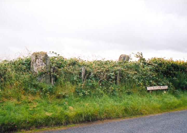

This four-poster circle sat on a pronounced mound originally, but the mound was destroyed on the S side when the road was built, and has been ploughed away on the N side in the field. However, it’s profile can still be seen by looking from the road. Two stones sit on the mound, surrounded by brambles behind the hedge, while another stone sits isolated on an island of grass at the junction of Tullibardine Road and Easthill Road. The fourth stone is also thought to be on the island, covered entirely by the grass.
The two hedgerow stones both feature interesting carvings. The NW stone has 4 large gouges cut into it’s northern face, but the SE stone is much more interesting. On it’s southern face is carved a medium-sized left hand-print, pointing down the way. The hand is quite faded, but can be easily found by running a hand over the surface of the stone.
The stones on the island in the road have fared less well. When Hutchison visited in 1893, both were lying prostrate, the more northerly one (now standing) half-covered by turf, and the more southerly one completely covered. The more northerly stone has a distinctive girdle mark around it’s centre, and leans sharply to the E. The more southerly stone is presumably still buried in situ.
Alternative names for Easthill
Auchterarder; Tullibardine Road
Where is Easthill?
Easthill is in the parish of Blackford and the county of Perthshire.
Grid reference: NN 9292 1246
Lat / long: 56.29201669, -3.73057009
OS Map for Easthill
OS Explorer map OL47
Buy from Ordnance Survey


