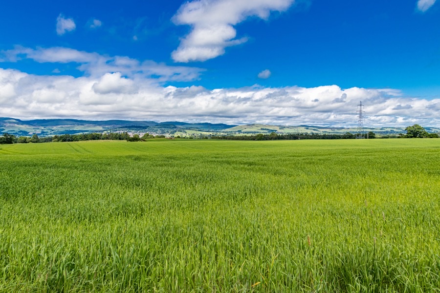

John the Bangster’s House was a probable fortified house which was surrounded by a moat or ditch however nothing of it now remains.
Little seems to be known about the house or John. Around 1840 the last remains of the building were removed and the ditch filled in. It was apparently still possible to see a slight rise in the field in 1967 and in the same year the farmer from Fintalich farm drained the field but nothing of interest was found.
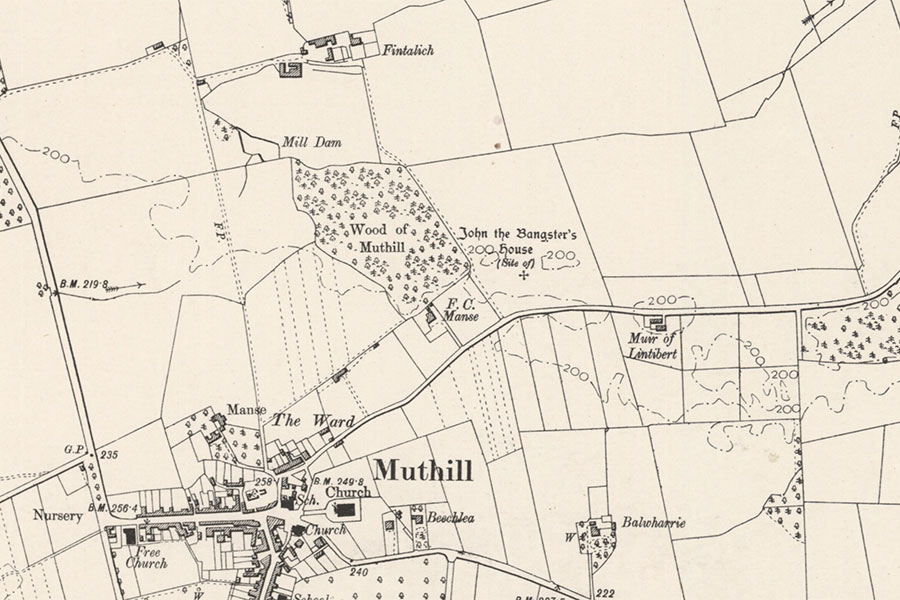
Ordnance Survey, 1901image courtesy of NLS
The house is said to have belonged to John the Bangster, a local robber who shot and killed a man named Murray with a bow and arrow following a feud. Murray’s cairn, the remains of which had been removed by the mid-19th century to build field walls, was supposed to have been constructed over Murray’s grave around 1.5km to the south near Murrayfield.
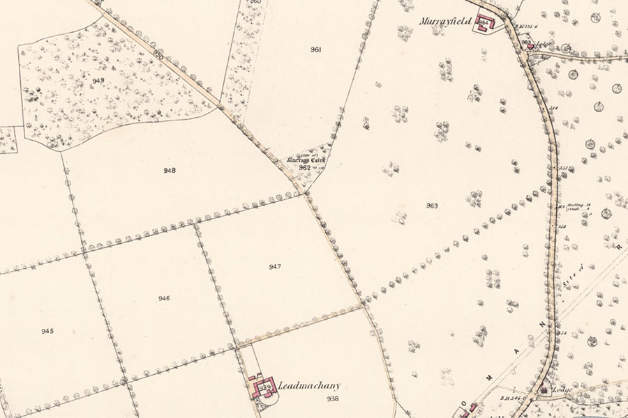
Ordnance Survey, 1865image courtesy of NLS
Beyond that there seems to be no other trace of John the Bangster. If it was a medieval moated site then it may have dated to the 12th or 13th centuries, however the house may not have been built by John and he may have occupied an old dwelling much later on. People in the local area were still using bows and arrows to settle scores certainly as late as the early 17th century.
The earliest map to show the area in any detail is Pont’s late 16th century map of Strathearn. Two buildings, possibly small towers, are marked in the vicinity of Muthill. To the north is one named Drumgaurak and to the east is one named Drumlakak. This latter name probably represents an old spelling of Drumlaken which was a short distance to the west of Muthill, leaving Drumgaurak unaccounted for.
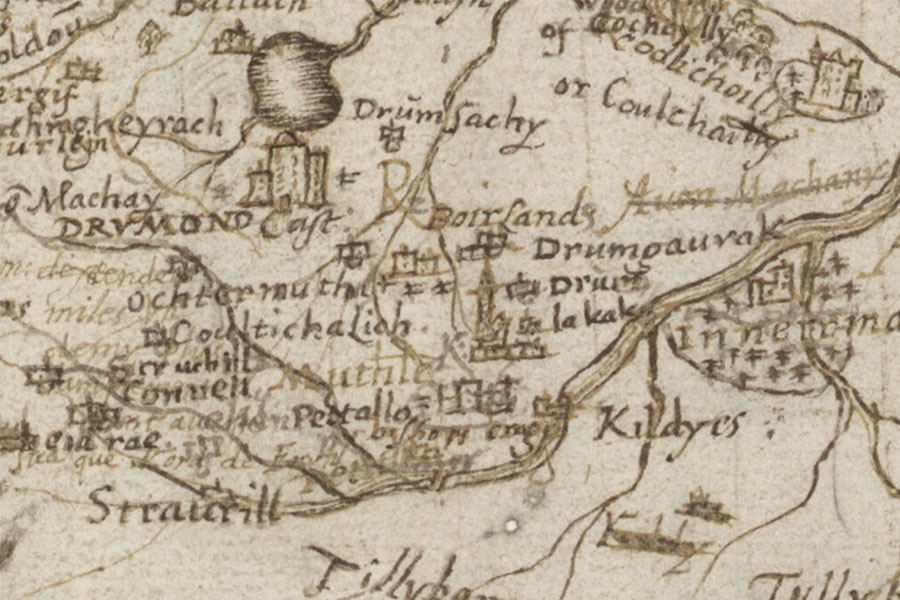
Timothy Pont, c.1583 – 1596image courtesy of NLS
In 1444 James II granted to Maurice de Drummond, son and heir of Malcolm de Drummond of Conchrag, and his wife, Mariote de Douglas, the lands of Acherich, Kelach, Dalchirla, Drummane, Conchrag, Tullichrawin, Dalquhone, Fintulich, Ladintibirt, Drumsarag, Drumgourag, Pethomochir, Shranore and le Knoke de Creiff. Many of these placenames are in the Muthill area.
The Drummonds were still styling themselves as “of Concraig” into the 16th century however in 1604 James Sandilands, 2nd Lord Torphichen, sold to Sir James Chisholm of Cromlix the temple lands of Concraig comprising of the lands of Lintibbert, Fintallich, Drumgowrok, Drumsauchie, Tempilhill and Concraig. This may suggest that the lands had been owned historically by the Knights Templar or Knights Hospitallers of the Order of Saint John.
In 1620 James VI granted to John Drummond, 2nd Earl of Perth, these same lands which James Chisholm of Dundurn had resigned. Although the placename Drumgaurak seems to have disappeared it was still extant in the late 17th century as a John Morison was resident in Drumgorake when he died in 1686. Unfortunately nothing is shown in the relevant area on Adair’s late 17th century maps.
Although not marked on Pont’s map as such it may be that the moated site was a progenitor of the lands of Fintalich. In the 14th century Sir Robert Erskine of Erskine, Lord High Chamberlain from 1350, gave various possessions including the lands of Fintalloch in Strathearn to Cambuskenneth Abbey “for the health of himself and Christian Keith, his wife”.
As with Drumgaurak the lands of Fintalich were granted to Maurice de Drummond in 1444, were sold by the 2nd Lord Torphichen to Sir James Chisholm of Cromlix in 1604 and were granted to the 2nd Earl of Perth in 1620. Around 1660 John Drummond of Fintullich married Elizabeth Graham, daughter of John Graham of Garvock and his wife, Agnes, daughter of George Drummond of Balloch. A substantial house is shown at Fintalich on Stobie’s late 18th century map.
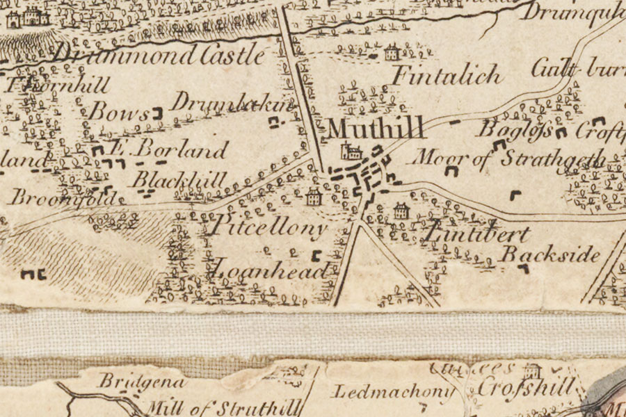
James Stobie, London, 1783image courtesy of NLS
Whether or not John the Bangster’s House was once named Drumgaurak or Fintalich is not clear. John’s story was recorded in Volume 62 of the Ordnance Survey’s Name Book for Perthshire in 1860 and the site of the house seems to have been marked for the first time on the Ordnance Survey’s 25 inch maps of 1865. Today the site lies within a field just to the north-east of Muthill.
Alternative names for John the Bangster's House
Drumgaurak; Drumgorack; Drumgorake; Drumgourag; Drumgowrok; Drumgurock; Drumgurrock; Fantullich; Fentalich; Fintalich; Fintallich; Fintalloch; Fintalloche; Fintdlich; Finteleych; Fintillich; Fintilloch; Fintolich; Fintulie; Fintulich; Fintullich; Fintullicks; Fyntolich; Muir Of Lintibert
Where is John the Bangster's House?
John the Bangster's House is in the parish of Muthill and the county of Perthshire.
Grid reference: NN 8727 1743
Lat / long: 56.335819, -3.824923


