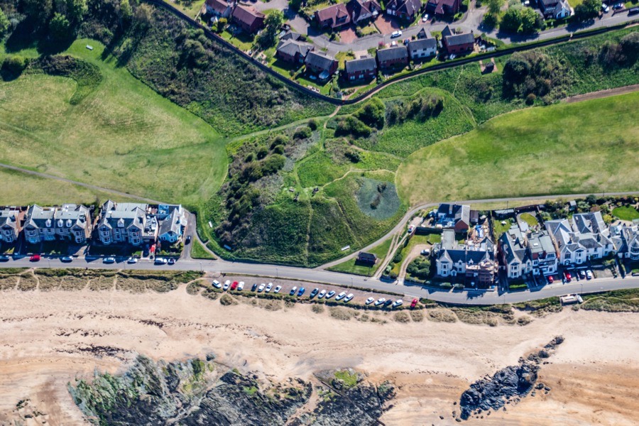
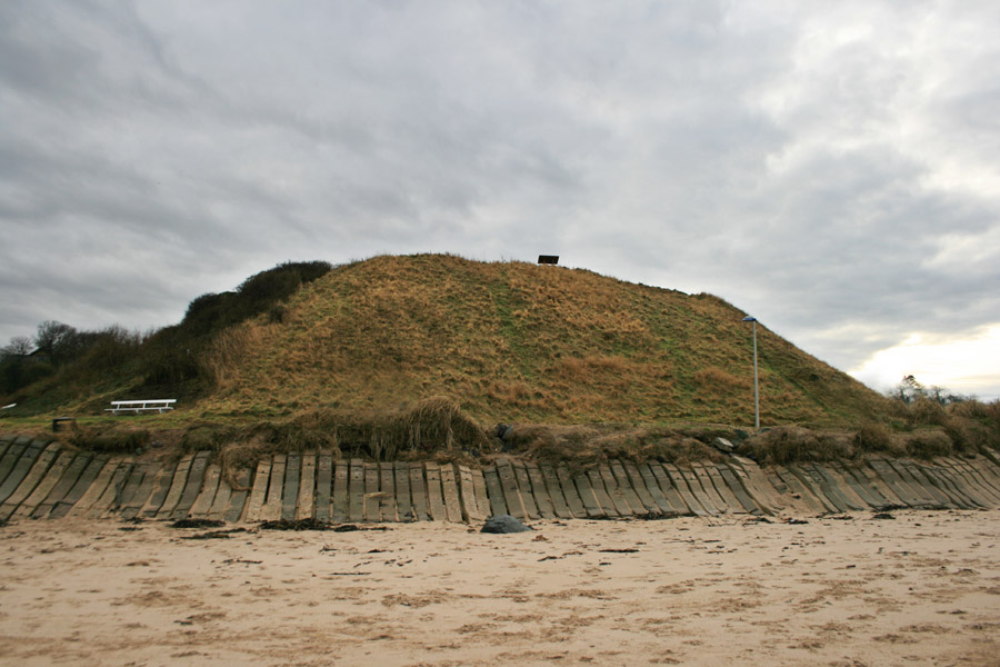
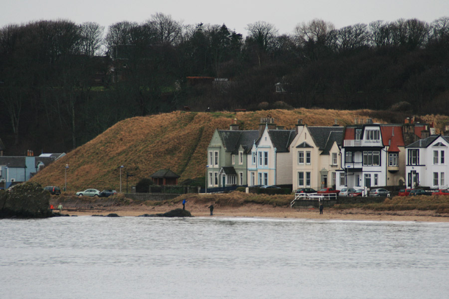
Castle Hill in North Berwick is a large motte which was the site of a castle belonging to the Earls of Fife.
North Berwick was an important settlement on the pilgrim route to the shrine of St Andrew in St Andrews in Fife, and a ferry operated across the River Forth from North Berwick to Earlsferry as early as the 8th century. The Earl of Fife seems to have had interests in East Lothian from the 12th century since around 1150 Duncan or Donnchad, Earl of Fife, founded a Cistercian nunnery on the western edge of the burgh of North Berwick.
Given their influence in the area it seems likely that the first castle at North Berwick would have been built by one of the MacDuff Earls of Fife, possibly Duncan’s son, also Duncan, or grandson, Malcolm. The castle would have been of a timber construction with a suggested date of the 13th century. It stood on Castle Hill which afforded commanding views along the coast and across to Fife.
Castle Hill consists of an enhanced natural mound rising up above the seafront and is separated from a long bank to its south by a narrow neck of land. The mound is around 12 metres in height and is cut off from the bank by a ditch which measures between 4.0 and 8.0 metres wide and 1.0 to 1.5 metres deep.
Around the summit are the remains of a stone and earth bank measuring approximately 1.0 metre high on the outside but only 0.1m to 0.2m on the inside. The embankment encloses an area of around 32.0 metres north to south by around 36.0 metres along the north edge. Within this embankment are traces of stonework which are thought to represent the foundations of a castle. During a geophysical survey in 2013 a higher resistance anomaly measuring around 17m by 4.7m was observed in the north-west area of the summit and has been interpreted as possible wall foundations.
Armitage speculated in 1912 that the first castle may have belonged to the De Vaux family, supposing that it was a predecessor of Dirleton Castle around 4.6km to the west, however I haven’t been able to find any other references to this potential early ownership whereas that of the Earls of Fife is relatively well documented.
Before the Battle of Falkirk in 1298 a division of the English army, commanded by Antony Beck, bishop of Durham, captured Dirleton Castle and also occupied the castle at North Berwick at this time.
In 1314 the castle was occupied by the troops of Edward II’s lieutenant in Scotland, Aymer de Valence, 2nd Earl of Pembroke, however the troops abandoned the castle following the Battle of Bannockburn. There is a suggestion it may have been slighted at this time by the Black Douglas, James Douglas, Lord of Douglas, on behalf of Robert the Bruce to prevent it from falling into English hands again, however given the resounding English defeat at Bannockburn this may not actually have happened and may have been confused with its fate at the hands of a later Douglas.
When the last MacDuff Earl of Fife, Duncan IV, died in 1353 without a male heir he was succeeded by his only daughter, Isabella, as Countess of Fife. She married four times with each of her husbands living for only a few years beyond their respective unions and with no children produced. In 1371 she was persuaded to resign the Earldom of Fife to Robert Stewart, Earl of Menteith, the brother of her late second husband, Walter Stewart, the second son of the future Robert II. The castle at North Berwick thus passed to the Stewart Earls of Fife.
Some sources suggest that the Lauder family may have built a stone castle with a barmkin at North Berwick late in the 14th century, however the castle seems to have still been in the possession of the Earls of Fife at this time so that is perhaps unlikely and perhaps is part of a confused history.
The end of the 14th century and start of the 15th century was a turbulent time, with competing branches of the Stewart family vying for influence. When Robert II died in 1390 his eldest son, John Stewart, ascended the throne as Robert III, however John’s younger brother, Robert, Earl of Fife, continued to hold power as the King’s lieutenant until 1393 when power was transferred to Robert III and his young son, David. In 1398 David was created 1st Duke of Rothesay and his uncle the Earl of Fife was created the 1st Duke of Albany by Robert III.
In 1402 the Duke of Rothesay was arrested in a move orchestrated by the Duke of Albany and Rothesay’s brother-in-law, Archibald Douglas, 4th Earl of Douglas. Rothesay was imprisoned first at St Andrews Castle and then at Falkland Place where he died, possibly of starvation. Despite his involvement Albany was absolved and became the king’s lieutenant once again.
In 1405, with Robert III’s health failing, the decision was taken to send his heir, James Stewart, to France for safe-keeping beyond the reach of his uncle, Albany. The following year a party containing the young prince moved south from St Andrews through Douglas lands in East Lothian where they were attacked by James Douglas of Balvenie, later 7th Earl of Douglas.
The prince fled to the safety of the Bass Castle where he remained for a month before a ship collected him on its way to France. The ship however was captured by English pirates off Flamborough Head and James began 18 years of captivity at the court of Henry IV of England.
Following the death of Robert III in 1406 Albany ruled as regent of Scotland, seemingly making little effort to secure the release of his nephew. Albany was succeeded by his son, Murdoch, as Duke of Albany, Earl of Fife and regent in 1420 but in 1424 the release of James was finally negotiated. James was crowned at Scone as James I and later that year Albany was arrested and in 1425 executed for treason, forfeiting his estates and titles.
What happened to the castle at North Berwick at this time is unclear. Some sources suggest it was slighted by William Douglas, 2nd Earl of Angus, from his base at Tantallon Castle although why is not explained. Douglas was a member of the jury that convicted Albany so this perhaps seems unlikely. Other sources state that the castle was owned by the Lauder family at this time but that they abandoned it in favour of the Bass Castle.
Either way the lands on which the castle stood seems to have been given to North Berwick priory in 1434 and the castle doesn’t seem to have been used beyond this period. Focus perhaps switched to other castles in the surrounding area which included the Earls of Fife’s Leuchie to the south-east, the Bass Castle and Tantallon.
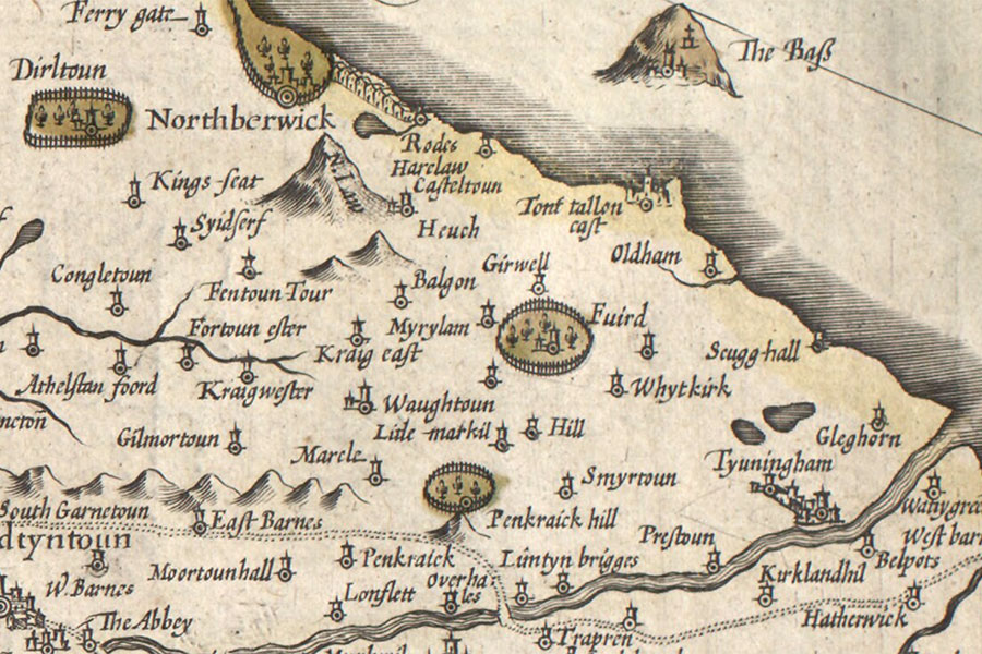
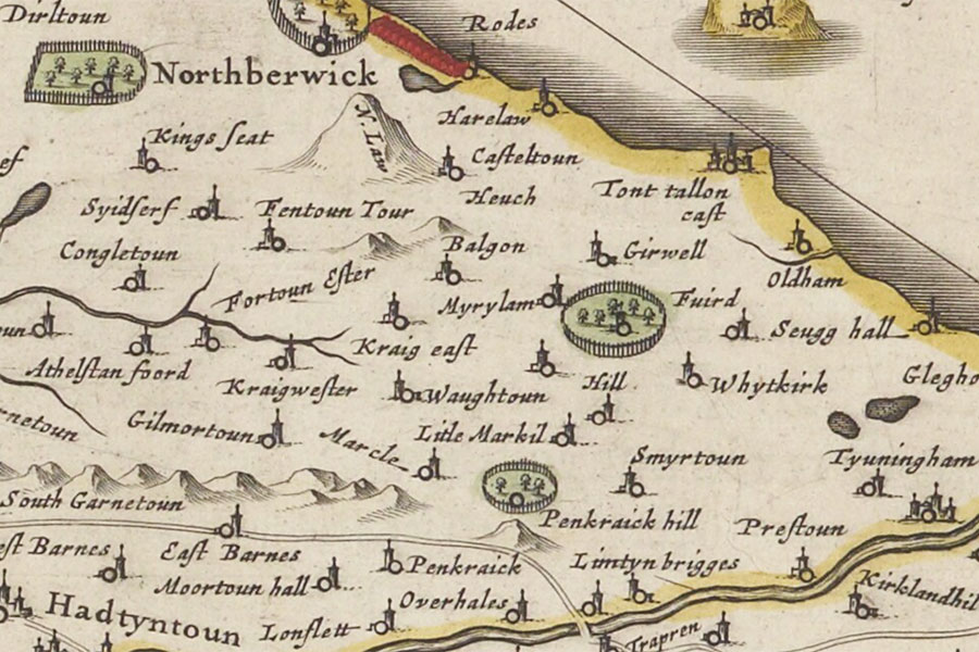
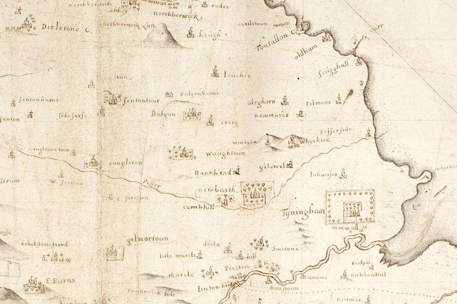
A tower at North Berwick is marked on 17th century maps however this may have been a later building on a different site which requires more research.
Hendrik Hondius, Amsterdam, 1630map image courtesy of NLS
Joan Blaeu, Amsterdam, 1654map image courtesy of NLS
John Adair, 1682map image courtesy of NLS
The mound is now part of a public park.


Alternative names for North Berwick Castle
Castle Hill; East Links; Northberwick