Locharwoods
Annandiae praefectura, Vulgo, The Stewartrie of Annandail
Joan Blaeu, Amsterdam, 1654map image courtesy of NLS
Joan Blaeu, Amsterdam, 1654map image courtesy of NLS
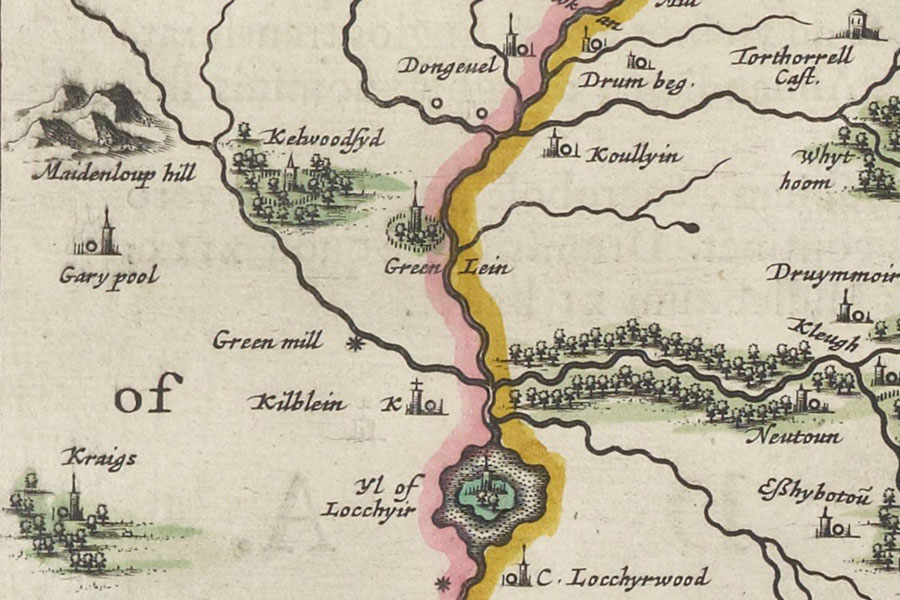
A possible tower named C. Locchyrwood is marked on Blaeu’s mid-17th century map of Annandale, based on Pont’s late 16th century work, but its exact location has been lost.
The location is a strategic one, guarding the high ground to the north of the Lochar Water which was a major invasion route from England.
I have placed the site of the tower at Upper Locharwoods farm pending further research.


Alternative names for Locharwoods
C. Locchyrwood; Castle of Locchyrwood; Locherwood; Upper Locharwoods
Where is Locharwoods?
Locharwoods is in the parish of Ruthwell and the county of Dumfriesshire.
Grid reference: NY 03596 67725
Lat / long: 54.994739, -3.508404


