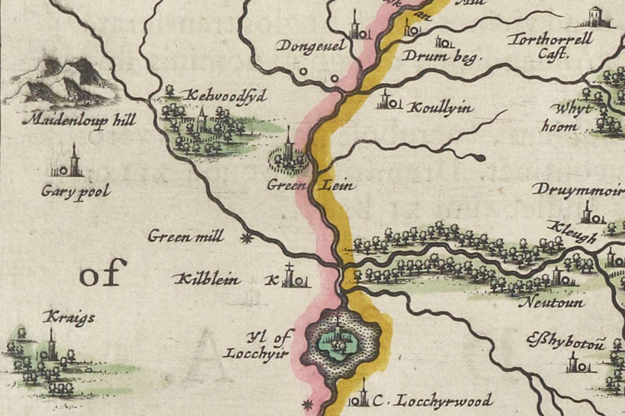

Joan Blaeu, Amsterdam, 1654map image courtesy of NLS
A tower named Kelwoodsyd, surrounded by a palisaded enclosure, is marked on Blaeu’s mid-17th century map of Annandale, based on Pont’s late 16th century work, but its exact location has been lost.
I have placed the site of the tower at an enclosure, which is visible as cropmarks on aerial photographs, pending further research.
The enclosure is to the east and north of the Kelwood Burn which may explain the derivation of the name. It is rectilinear in plan and measures around 77.0m west-south-west by east-north-east although the south and west sections have been obliterated. The enclosure is defined by a ditch around 5.2m wide.
Another possible location could be Bailie Knowe, to the south and east of the Kelwood Burn, which has been variously described as a motte or a fort.
Alternative names for Kelwoodside
Kelwoodsyd
Where is Kelwoodside?
Kelwoodside is in the parish of Dumfries and the county of Dumfriesshire.
Grid reference: NY 01186 70700
Lat / long: 55.020990, -3.547087


