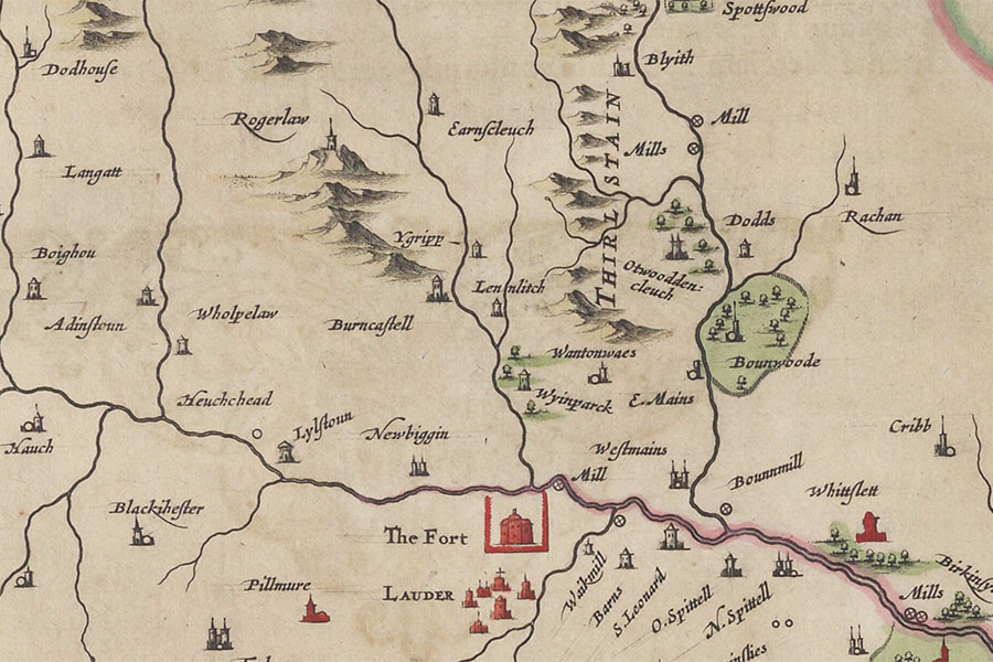

Joan Blaeu, Amsterdam, 1654map image courtesy of NLS
Edgarhope Castle is mentioned in 15th century parliamentary records however its exact location is now lost.
The reference, to Egrop and Egrope Castell, is in relation to it being the site of one of a chain of signal beacons to warn of an English invasion. The first beacon would be lit at Hume Castle followed by the one at Edgarhope and then one at Soutra which would be visible at Edinburgh Castle.
Little seems to be known about the castle. A Richard de Egrope is mentioned around 1170 and again in the early 13th century in a charter by Thomas of Thirlestane. Ralph or Rauf de Egerhope swore fealty to Edward I of England in 1296.
In 1477 William Maitland of Thirlestane and Lethington received a sasine of Egrop and again in 1508, however his lands were seized by the Crown in 1508. The following year Alexander Lauder of Blyth, Provost of Edinburgh, was granted Maitland’s lands including Egrop.
The property seemed to be owned by Robert Home of Reidheuch in 1568 however in the late 16th century it was owned by Sir John Maitland of Thirlestane. The land of Egrope is mentioned as a possession of Sir John’s eldest surving son, John Maitland, in a document of 1632 proposing his marriage to Anne Home, daughter of Alexander Home, 1st Earl of Home.
By the early 17th century it was in the possession of the Cranstoun family, with Alexander Cranstoun served heir to his father, Thomas Cranstoun of Morestoun, in Burncastle, Ernescleuch and Egrop in 1607.
The tower of Ygripp is marked on Blaeu’s mid-17th century map of Berwickshire, based on Pont’s late 16th century work, just across the Earnscleugh Water from Burncastle and further from the burn than its neighbour.
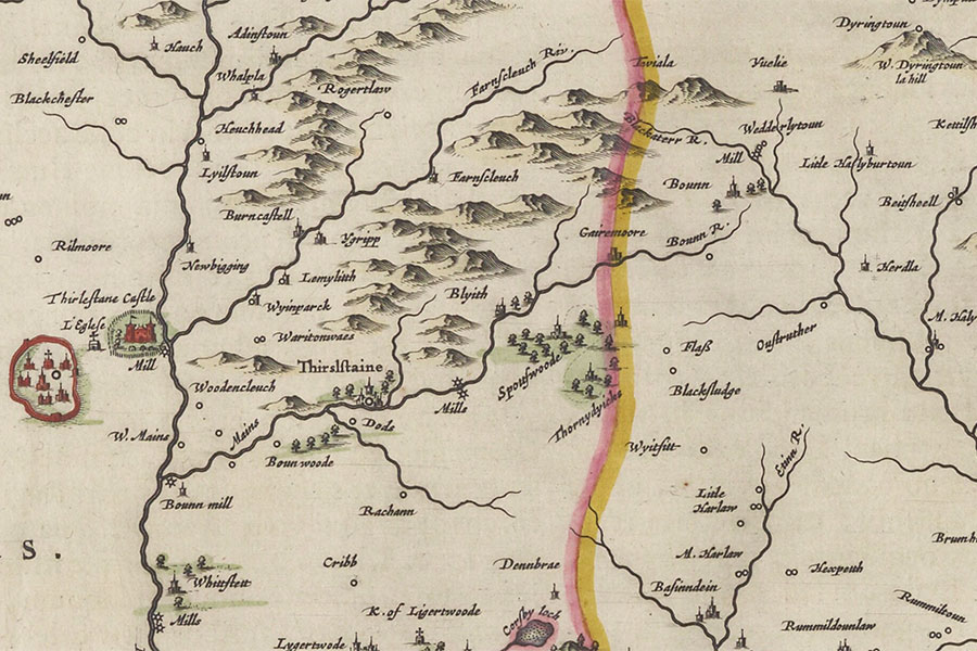
Joan Blaeu, Amsterdam, 1654map image courtesy of NLS
On Blaeu’s map of Lauderdale, contemporary with that of Berwickshire, Ygripp is again marked but this time slightly further up the Earnscleugh Water.
It isn’t marked on Roy’s mid-18th century map perhaps suggesting that it was no longer a significant building but it appears as Idgrop on the Armstrongs’ and Blackadder’s late 18th century and Thomson’s early 19th century maps. On Sharp, Greenwood & Fowler’s early 19th century map however it is shown as Eagerhope and by the time the Ordnance Survey 25 inch to the mile map of the area was published in 1859 this had changed to Edgarhope, a rectangular building located on the north-eastern corner of Edgarhope Wood.
Edgarhope is not marked on the 2nd edition of this map, published in 1898, and is not named on subsequent Ordnance Survey maps although an unnamed building in a similar location is marked on some maps until 1904, possibly suggesting that it had fallen out of use.
I have placed the site of Edgarhope Castle at what I believe is the position of the building marked on the 19th century Ordnance Survey map pending further research.
Alternative names for Edgarhope Castle
Eagerhope; Egerhope; Eggerhop Castle; Eggerhope; Egrop; Egrop Castell; Europe; Egrope Castell; Egroph; Idgrop; Ygripp


