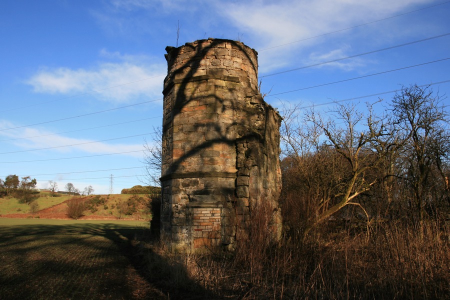

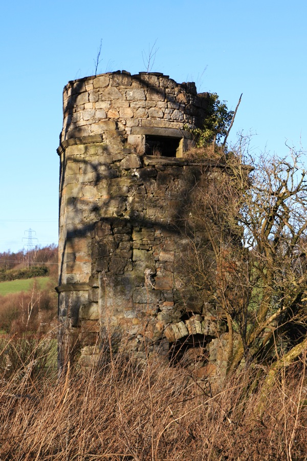
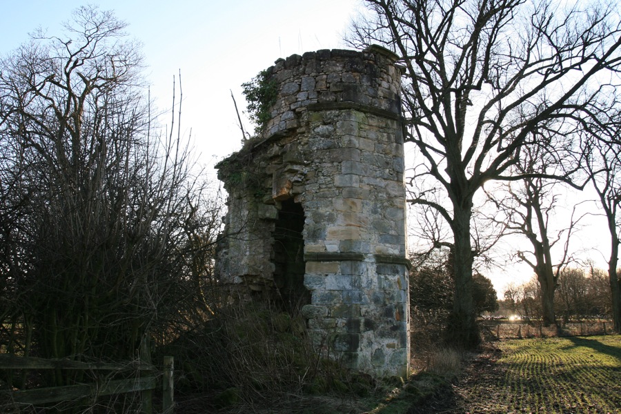
All that remains of Dunipace Castle is an octagonal stair tower which has now been converted into a dovecot.
Dunipace appears in records as far back as the 12th century, and there seems to have been a castle here since that time. The first castle was probably built on one of the Hills of Dunipace.
In the 12th century an Anglo-Norman baron, Gilbert de Umfraville, gifted land at Dunipace to the Abbey of Cambuskenneth, and it remained the property of the Abbey until they sold it to Alexander Livingston in 1495.
However, there seems to have been several divisions of land in Dunipace, as in 1479 a record of Parliament states that Malcolm Forrester of Torwood gave some land at Dunipace to an Elizabeth of Erth or Airth. Malcolm’s elder brother, Alexander Forrester of Torwood, had married Agnes Livingston, daughter of John Livingston of Manerstoun married Agnes d’Erth, in 1463.
At some point in history, possibly in the 15th century, a new castle seems to have been built to the north of the old castle. It may well be that it was Alexander Livingston who was responsible for building Dunipace Castle, although I haven’t found any direct evidence of this. No detailed pictures of Dunipace Castle seem to exist, but it was said to have been similar in style to Torwood Castle.
In 1507 Alexander Livingston of Dunipace bought the barony of Plane from James Livingston of Manerstoun.
Dunipace Castle is marked on Pont’s map of the East Central Lowlands, which was drawn in the late 16th century. Interestingly the castle appears to be situated on an island created by the intersection of the River Carron and the Bonny Water, and the Hills of Dunipace and a cross for the church are also marked. However when looking at the modern Ordnance Survey map, the remnants of an old river can be seen to the east of Dunipace.
In 1634 Sir John Livingstone succeeded his father and became the 6th Livingston laird of Dunipace, but the same year he sold it to Sir Robert Spottiswoode. The stair tower that is all that remains of Dunipace Castle appears to be of mid-17th century date, and it may be that it was built by Spottiswoode.
Octagonal in form, only four sides of the octagon are free, with the rest of the tower attached to two short sections of wall which represent the re-entrant angle of an older L-shaped castle.
At ground level on the west side is the entrance, now bricked up, and to the left of that is a bricked up window opening. Given that the window is quite large and at ground level, it would seem that defence was not an issue when this tower was built.
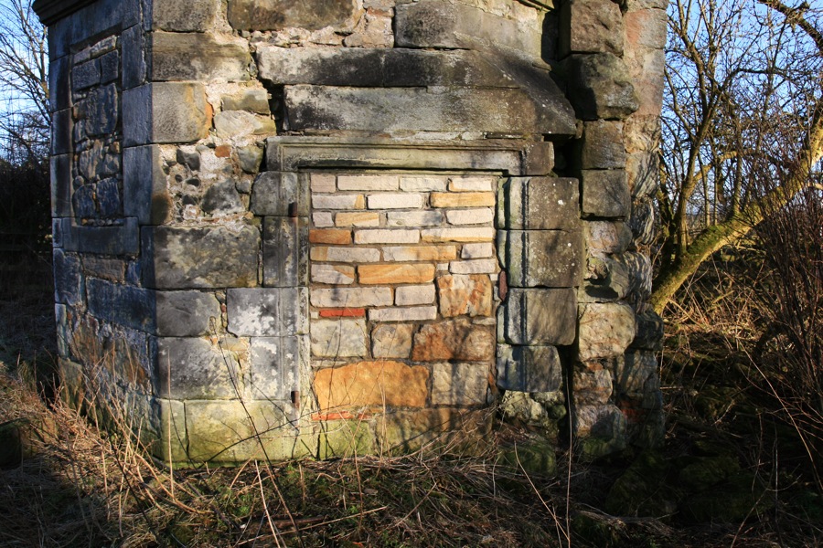
At first floor level on the north-west side is another bricked up window. The south side has one of the sections of the castle wall attached to it.
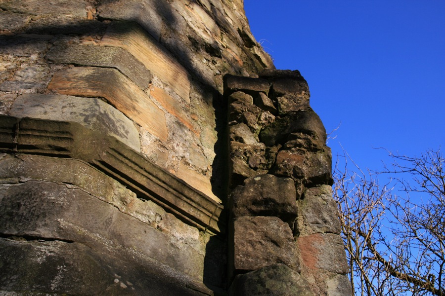
On the south side of the wall, which would have been inside the castle, is a doorway on the ground floor. It is bricked up on the stair tower side, and partially bricked up on the outside, and has an arch above it. Following the line of the stonework from this arch, it looks as though there may be evidence of a vaulted basement. Higher up on this south wall is an opening which is probably a doorway from the stair tower onto the first floor.
In 1643 Spottiswoode sold Dunipace to a James Aikenhead, who in turn sold it to James Livingston, the 1st Earl of Callendar, in 1646. Since he had no heir, Dunipace passed through his niece, Eleanor Livingstone, to her son Sir Thomas Nicolson.
On Gordon’s mid-17th century map Dunipace is no longer surrounded by water, but is marked within the fork between the River Carron and the Bonny Water. In the Blaeu Atlas, published in 1654 (later than Gordon’s map but based partly on Pont’s earlier work), Dunipace Castle is once again on an island, with a large castle, a small tower, and three small hills marked.
In 1665 Nicolson sold Dunipace to William Murray, who sold it to Sir Archibald Primrose of Dalmeny in 1677. In the late 17th century a lot of work seems to have been done by the Primrose family laying out formal gardens at Dunipace.
Some time in the 18th century, probably in the first half of the century, a new house was built. Known as the Place of Dunipace, it was constructed to the west of the old castle.
In 1746 a later Sir Archibald Primrose was executed for his part in the Jacobite Rising, and his estates of Dunipace were forfeited. In 1754 Dunipace was bought from the Exchequer by John Russell, who sold it to a James Spottiswood the following year.
By the time of Roy’s military survey in the 1750s, the laid out estates of Dunipace are shown, with an ornamental garden to the east of two red dots. It’s tempting to suggest that these dots represent the new mansion and the old castle.
The new Place of Dunipace probably used the stone of the old castle in its construction, but the octagonal stair tower was left standing. It was later converted into a dovecot, with a cylindrical extension added to the top of the tower, the stairs removed, and nesting boxes for the doves added around the inside of the walls.
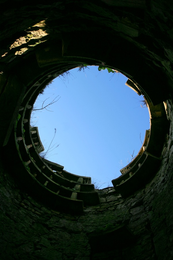
The other section of castle wall, on the north-east side of the tower, has partly fallen away leaving a gaping hole in the side of the tower. There has evidently been some damage to the dovecot over the years, as when it was visited by the RCAHMS in 1955 it had a slate roof with an ornamental lantern-style opening for the pigeons, which have now gone.
John Thomson’s Atlas of Scotland, published in 1832, shows that the castle has gone and the mansion of Dunipace is drawn, along with the church. Dunipace had passed through marriage from the Spottiswood family to the Harvie-Brown family of Shirgarton and Quarter.
In 1897 the new house of Dunipace burnt down, although it was later rebuilt. From 1922 to 1931 Dunipace House was home to St Andrew’s boarding school, and during the Second World War it was requisitioned by the Army. Some time in the 1940s Dunipace House was demolished, and all that is now left is the stair tower from Dunipace Castle.
Alternative names for Dunipace Castle
Dinnieplace; Donapace; Donipas; Donypace; Donypas; Dunipace Park; Dunnipace; Dunypais; Old House of Dunipace; Place of Dunipace


