Downfield

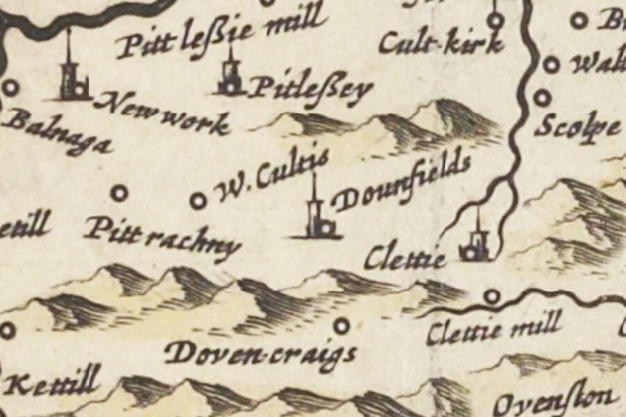
Joan Blaeu, 1654
The remains of Downfield, known as The Vault, consist of the vaulted basement of a castle, the rest of which has been removed.
Downfield’s early history seems to be unknown, but a date of the 17th century has been suggested for its construction. Since little in the way of datable features remains it could indeed be earlier.
It consists of a block measuring approximately 12.4m in length by around 7.0m wide at the east gable, narrowing to around 5.5m at the west gable, and standing around 4.5m in height. An entrance in the south wall leads into a single chamber measuring approximately 10.2m long by around 4.7m wide internally. This suggests that the rubble-built walls are around 1.1m thick. The ceiling is barrel vaulted and the space is lit by four slit windows.
The earliest reference I can find to Downfield is the mention of a Laurence Ramsay of Downfield in judicial proceedings in the Records of the Parliaments of Scotland in 1483 and 1491.
At some point in time the lands of Downfield seem to have been divided, as Cristina Ramsay is described as “lady of the half of Dunfeild” in 1541 while the other half was granted to Patrick Wemyss of Pittencrieff in 1537 by David Ramsay of Dunfield.
Ramsay wrote a charter of sale “Forthir” for the half lands of Dunfeild in favour of David Pitcairn of that Ilk and his wife Elizabeth Drury on the 28th of March that year. The Ramsays and Pitcairns were related twice through marriage – that of Elizabeth Ramsay of Forthar and Henry Pitcairn in 1456 or 1460, and that of their daughter Elizabeth Pitcairn who married John Ramsay of Dounfield.
A royal charter dated the 27th of January 1551 confirms the sale of “the lands of Forthir, with tower, fortalice, manors, gardens, and orchards, the lands of Dunfeild, with tower, fortalice, manors, gardens, and orchards” by David Pitcairn in favour of his son Robert, later the Commendator of Dunfermline and Archdeacon of St Andrews.
By the second half of the 17th century Downfield was in the possession of the Watson family as the Rigg family, descendents of the Riggs of Carberry, sold their nearby property of Aithernie Castle to James Watson of Downfield in 1670.
Downfield is marked on Blaeu’s Atlas of 1654 as a tower named Dounfields (based on James Gordon’s map of 1642 where it is marked as Downfeilds), and again on John Adair’s map of 1684 as Dunfield.
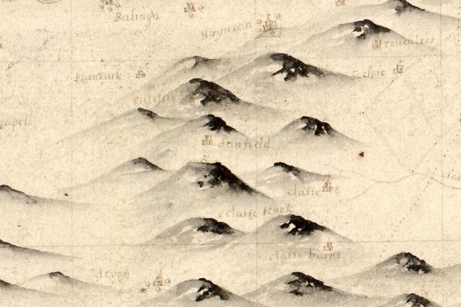
John Adair, 1684
In 1720 another Rigg, William Rigg, had a charter of the lands of Downfield. The Downfield area of Dalry in Edinburgh, now evident in the street name Downfield Place, was named after William’s great grandson James Home Rigg whose trustees had feued the land to the developer James Steel in 1874.
Downfield doesn’t seem to appear on Roy’s Military Survey of Scotland in the mid-18th century, suggesting that it was no longer a significant place at this time and most likely a ruin. Latterly the Riggs lived at Hill of Tarvit and rented out Downfield.
Today the ruins of the tower stand next to farm buildings at the edge of a field.
Alternative names for Downfield
Dounfield; Dounfields; Downfeilds; Dunfeild; Dunfield; The Vault


