
Bothwell Castle was a 16th century town house, which may have replaced an earlier fortified building, and was demolished in the mid-20th century after falling into disrepair.
The building is usually described as having been a late 16th or early 17th century building but if that was the case it must have replaced, or been remodelled from, an earlier building as there are references to it in the mid-16th century. Mary Queen of Scots may have stayed there on the way to and from Dunbar Castle.
There are precious few clues regarding Bothwell Castle on early maps since the earliest to show the area in any detail, an early 17th century map by Hendrik Hondius based on Timothy Pont’s late 16th century work, depicts various unnamed towers or buildings representing Hadtyntoun.
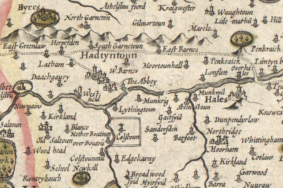
Hendrik Hondius, Amsterdam, 1630map image courtesy of NLS
From 19th century sketches it is clear that the building was extended and added to over time. The main block was arranged approximately north to south between a street named Hardgate to the west and the River Tyne to the east. In in the early 19th century this consisted of ground and first floors plus an attic level in the eaves, although whether this was the original configuration is not known.
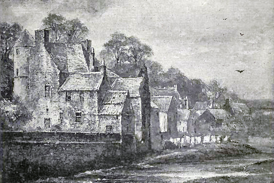
Newcastle-upon-Tyne, 1891
At the south-west corner of the main block was a round tower rising an extra storey in height, with top floor corbelled out slightly like a caphouse. What has been taken to be the original main entrance to the property was at ground level on the south-west side of this round tower, latterly blocked, with a roll-moulded niche above for a heraldic panel. The panel was missing or destroyed by the 19th century.
Two wings, probably added later and both of which seem to have risen to a height of three storeys, projected east towards the river from the main block creating a small courtyard between them, open on the east side. The northern wing was longer and its vaulted basement housed the kitchen with a large arched fireplace at the east end. Above this the first floor was divided into two chambers, the larger and easternmost of which had the flue of the kitchen chimney running through its north-east corner giving the eastern window a deeply-recessed appearance.
The southern wing was shorter in length, and on its first floor was a single chamber. Attached to the east end of the southern wing was a rectangular doocot, unusual in that doocots were usually constructed some distance from their associated castles or houses.
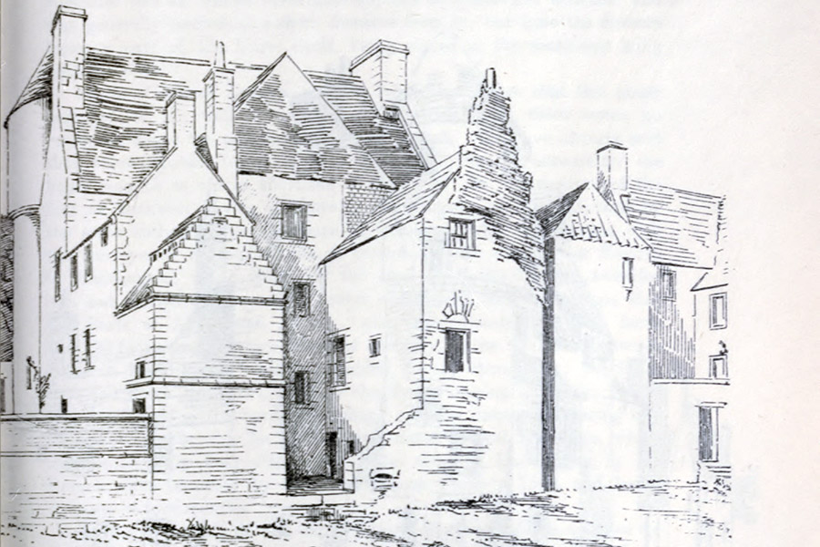
David MacGibbon and Thomas Ross, Edinburgh, 1892
Later a new entrance was created in the west wall of the main block, leading from the street through a hallway to a scale and platt staircase which was added between the two wings at the back of the building. As well as leading to the upper floors this staircase also led down to the lower storey of the two wings.
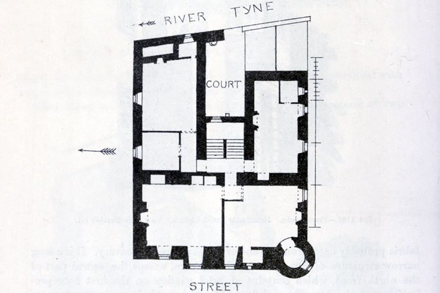
David MacGibbon and Thomas Ross, Edinburgh, 1892
Further support for there having been an earlier, possibly defensive, building on the site was a thicker section of wall rising to first floor height and running north from the round corner tower, noted by MacGibbon and Ross. At ground level in this section was the new entrance and at first floor level were two windows which were made larger in the 17th century. The thick wall contained an intra-mural chamber, as can be seen on the floor plan above.
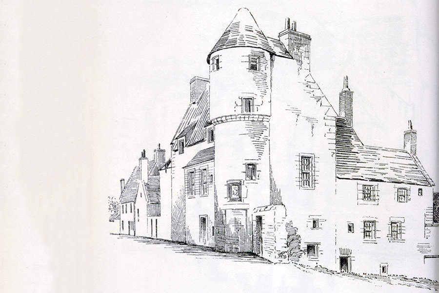
David MacGibbon and Thomas Ross, Edinburgh, 1892
The origin of the building’s name is unclear. Some sources state that it owed its name to being owned by the Earls of Bothwell, while others state that it was originally called Sandybed House but that James Hepburn, 4th Earl of Bothwell, hid there and so his name became associated with it. Both histories seem to agree that the property was owned by the Cockburns of Sandybed at some point and the property deeds show that they owned it throughout the time of the 4th Earl.
In 1559 the 4th Earl ambushed John Cockburn of Ormiston who was carrying 4000 crowns from Berwick to the Lords of the Congregation to pay for mercenaries in their campaign against Mary Queen of Scots. Bothwell attacked Cockburn, wounding him in the head, and stole the money.
According to one version of the story James Hamilton, 2nd Earl of Arran, and James Stewart, later 1st Earl of Moray, are said to have ridden to Bothwell’s house in Haddington, presumably Bothwell Castle, with 200 horsemen, 100 foot soldiers and two pieces of artillery to apprehend him. Bothwell saw them entering Haddington’s city walls (possibly at the North East Port) and fled down Gowl Close then along the bank of the River Tyne. He entered the house of George Cockburn of Sandybed by a back door and swapped clothes with a servant whose job it was to turn the spit in the kitchen. Bothwell remained there for several days, turning the spit, before making his escape.
Another version of the story states that Arran and Moray approached Bothwell at Crichton Castle which caused him to flee, first to Borthwick Castle and then on to Haddington.
In gratitude Bothwell rewarded Cockburn and his heirs with an annual payment derived from “four bolls of wheat, four bolls of barley, and four bolls of oats” taken from his lands at Mainshill. This payment continued to Cockburn’s heirs until around 1760 when his descendent George Cockburn of Sandybed sold it, along with Sandybed itself, to John Buchan of Letham upon succeeding to the Gleneagles estate. Buchan in turn sold it to Francis Wemyss Charteris, 7th Earl of Wemyss.
Interestingly Sir John Cockburn of Ormiston owned a property called Boithill or Bold in the mid-16th century. He attempted to sell it to David Edington of Clarybarde, son of Edington of Edington in 1566 but the sale seems to have fallen through as Sir John’s son, also Sir John, was served heir to his father in “the lands of Boithill and the mill thereof, in the shire of Edinburgh and constabulary of Haddington.” The elder Sir John was married to Alison Sandilands.
It is tempting to speculate that Boithill could have become corrupted into Bothwell over time. Equating Sandilands to Sandybed might be a step too far.
Whether or not Bothwell Castle was originally called Sandybed House is also unclear. At least one source suggests that what is now known as Millfield House, on the south edge of Haddington, was the original Sandybed, perhaps suggesting that Bothwell Castle wasn’t previously known as Sandybed House. Another source suggests that Bothwell Castle was owned by the Cockburns of Sandybed but that they may have rented it to the Earl of Bothwell.
Patrick Hepburn, 3rd Earl of Bothwell, is known to have had a townhouse immediately to the north of the tolbooth, which once stood on Market Street, placing it somewhere on Newton Port or Mitchell’s Close. This might make it unlikely that the Earls of Bothwell owned or rented another townhouse so close by, but is far from conclusive.
Bothwell Castle was used as a girls’ school at the beginning of the 19th century, run by a Miss Jenny Halyburton. Misbehaving students were placed in the old kitchen as a punishment. By the late 19th century the building, owned then by the Todrick family, was in a dilapidated state and occupied by pensioners.
According to an entry in the Haddingtonshire Courier on the 9th of February 1917 Bothwell Castle gained a reprieve from demolition. Aerial photography from the 1940s seems to show the building roofless, and it was demolished to street level either in 1951, 1952 or 1955, depending on the source, while the basement level was filled in with rubble and the site later turned into a public park.
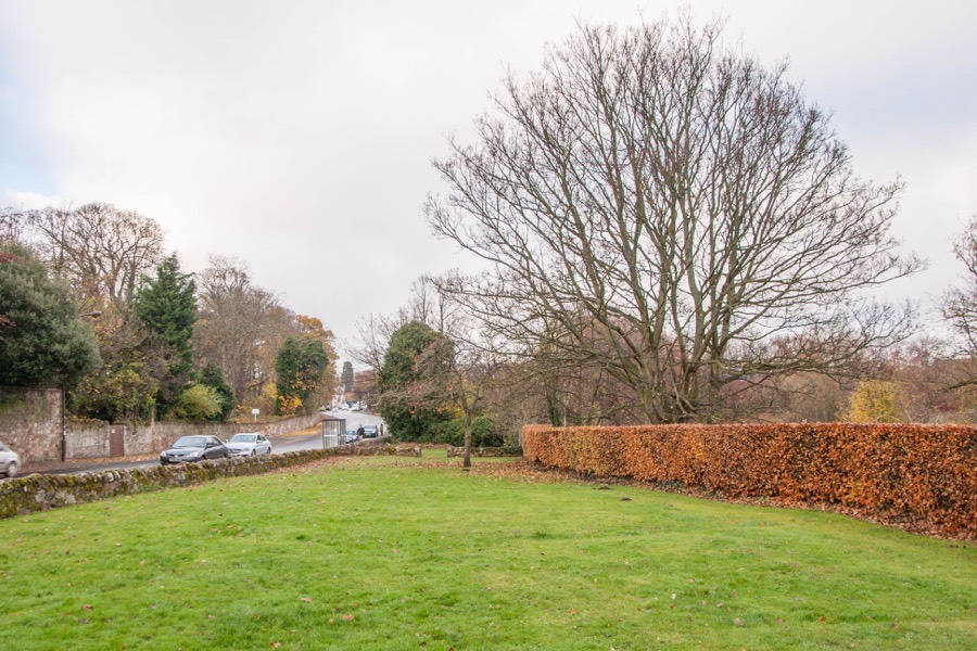
In September 2013 a community excavation of the site was undertaken by Connolly Heritage Consultancy with funding and help from the East Lothian Council Archaeology Service as part of the Peter Potter Gallery Monument Project. It was discovered that the building still stands to a height of 2.0 to 2.5m below ground level on the eastern side.
The vaulting had been removed from the kitchen but the walls still stood and a doorway leading into it from the courtyard was still intact complete with its lintel. To the south of this door a red sandstone window sill was discovered in situ in the rear staircase extension, looking out over the courtyard.
An excellent 3D model of the excavated site can be viewed here.
Alternative names for Bothwell Castle
Bothwell House; Bothwell's Castle; Bothwell's House; Sandybed House; Sandybeds


