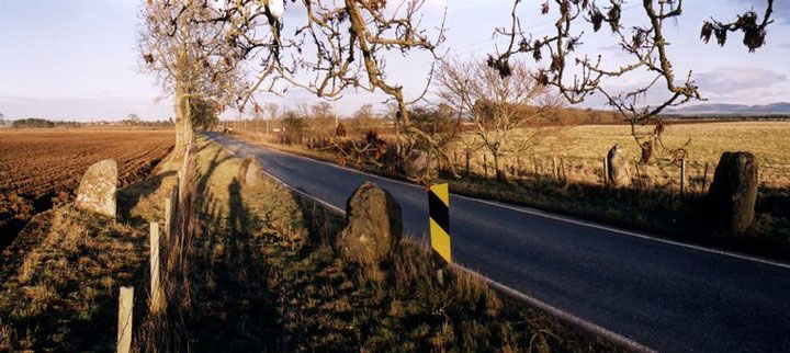

This circle of 6 stones is split by the B947 which runs through it E-W, with 3 stones to the N of the road, and 3 stones to the S.
The road was built in 1858 to replace an exisiting moorland track, and narrows slightly to pass through the circle. At that time, 2 of the stones had fallen, but when the new road was built, they were re-erected.
In the 1970s, one of the stones was hit by a lorry, and re-erected in concrete with iron supports. The stones closest to the road now have reflective warning signs in front of them to prevent further collisions. Only 2 of the stones are thought to be in their original positions, the W and NE stones being moved from their previous positions where the road now runs.
In the surrounding fields, aerial photography has revealed linear cropmarks, pit alignments and ditched barrows.
The shortest stone is 1.3m tall, & the tallest is 1.8m. The stones are graded to the SW and the circle is elliptical, measuring 16m by 15m.
Alternative names for Ardblair
Blairgowrie; Essendy Road; Leys, Leys of Marlee
Where is Ardblair?
Ardblair is in the parish of Kinloch and the county of Perthshire.
Grid reference: NO 1599 4388
Lat / long: 56.579309, -3.369142
OS Map for Ardblair
References (books)

London and New Haven, 1976

London and New Haven, 2000


