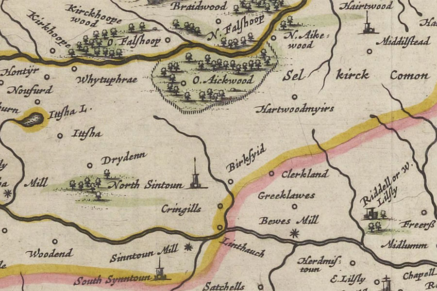
Riddell
Teviotia, Vulgo, Tivedail
Joan Blaeu, Amsterdam, 1654map image courtesy of NLS
Joan Blaeu, Amsterdam, 1654map image courtesy of NLS
Riddell House is a ruined mansion which incorporates the remains of Riddell Tower, a 16th century tower house.
In the late 16th century Sir John Riddell of Riddell married Jean, daughter of Sir James Anstruther of Anstruther. They granted the barony of Riddell to his eldest son, Walter Riddell, in 1630.
Some sources state that Sir John Riddell of Riddell married Anne, a daughter of Sir William Anstruther of Anstruther, however other sources state that Sir William died without issue and Anne may have been confused with Sir William’s sister, Jean.


Alternative names for Riddell
Riddell Tower; W. Lilsly; W: Lilsly