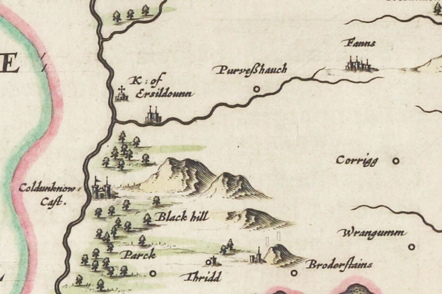
Cowdenknowes

Alternative names for Cowdenknowes
Coldenknowes; Coldingknowes; Coldunknow Castle; Coudenknollis; Cowdenknowes House; Sorrowlessfield
Coldenknowes; Coldingknowes; Coldunknow Castle; Coudenknollis; Cowdenknowes House; Sorrowlessfield
Cowdenknowes is in the parish of Earlston and the county of Berwickshire.
Grid reference:NT 57728 37038
Lat / long:55.625071,-2.6728482

Enter a starting point