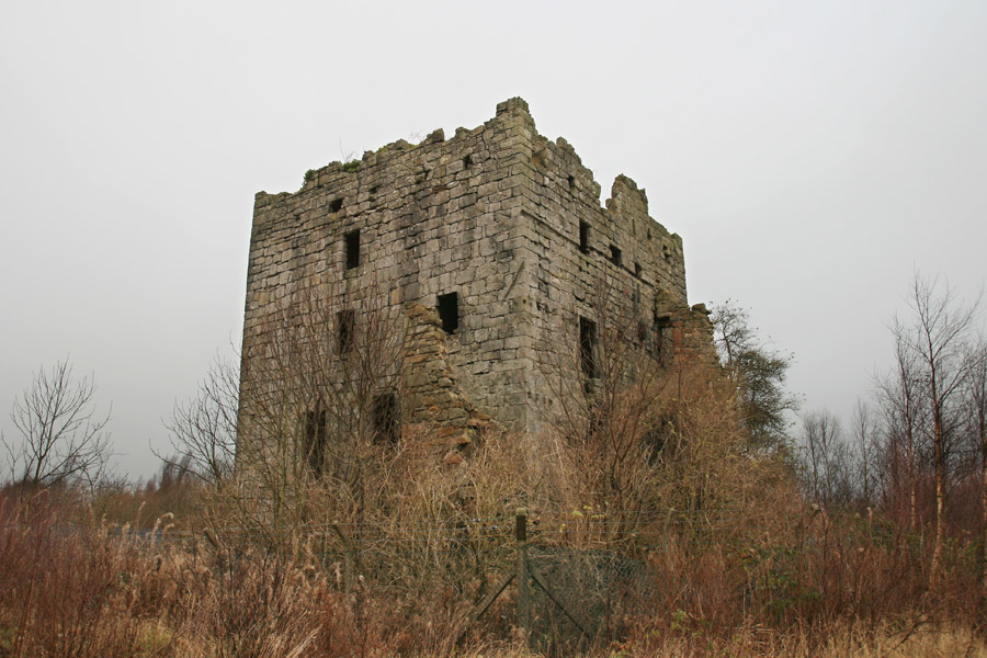
Almond Castle, formerly known as Haining Castle, is a ruined 15th century tower to which additions were made in the 16th century.
The earliest recorded reference to the then Haining Castle is from 1425, when it was owned by the Crawfords of Haining. It is likely that it was built some time not much earlier by a Crawford, perhaps William de Crawfurde de Manuel, who owned the surrounding barony of Manuel of which Haining Castle was the principal seat. William de Crawfurde de Manuel appears in written records as early as 1417.
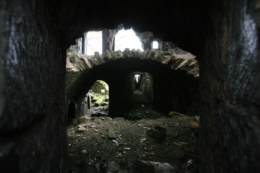
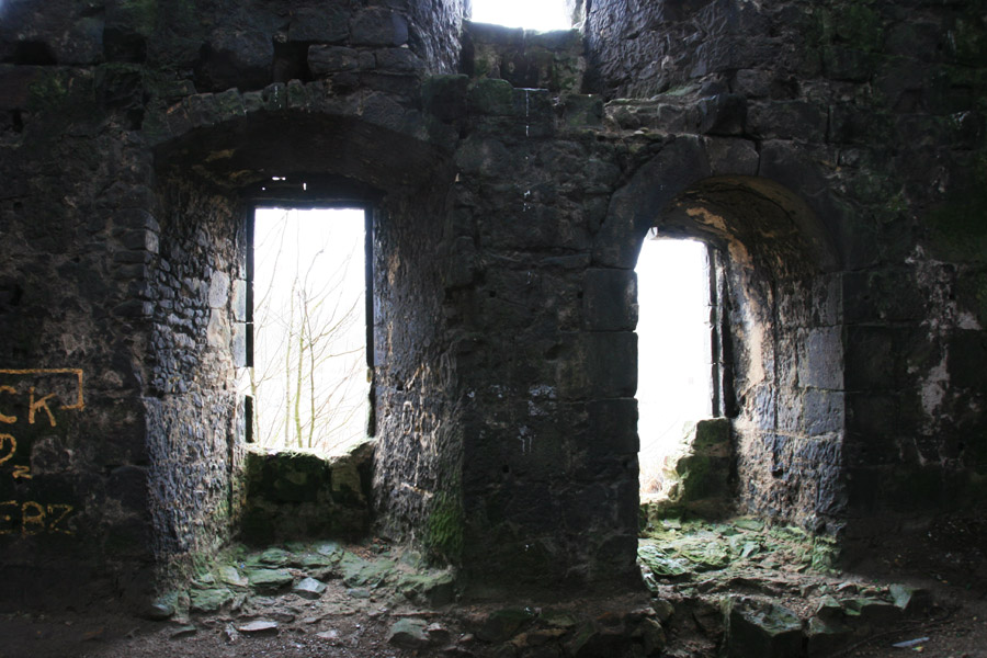
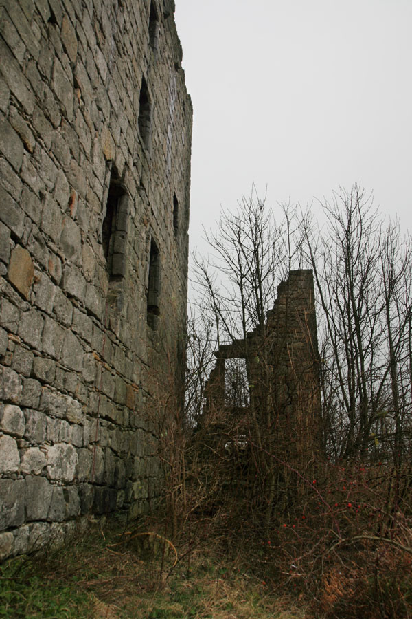
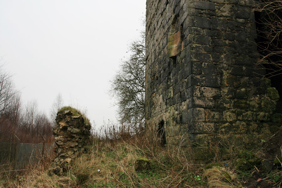
Originally built on an L-plan, the main block is rectangular aligned approximately east to west, with a smaller wing projecting from the east end of the north wall. Both have walls around 2.1m thick at ground level, and rise to a height of four storeys plus a garret. Standing on gently rising ground, the castle was once surrounded by a ditch, no trace of which remains but which was still around 5 metres wide in 1860.
The main entrance is via an arched doorway at first floor level, not within the re-entrant angle as is usual on later L-shaped castles, but in the centre of the long east wall. The entrance was protected by a projecting bartizan above, the remains of which can still be seen.
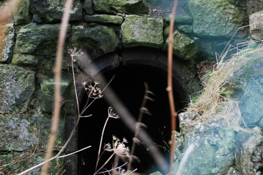
Part of the basement vaulting has now fallen in, and looking through a small window in the west wall allows a unique view of both the basement and first floor levels.
Thomas set about improving Haining Castle, updating the accommodation to be more fitting for 16th century living by adding a new wing to the south-west side of the original tower.
In 1582 Thomas married for the second time, taking Elizabeth Forrester for his wife. Soon after this another new wing was added, covering the whole of the front of the old castle and extending beyond it to the south-west.
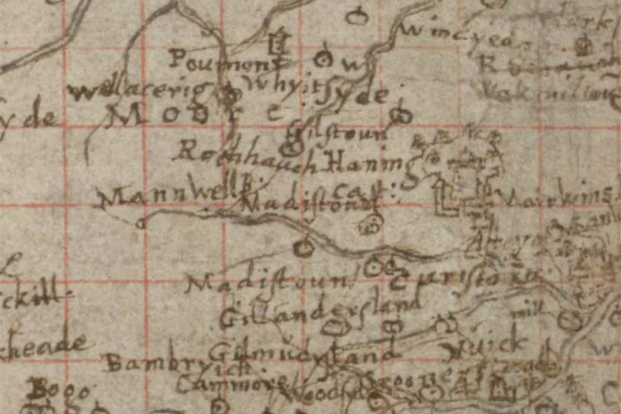
Timothy Pont, c.1583 – 1596image courtesy of NLS
Thomas Livingston was still alive as late as 1606, but by 1640 Haining Castle had passed to Sir James Livingston, son of Alexander Livingston, the 1st Earl of Linlithgow, and grandson of Thomas’ brother William, the 6th Lord Livingston.
Sir James had been given the title of Lord Almond by Charles I in 1633, and when he inherited Haining Castle he changed its name to Almond Castle, the name by which it is now more commonly known.
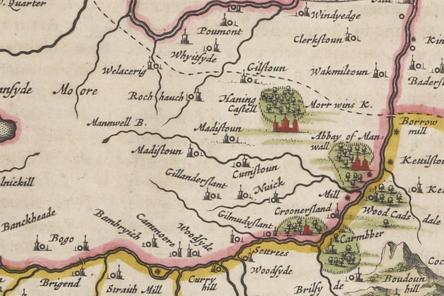
Joan Blaeu, Amsterdam, 1654image courtesy of NLS
In 1715 James, the 4th Earl of Callendar and 5th Earl of Linlithgow, joined the Jacobite Rising with 300 of his retainers, and as a result the Livingston seats of Almond Castle and Callendar House were forfeited.
The York Buildings Company bought Almond Castle and Callendar House from the Government in 1720. Although it is unclear what they did with the castle it was apparently let to tenants until it was abandoned as a place of residence around 1750 and later fell into ruin.
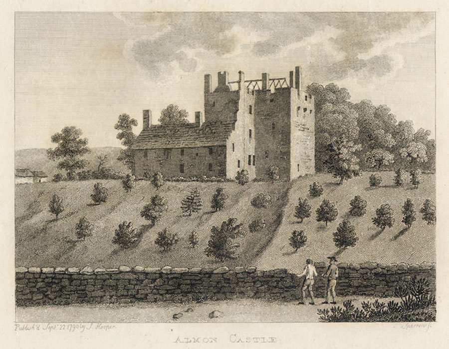
When the York Buildings Company went into liquidation in 1783, the now ruinous Almond Castle was sold to William Forbes, an Aberdeenshire copper merchant who also bought Callendar House. The Forbes family made Callendar House their home, and little seems to have been done with Almond Castle, which by 1790 was a substantial ruin.
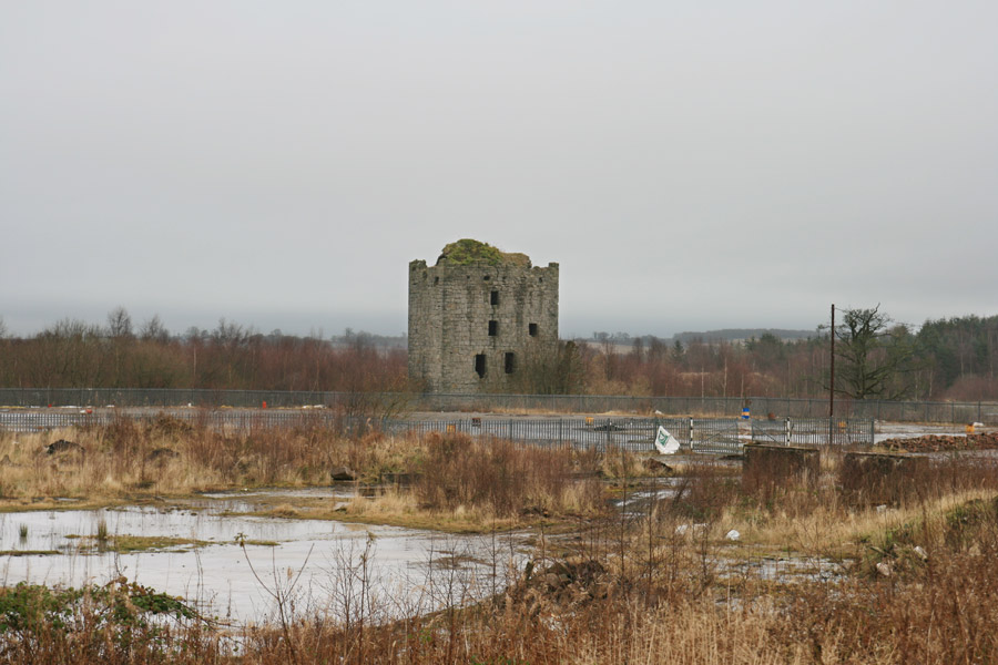
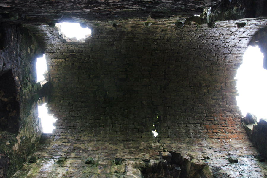
Almond Castle is a very substantial ruin, but it is in danger of deteriorating, with several holes in the vaulted roof weakening the structure.


Alternative names for Almond Castle
Almon Castle; Almont; Amont; Castle of Haining; Haining Castle; Haning Castell; Hayning; The Haining; Vellore
Where is Almond Castle?
Almond Castle is in the parish of Muiravonside and the county of Stirlingshire.
Grid reference: NS 95663 77284
Lat / long: 55.97722, -3.673607