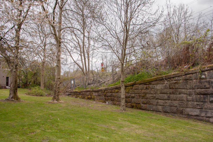

Easter Greenock Castle was a 16th century castle which had been completely removed by the end of the 19th century.
The earliest history of the lands of Easter Greenock isn’t known, however a Hugh of Greenock swore to Edward I of England in 1296. His surname isn’t recorded but he is assumed to be an ancestor of the Galbraith family who held the lands of Greenock by the 14th century. When Malcolm Galbraith died without a male heir the lands were divided between his two daughters, with Easter and Wester Greenock being split by the Strone Burn. The castle of Easter Greenock seems to have existed by this time.
Malcolm’s elder daughter received the lands of Easter Greenock and when she married Malcolm Crawfurd of Loudon, during the reign of Robert III (1390 to 1406) the estate passed to that family, although they appear not to have lived there permanently until the mid-16th century. Their son, also Malcolm, was the progenitor of the Crawfurds of Kilbirnie. Malcolm’s younger daughter married a Schaw around 1420 and took with her Wester Greenock.
The castle of Easter Greenock was situated just to the north of the confluence of two burns, one of which was the Craigieknowe Burn, both of which are now covered over. It’s marked on Pont’s map as Easter Greenock and shown as a large castle, the biggest in the immediate area indicating its important status.
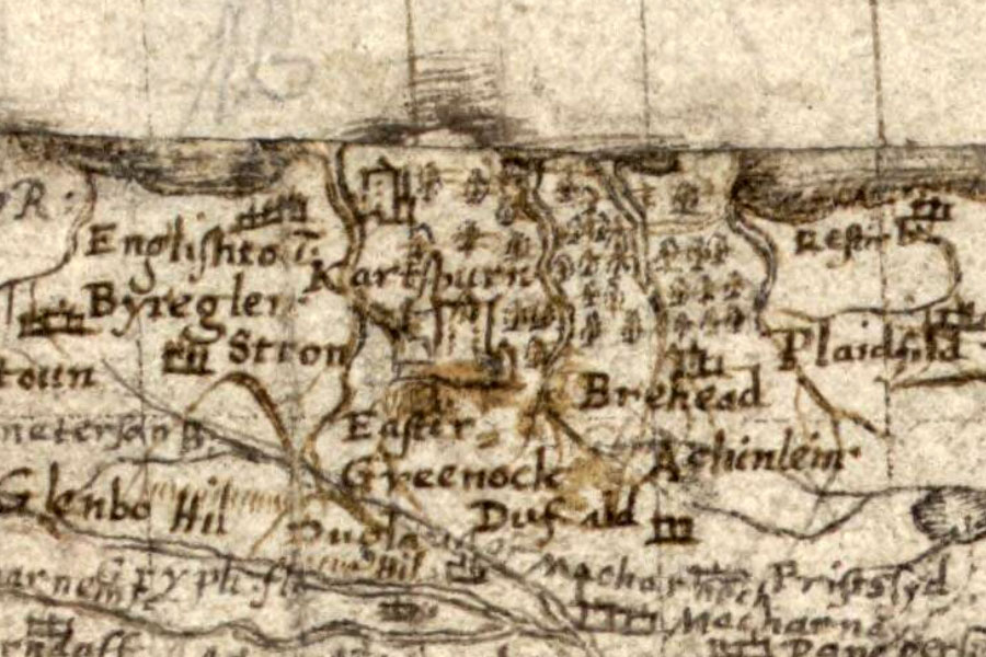
Timothy Pont, ca. 1583 – 1596map image courtesy of NLS
In 1528 Malcolm’s great-great grandson Lawrence is recorded as excambing or exchanging his part of Crawfordjohn with Sir James Hamilton of Finnart for the lands of Drumry. When Lawrence died in 1547 Kilbirnie was inherited by his eldest son, Hugh, Easter Greenock passed to his second son, John, and his third son, Thomas, was the ancestor of the Crawfurds of Jordanhill and the Crawfurds of Cartsburn.
John is thought to be the first Crawfurd to reside permanently at Easter Greenock, but he died in 1603, seemingly without male issue, and the estate may have passed back into the main Kilbirnie line at this time. Certainly in1624 Sir John Crawfurd of Kilbirnie obtained a Royal grant of the lands of Easter Greenock, becoming known as Sir John Crawfurd of Kilbirnie and Easter Greenock. On Blaeu’s map of “The Baronie of Renfrow” (published in 1654) Easter Greenock is again shown as a large and prominent castle.
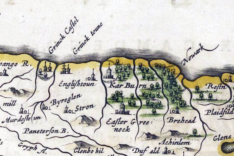
Joan Blaeu, Amsterdam, 1654map image courtesy of NLS
When Sir John died in 1661 his estates passed to his daughter Margaret on the condition that her heirs took the surname of Crawfurd. In 1664 she married Patrick Lindsay, the second son of John, 15th Earl of Crawfurd, and became known as Dame Margaret Crawfurd, Lady Kilbirnie.
The Easter Greenock estate was in debt when it came into her possession so she decided to sell it to Sir John Schaw of Wester Greenock in 1669, although she retained a portion of it around Crawfurdsdyke named Cartsburn. This she sold to her distant relative Thomas Crawfurd, the second son of Cornelius Crawford of Jordanhill, in 1668.
How the Schaw family used Easter Greenock Castle is unknown, however their main residence seems to have continued to be that of Wester Greenock. In 1670 Sir John Schaw was granted a Crown charter allowing him to unite Easter and Wester Greenock into a single barony, the Burgh Barony of Greenock.
The castle is marked on Herman Moll’s map, drawn some time before his death in 1732 and published in 1745, as Easter Greenock alongside a castle symbol, and is seemingly marked on Roy’s map of the Lowlands as Killbirny. By the middle of the 18th century Easter Greenock Castle was in ruins, and is marked as “Castle in ruins” on John Ainslie’s map of 1800. A drawing of the ruins appeared in The Scots Magazine in September 1809 (and was reprinted in a later book), at which time one corner section of wall still stood to second floor height.
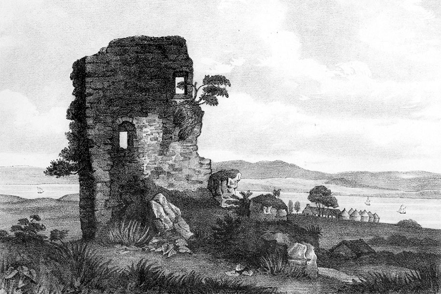
Greenock, 1891
The image was accompanied by the text “The view annexed represents the ruins of the Castle as they appeared about five years ago. The tower has since fallen, and in the course of a few years the plough will probably pass over the remains.”
When Captain John Campbell built Bridgend House to the south-west of the castle he is thought to have used stones from the ruins in its construction. The site of the castle is marked on the 1864 OS 25 inch map (surveyed in 1857) as a round mound within the landscaped grounds of Bridgend.
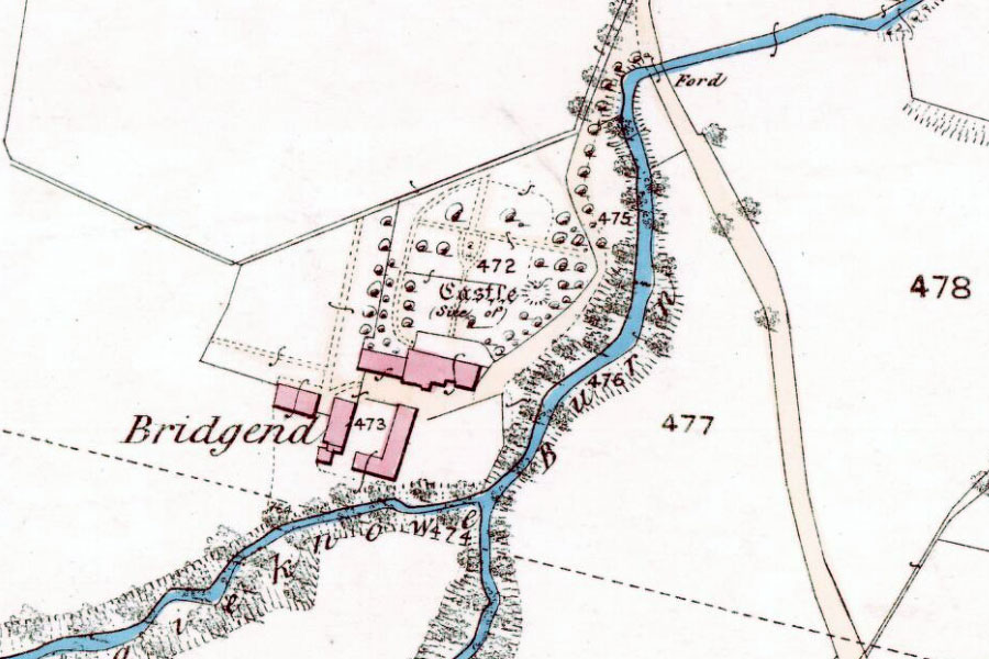
Ordnance Survey, 1864map image courtesy of NLS
The same style of round mound is marked on the 1864 OS Six inch map (surveyed in 1857) immediately to the south of the railway. Interestingly it is said to have been destroyed when the Wemyss Bay branch of the London Midland & Scottish Railway line was built in 1886. The round mound also appears on the 1898 OS Six inch map (revised in 1896), overlapping the railway embankment.
When the last of the castle’s ruins were finally removed is not clear, however the site is marked on the 1941 OS 25 inch map (revised in 1938) but without the mound symbol. Nothing of the castle remains today, and the only clue to its existence is in the name Castle Street which curves to the south of the castle’s original position.
Alternative names for Easter Greenock Castle
Easter Kilbirny Castle; Greenock-Easter; Greenock Castle; Kibery-Grenock; Killbirny


