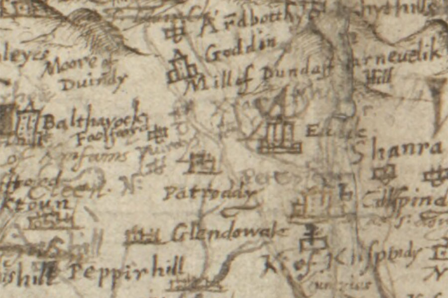
Balthayock Castle


Alternative names for Balthayock Castle
Tower Of Balthayock
Where is Balthayock Castle?
Balthayock Castle is in the parish of Kinnoull and the county of Perthshire.
Grid reference:NO 17411 22957
Lat / long:56.391708,-3.339327
Tower Of Balthayock
Balthayock Castle is in the parish of Kinnoull and the county of Perthshire.
Grid reference:NO 17411 22957
Lat / long:56.391708,-3.339327

Enter a starting point


