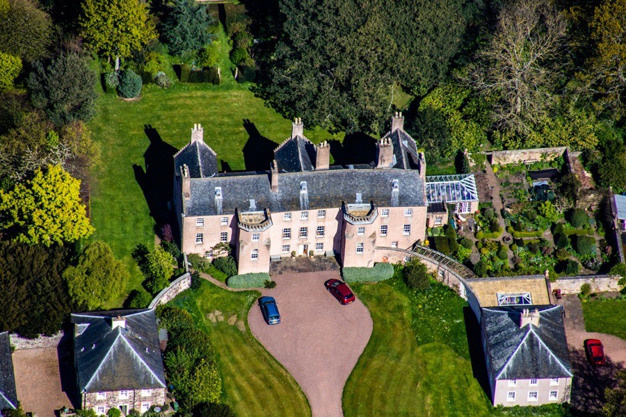
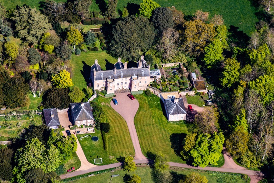
Balgone House is a largely early 18th century mansion but incorporates a 17th century tower house which itself incorporates earlier work.
In the 14th century Balgone seems to have been owned by the Lauders of the Bass, with Sir Robert Lauder resigning his lands of Balgone and Bass, and Edrington in order to receive a new charter of them from James I.
The first building at Balgone was almost certainly a small rectangular tower. Within the south end of the present house are small vaulted chambers, at the south-west corner, and a large chimneypiece that has been dated to the 15th century. Later the tower was extended to form an L-plan tower house, consisting of three storeys and an attic with a kitchen in the basement, featuring a large fireplace, and a spiral staircase in a polygonal stair tower leading to the upper floors.
By the early 17th century the Lauders were in some financial difficulty, and in 1624 George Lauder of the Bass, Sir Robert’s grandson, sold Balgone, along with numerous other estates, to Thomas Hamilton of Priestfield, 1st Earl of Melrose and later 1st Earl of Haddington.
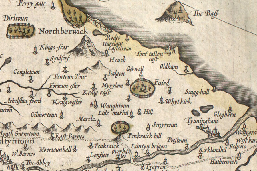
Hendrik Hondius, Amsterdam, 1630map image courtesy of NLS
Balgone seems to have passed from the Earl of Haddington to the Ross of Halkhead family since in 1632 James Ross, 6th Lord Ross, received a charter of Balgone, but died the following year. Lord Ross was the son of Robert Ross, 5th Lord Ross, and Jean Hamilton, the daughter of Gavin Hamilton of Raploch. Perhaps there was some connection between the Hamiltons of Priestfield and the Hamiltons of Raploch involved in the transfer of ownership of Balgone, although if there was I haven’t yet been able to ascertain what it was.
This is also the case with the next transfer of ownership, to the Sempill or Semple family. Again, there is a hint of a connection since James Ross, 4th Lord Ross, was married to Jean Sempill, daughter of Robert, 3rd Lord Sempill. However James Ross, 7th Lord Ross, and Robert Ross, 9th Lord Ross, received charters of Balgone in 1636 and 1641 respectively.
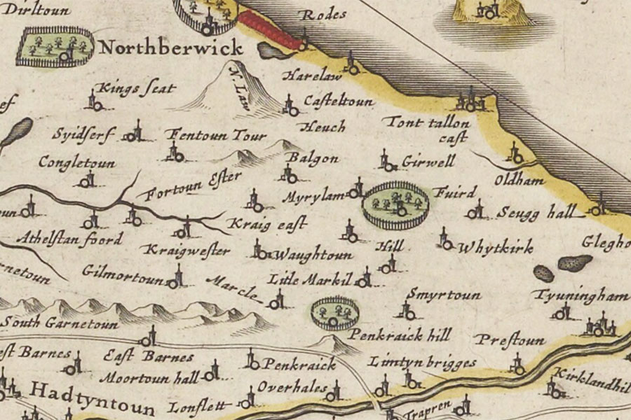
Joan Blaeu, Amsterdam, 1654map image courtesy of NLS
John Semple of Balgone was Writer to the Signet in 1658 but died in 1662 and was succeeded by his nephew, also John Semple. The younger John’s daughter and heiress, Marion, married George Suttie of Addiston, possibly in 1677, and when her father died in 1680 Balgone passed into the Suttie family.
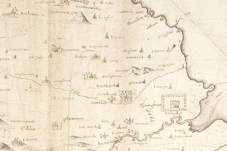
John Adair, 1682map image courtesy of NLS
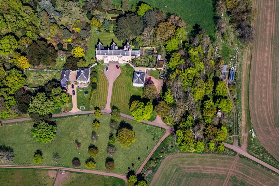
In 1690 Sir George Suttie of Balgone was a Commissioner for the shire of Haddington. Around 1700 the house was extended considerably to the north, forming a nine bay façade on its east and west sides. When viewed from the air it can be seen that the oldest section of the house to the south is at a slight angle to its extension.
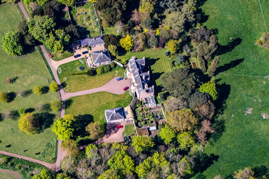
On the west side a second polygonal tower was added to make the front symmetrical, with a new entrance created centrally between the two projecting towers. The east side was also made symmetrical, with two projecting crow-stepped gables added at the middle and the north end to mimic the projecting wing of the L-plan tower at the south end and create an E-plan building.
Sir George was made a baronet of Nova Scotia in 1702, died in 1710 and was succeeded by his son, Sir James, 2nd Bt, who was married to Elizabeth Dalrymple, daughter of Sir Hew Dalrymple, 1st Bt., of Leuchie. The same year the first baronet’s daughter, Marion Hepburn, married Patrick Hepburn of Smeaton.
Upon Sir James’ death in 1736 he was succeeded by his son, Sir George, 3rd Bt., and some time after 1739 he was responsible for adding a pair of two storey pavilions just to the north-west and south-west of the house and linked to it by curved walls. Around this time formal gardens were laid out to the north and east of the house.
The third baronet married Agnes Grant, second daughter of William Grant, Lord Prestongrange, in in 1757 and was Member of Parliament for Haddingtonshire between 1768 and 1777. Later in the 18th century a new drive was constructed, approaching the house from the east before curving around the north gardens to arrive at the entrance on the west façade.
Sir George died in 1783 and was succeeded by his son, Sir James, 4th Bt.. When his maternal grandfather, Lord Prestongrange, died in 1764 his estates passed to his eldest daughter, Janet, and upon her death in 1818 they passed to her nephew, the 4th baronet. He added Grant to his name to become Sir James Grant-Suttie.
Early in the 19th century the house was further remodelled with the gap between the two projecting towers on the west façade being filled in with the addition of a three bay extension and a Scots Baronial wing being added to the east. The family’s wealth had increased partly due to the coal mining taking place on the Prestongrange estate.
Following Sir James’ death in 1836 the estates passed to his son, Sir George, 5th Bt., who was probably responsible in the mid-19th century for the rerouting of the driveway so that it approached the house from the north. The neighbouring Rockville estate was amalgamated with that of Balgone around this time and so the driveway was designed to split and give access to both properties. Around 1859 to 1860 a new Scots Baronial wing was added to the north-east of the house, built to a design by James Anderson Hamilton. North and south gate lodges on the edges of the estate were constructed in 1862.
Sir George died in 1878 and was succeeded by his son, Sir James, 6th Bt., but he died unexpectedly within a few months of his father placing financial pressure on the family’s estates which passed to his son, Sir George, 7th Bt. When this Sir George died without issue in 1947 the estates passed to the young son, Sir (George) Philip, 8th Bt., of his cousin George who had emigrated to Canada after the Second World War. Due in part to his age but also because his family were abroad the estates were managed by lawyers.
In 1956 Prestongrange was sold and in 1959 the 8th baronet moved to Scotland to find Balgone House run down, occupied by a pair of old aunts, and the estate in a bad condition. The farmland had been tenanted out up to this point however he took the farm back to manage it directly.
When the aunts died Sir Philip and his son, James, took the decision to sell the house to a surgeon, Alan Dean, in 1989, keeping the rest of the land and moving to Sheriffhall on the estate. The north and south pavilions and the north and south gate lodges were also sold off. The surgeon and his architect son, Marcus Dean, restored the house during the 1990s and removed the Victorian additions in 1992. The north part of the house was later converted into a self-contained apartment.


Alternative names for Balgone House
Balgon; Balgoun; Balgown