Crichton Mains
Crichton Mains souterrain is situated in the middle of a field, on the north side of a slight ridge, and is around 400 metres west-north-west from Longfaugh fort.
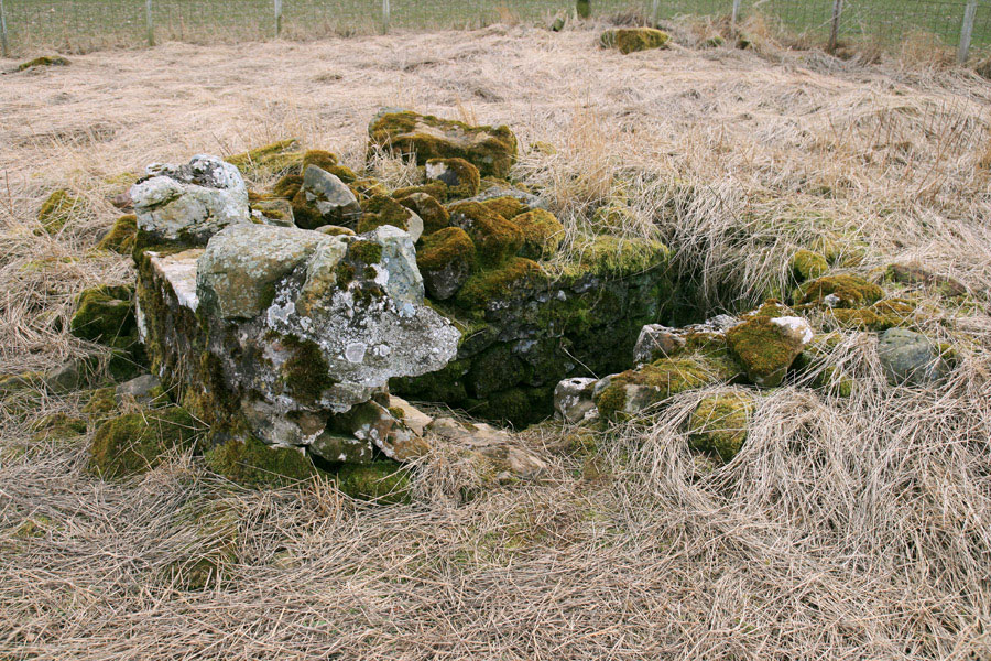
Above ground are a number of dressed stones forming the entrance.
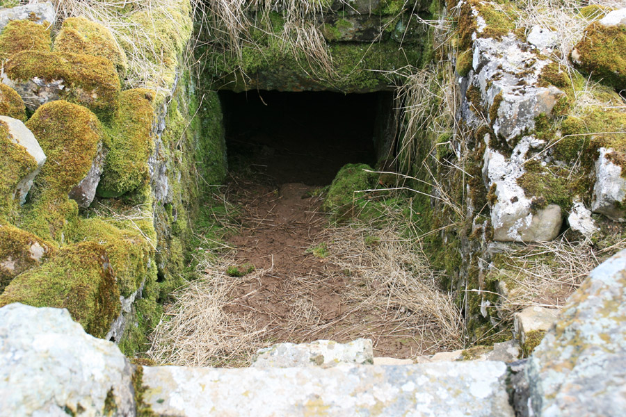
At the bottom of the narrow, moss-lined entrance is a small opening giving access to the souterrain.
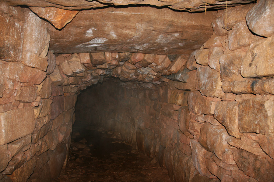
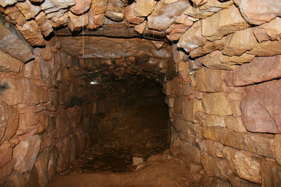
Through this opening is a low-roofed passageway leading to the main chamber of the souterrain, which opens out both left and right, and it is tall enough to stand up in. The roof is a mixture of huge lintels and smaller stones forming an arch. The souterrain was re-roofed in the 19th century, the roof having fallen in.
Unlike some other souterrains, the ends are just squared off rather than widening out into a bell shape.
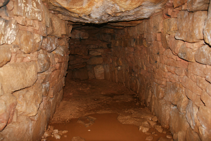
The builders of the souterrain reused stone from a variety of periods, and it’s possible to see carved Roman stones from a nearby military post, and what looks like a lintel featuring cup marks.
Looking up the low entrance passageway emphasises how small the entrance opening is compared to the interior of the souterrain.
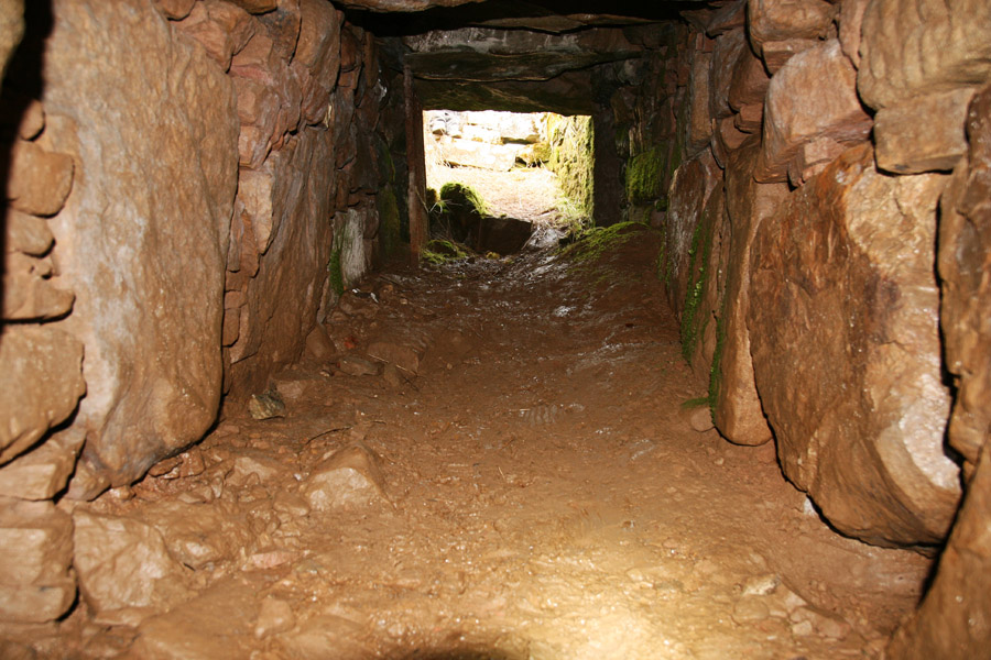
It has been speculated that the current entrance may be a secondary one, with a main entrance at the north-west end where a partly-buried lintel can be seen above ground.


Where is Crichton Mains?
Crichton Mains is in the parish of Crichton and the county of Midlothian.
Grid reference: NT 4001 6191
Lat / long: 55.846696, -2.959565
OS Map for Crichton Mains
Directions to Crichton Mains
Enter a starting point


Weather at Crichton Mains
max 7°C / min 4°C
1003mb
66%
19%
04:34 19:44
Few clouds
Weather observed at Gorebridge at 21:58


