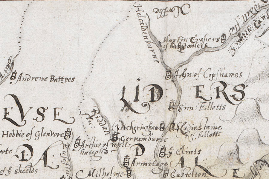
Andrew Battye's Tower
The Burghley Atlas© British Library Board, Cartographic Items Royal MS.18.d.III., f.76r
A tower belonging to Andrew Battye or Beattie once stood in this area but nothing of it now remains and its exact location is unclear.
The tower is marked as “Andrewe Battyes” on a map of 1590 which appeared in “An atlas of England and Wales, made by Christopher Saxton”, a book owned by William Cecil, 1st Baron Burghley, and commonly referred to as The Burghley Atlas.


Alternative names for Andrew Battye's Tower
Andrewe Battyes Tower; Raeburnfoot
Where is Andrew Battye's Tower?
Andrew Battye's Tower is in the parish of Eskdalemuir and the county of Dumfriesshire.
Grid reference: NY 252 991
Lat / long: 55.280332, -3.1790889