Scrogs
Twee-dail with the Sherifdome of Etterik-Forest called also Selkirk
Joan Blaeu, Amsterdam, 1654map image courtesy of NLS
Joan Blaeu, Amsterdam, 1654map image courtesy of NLS
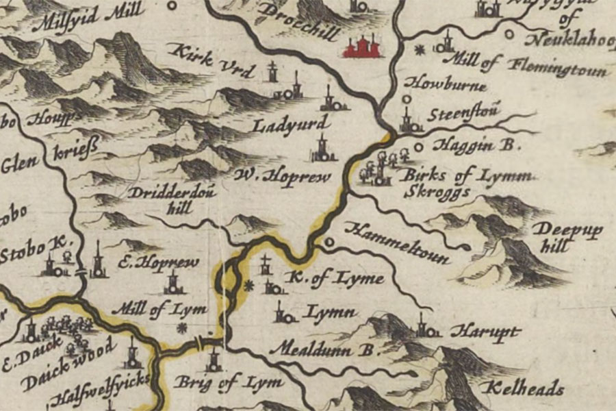
Skroggs is marked as a tower on Blaeu’s mid-17th century map and the lands of Scrogs are mentioned in 1208.
The property is also marked on Hondius’s map of 1630, based on Pont’s late 16th century work, as a tower named Birks of Lymm Skroggs.
A new description of the shyres Lothian and Linlitquo
Henrik Hondius, Amsterdam, 1630map image courtesy of NLS
Henrik Hondius, Amsterdam, 1630map image courtesy of NLS
The last remains of it were removed some time before 1856 and the stones used to build Hamildean farm.


Alternative names for Scrogs
Birks of Linn; Birks of Lymm Skroggs; Skroggs
Where is Scrogs?
Scrogs is in the parish of Lyne and the county of Peeblesshire.
Grid reference: NT 1827 4212
Lat / long: 55.6656849042535, -3.30082352425386