Stevenson
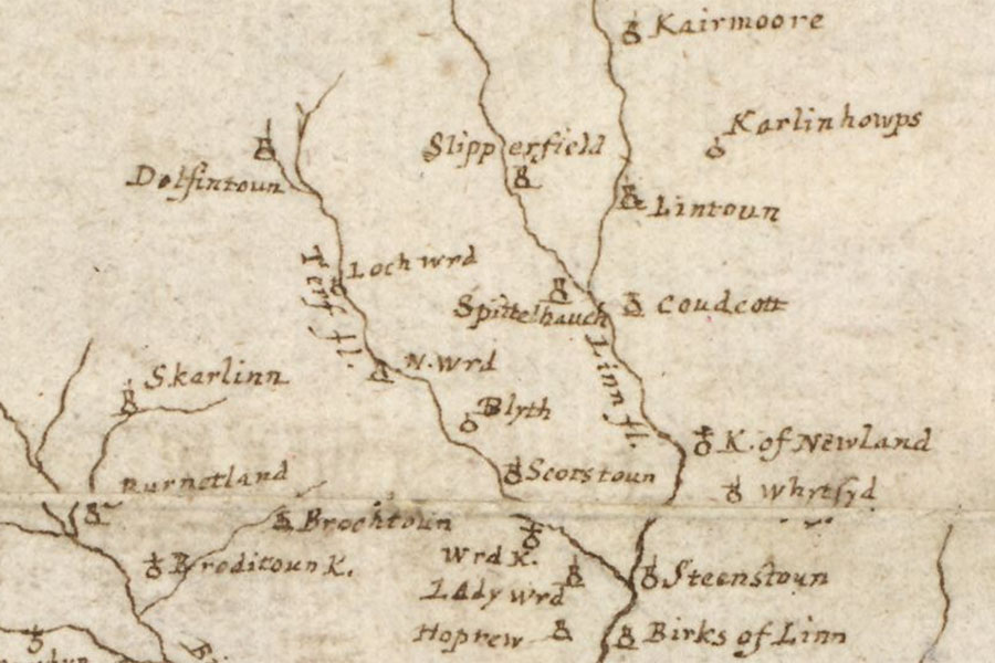
A map of the Clyde and Tweed basins
Robert Gordon, c. 1636 – 1652map image courtesy of NLS
Robert Gordon, c. 1636 – 1652map image courtesy of NLS
Stevenson is marked as a tower on Gordon’s and Blaeu’s mid-17th century maps.
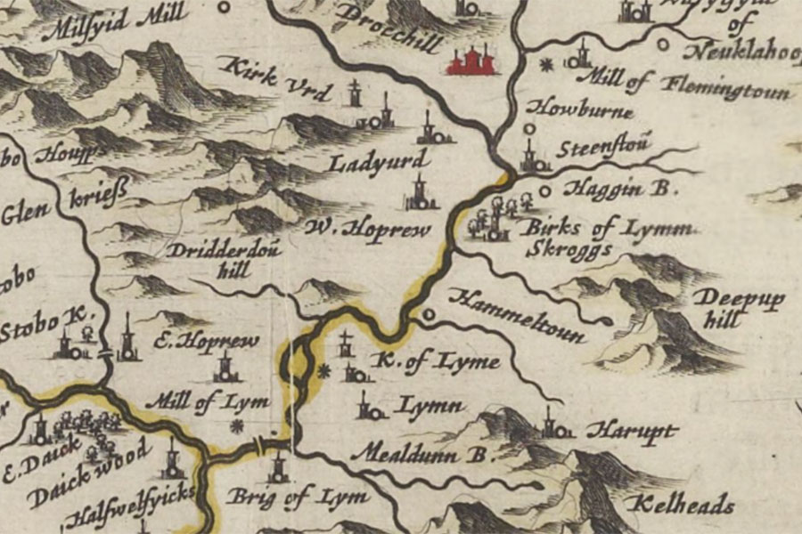
Twee-dail with the Sherifdome of Etterik-Forest called also Selkirk
Joan Blaeu, Amsterdam, 1654map image courtesy of NLS
Joan Blaeu, Amsterdam, 1654map image courtesy of NLS
I have placed the location of the tower at Stevenson farm pending further research.


Alternative names for Stevenson
Steenstou; Steenstoun; Stevenston
Where is Stevenson?
Stevenson is in the parish of Newlands and the county of Peeblesshire.
Grid reference: NT 16966 43073
Lat / long: 55.674024, -3.321836