Rossland (site of)
Rossland was a tower house that dated back to at least the 16th century but was demolished in the 19th century.
Rossland appears on Pont’s late 16th century map as Roslad, marked as a substantial tower. It has been described as one of the principle properties of the parish of Erskine in the 16th century.
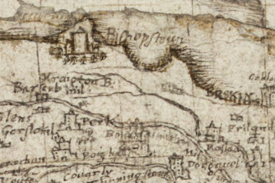
Timothy Pont, c. 1583 – 1596map image courtesy of NLS
Little is known about the early history of Rossland. A charter of 1595 refers to a John Stewart of Rossland, who is described as holding “the office of forester and custodier of the new forest called the Park of Partick”, and it has been assumed that these Rosslands are one and the same. However the charter is a list of properties and their owners in the parish of Govan, which would seem to rule out this being the Rossland in the parish of Erskine.
In addition to this a Robert Brisbane is recorded as owning Rossland in the second half of the 16th century. He married Janet, the daughter of James Stewart of Ardgowan, in 1562 and transferred the lands of Rossland to their son, Hannibal. Hannibal’s son, also named Hannibal, inherited Rossland from his father in 1636 and in 1638 sold it to his cousin John Brisbane of Bishopton.
Rossland appears on Robert Gordon’s mid-17th century map as Rosland.
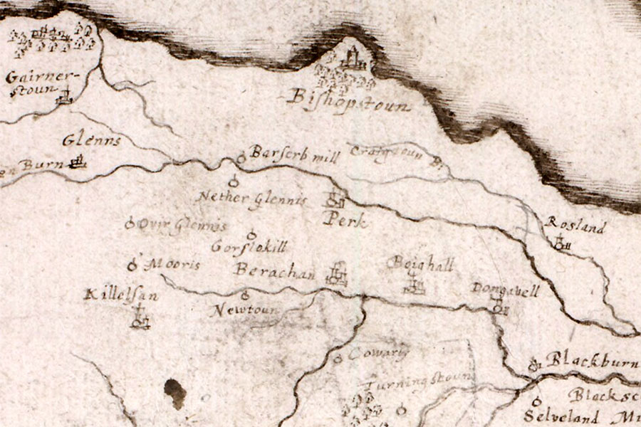
Robert Gordon, c. 1636 – 1652map image courtesy of NLS
In Blaeu’s Atlas of Scotland, published in 1654, it is marked as a significant tower with the name of Rostad which is probably a transcription error from Pont’s earlier map. A Matthew Brisbane of Rossland is mentioned in an Act of Parliament in 1661.
Some time later the estate was split into Easter Rossland, the half with the castle, and Wester Rossland. John Paterson of Craigton bought Easter Rossland from the Brisbanes, probably late in the 17th or early in the 18th century. His sister, Margaret, was married to Walter Brisbane, a merchant in Glasgow. In 1705 John Brisbane of Bishopton disposed of that estate to John Walkinshaw of that Ilk, along with the lands of Wester Rossland, Drum, Kirkland and Glenshinnoch.
In 1800 Rossland is shown on John Ainslie’s Map of the County of Renfrew as Roslin Castle but by 1808 it was in ruins, described as such in Duncan’s The Scotch Itinerary. On the Ordnance Survey 25 inch to the mile map of 1863, surveyed in 1857, Easter Rossland is shown as a collection of four buildings but there is no mention of castle ruins. This may suggest that the last of the ruins had been cleared away by this time.
Today Rossland gives its name to an area of Bishopton, and a Castle Crescent can be found just to the west of the site of the castle off Kingston Road.


Alternative names for Rossland
Easter Rossland; Roslad; Roslin; Roslin Castle; Rostad