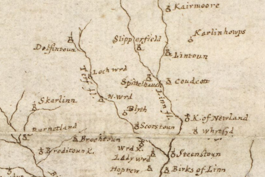
Lochurd
A map of the Clyde and Tweed basins
Robert Gordon, c. 1636 – 1652map image courtesy of NLS
Robert Gordon, c. 1636 – 1652map image courtesy of NLS
Lochurd is marked as a tower on Gordon’s mid-17th century map and was a property of the Scotts of Buccleuch in the 15th century.
I have placed the location of the tower at Lochurd farm pending further research.


Alternative names for Lochurd
Loch Wrd