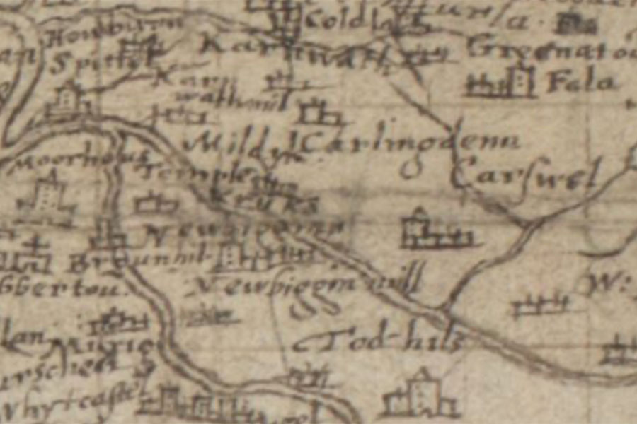
Falla
Pont 34: Glasgow and the county of Lanark
Timothy Pont, c.1583-1614map image courtesy of NLS
Timothy Pont, c.1583-1614map image courtesy of NLS
A tower named Fala is marked on Pont’s late 16th century map, but nothing of it now remains.
I have placed the site of the tower at Falla steading, the plot protected on two sides by the Falla Burn, pending further research.


Where is Falla?
Falla is in the parish of Carnwath and the county of Lanarkshire.
Grid reference: NS 9915 5030
Lat / long: 55.735603, -3.607589