Carterhope
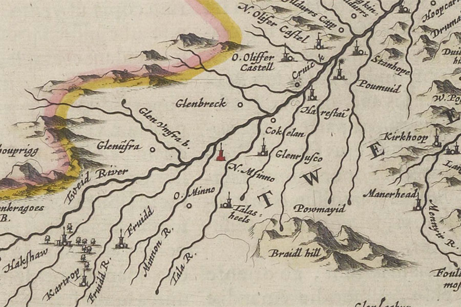
Twee-dail with the Sherifdome of Etterik-Forest called also SelkirkJoan Blaeu, 1654image courtesy of NLS
Carterhope is marked as a tower named Kartrop on Blaeu’s mid-17th century map of Tweeddale, based on Pont’s late 16th century work.
I have placed the location of the tower at Carterhope farmstead, now submerged under the Fruid Reservoir, pending further research.


Alternative names for Carterhope
Kartrop
Where is Carterhope?
Carterhope is in the parish of Tweedsmuir and the county of Peeblesshire.
Grid reference: NT 1010 1846
Lat / long: 55.451759, -3.422877