Bucklerhole was a Border tower associated with the Grierson family, but nothing of it now remains.
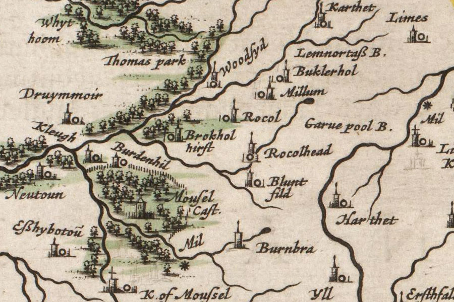
Exactly when it was built is unclear, however it is named (as Buklerhol) on a map in Joan Blaeu’s Atlas of Scotland, published in 1654 but based in part on Timothy Pont’s maps of the late 16th to early 17th century.
The 16th century was a turbulent period in this area, and a lot of towers were built around this time, so the date seems a likely one. It has been described as a Border tower or watchtower, and it seems probable that it consisted of two or three storeys with thick walls.
Standing on a slight natural knoll the east bank of the Linns Burn, it occupies a strategically important position, not far from the old Grierson castle of Rockhall. The clan were very active in the area, with their ancient seat of Lag around 25km (15mile) to the north-west.
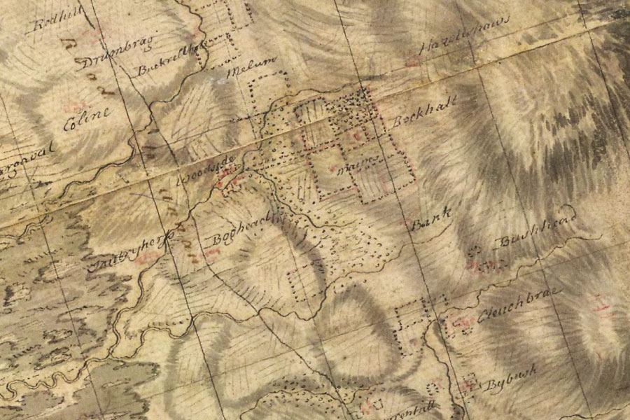
In William Roy’s Military Survey of the Lowlands, published between 1752 and 1755, Bucklerhole appears as what looks like Buckrellhole, visible just to the north-west of Rockhall.
By the early 18th century Bucklerhole was being farmed by a branch of the Grierson family, but it is unclear whether they were living in the tower, or perhaps in a newer building close by. The New Statistical Account of Scotland (written in 1845) states that until recently two storeys of the tower still stood, but “the walls are now little more than traceable”.
Some remains were still visible in 1882, and Bucklerhole was included in the RCAHMS Inventory of Monuments and Constructions in the County of Dumfries published in 1920. However nothing now remains on the site, although there is a later ruined cottage a few metres to the east.


Alternative names for Bucklerhole
Bucklahole; Bucklaw Hole; Bucklerhold; Buklerhol
Where is Bucklerhole?
Bucklerhole is in the parish of Mouswald and the county of Dumfriesshire.
Grid reference: NY 0441 7624
Lat / long: 55.071386, -3.4985379