skip to main content
Menu
  • Blog
    • Art & design
    • Castles
    • Cycling
    • Edinburgh
    • Edinburgh Festival
    • Food & drink
    • General
    • History
    • Music
    • Sport
    • Walking
    • Whisky
    • Wildlife
  • Castles
    • Glossary
    • Mottes
    • Stay in a castle
    • Castle blog posts
    • Alphabetical list of castles
    • Castles divided by county
    • Photos of castles
    • Castles we've visited
  • History
    • Castles
    • Ancient history
      • barrows
      • brochs
      • cairns
      • caves
      • chambered cairns
      • cists
      • crannogs
      • cursus monuments
      • forts
      • henges
      • rock art
      • sacred sites
      • souterrains
      • standing stones
      • stone circles
    • Pictish history
      • Pictish stones
      • Pictish sites
      • Pictish placenames
    • Clans
      • Surnames
      • Trace your ancestors
      • Tartan
    • Trace your ancestors
  • Culture
    • Music
      • Bands & musicians
      • Music links
    • Film
    • Television
    • Placenames
      • Pictish placenames
  • Eat
  • Drink
    • Scottish beer
    • Scottish gin
    • Scottish vodka
  • Stay
  • Travel guide
    • City guides
    • Car hire
    • Airports
  • Walking
    • Munros
    • West Highland Way
  • Photos
  • Offers
  • Home
  • blog
ancient sites in glorious sunshine

The sun was burning bright in a brilliant blue sky as I left Dundee this morning, heading west towards Loch Earn. The further west I went, the more glorious the weather got, the sun picking out the individual hills on the horizon. I parked the car in a layby beside the loch, just beyond the village of St Fillans, and walked back through the village to the footbridge over the River Earn.

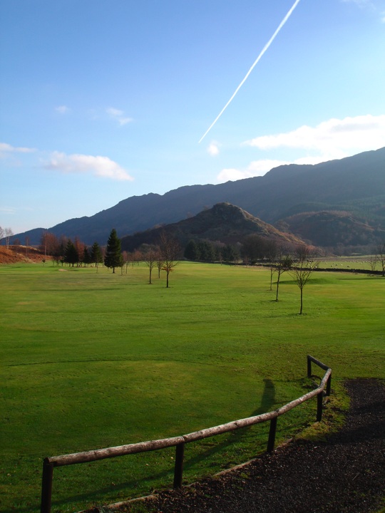
Over the footbridge I turned left and followed the path then the minor road along the edge of the river before turning onto the track that cuts across St Fillans golf course to Wester Dundurn. It was another Dundurn I was on my way to though, the fort on St Fillan’s Hill, rising majestically above the golf course.

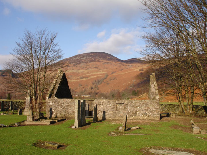
The fort is approached by way of a road to a sewage works, passing the ruins of St Fillan’s Church.

The road stops at the sewage works – thankfully there wasn’t much of a smell – so then it was across a muddy field before fording a wide, shallow burn on the way to the base of the hill. A gate gives access through a fence around the hill, after which the climb starts.

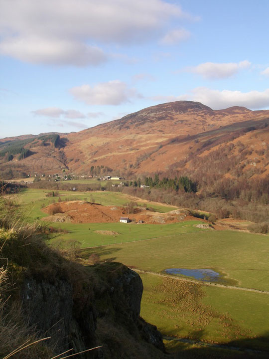
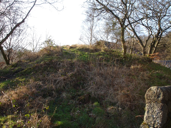
You can see why Dundurn was chosen as the site of a fort, as it rises steeply from the flat ground around it making it easy to defend. The slopes are littered with stones that are from the fort’s walls, which have now tumbled from their original position on the flat summit.

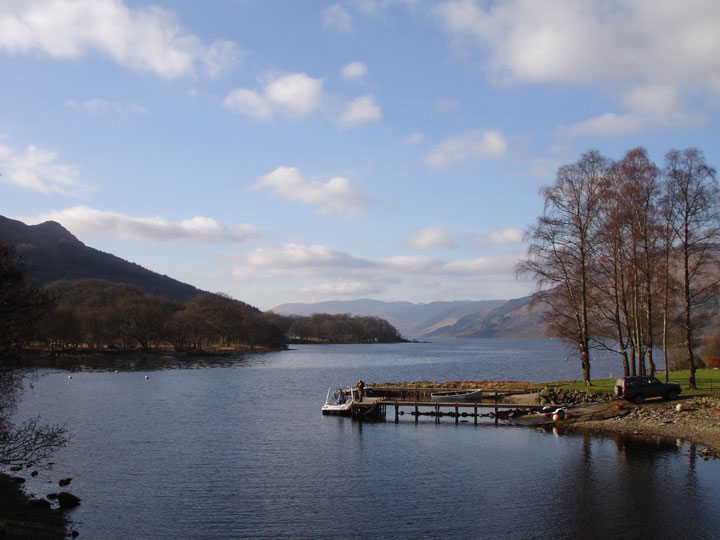
After scrambling up between these stones and the volcanic rock that formed this naturally-defendable position I reached the wide flat summit, which struck me as being much larger than I imagined after viewing Dundurn from the road. The views from the top are absolutely breathtaking, and provide great views over three major mountain passes, showing how strategically-important the fort was.

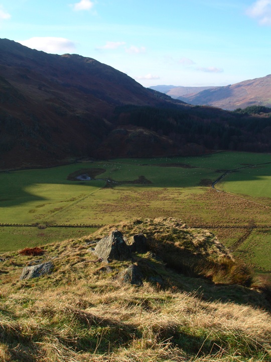
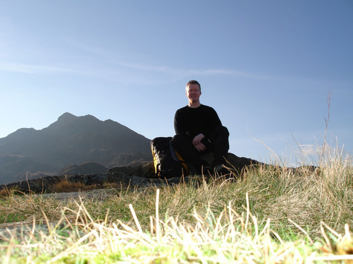
I stopped up here for my lunch, sitting on the rocky outcrop at the west end, legs dangling, enjoying the view towards Loch Earn, the only noise being babbling of the River Earn far below. The only noise that is until some goats appeared on the lower terrace.

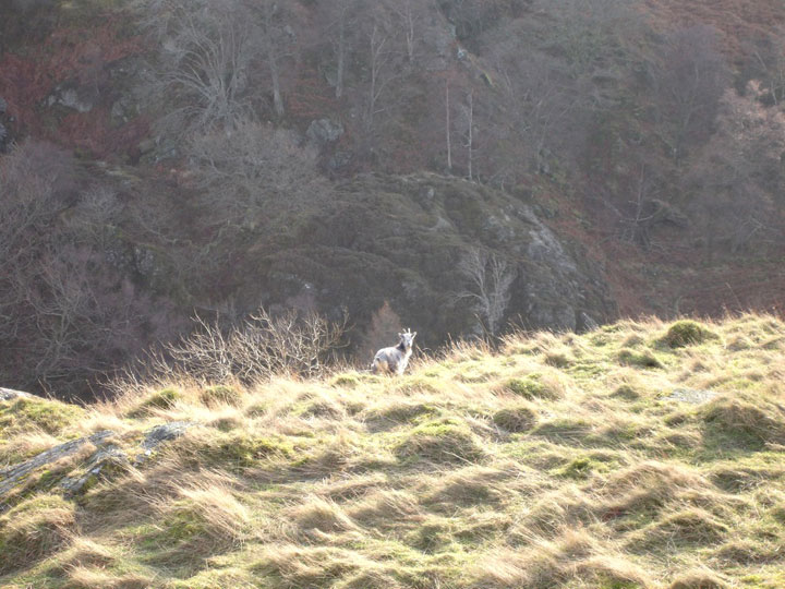
On any other day coming across a wild goat would have been fairly unusual, but I would see far stranger animals later in the day. After spending half an hour at the top of Dundurn I began the scramble back down the slopes, and retraced my steps back to the car. I drove the short distance to Comrie and parked by the school, then walked round the corner to the United Free Church.

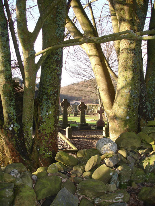
Behind the church is a mound called Tom na Chessaig (the hill of Kessog ) which is supposed to have been the site of a stone circle. It’s not much to look at now, overgrown and hemmed in by the church and houses, but originally it would have been in a stunning location, close to the banks of the River Earn with views up and down Strathearn.

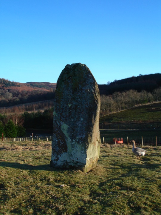
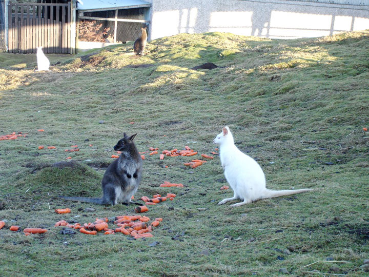
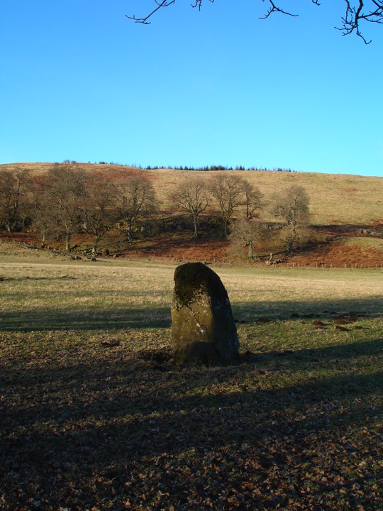
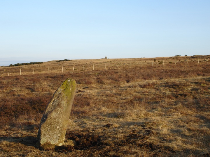
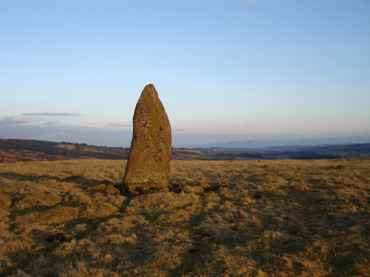
Then it was back to the car again, this time heading south over the River Earn and past the West Cowden Farm standing stone to the Auchingarrich Wildlife Centre. The rough track up was frozen and unforgiving, but it’s well worth the effort, because at the top – as well as all kinds of animals – is a large standing stone.

Back in the car I continued on the short distance to Craigneich Farm where there is a complex of fantastic ancient monuments. I parked carefully at the entrance to a field, making sure I didn’t block it, but as it happened the farmer’s wife came past on a quad bike driven by her grandson and said to park in the farm drive to be safe since they were about to take some hay bales in to the cows in that field. So I moved the car 100m and walked back to the first in this series of stones, Dunruchan F.

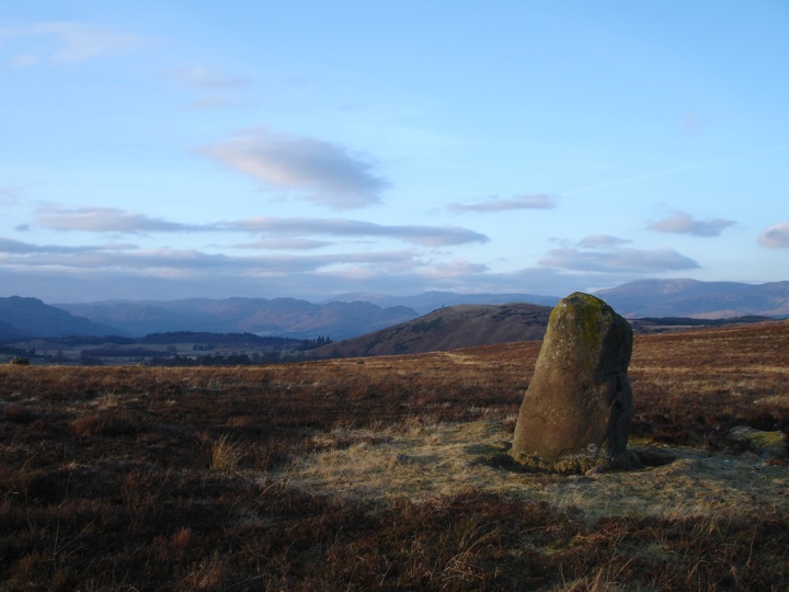
I set off up the track and through a large thicket of gorse, and emerged on the edge of a moor with a one standing stone visible in front of me (Dunruchan B), and another off to my left.

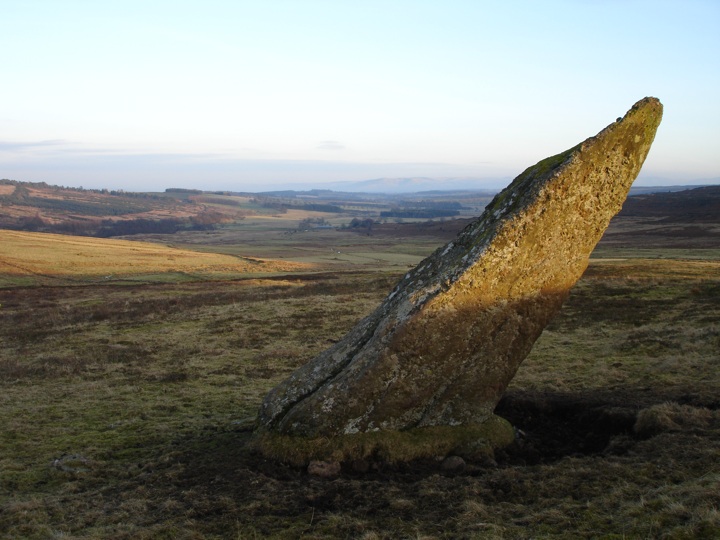
I decided to keep heading up as I knew there were several others further on, and would come back to the outlier on the way back down. After a few hundred more metres traipsing through the heather, I came to another stone, Dunruchan C, a massive stone leaning at a sharp angle.

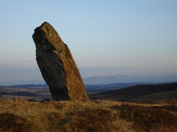
I could see the next stone, Dunruchan D, over the crest of another ridge. It turned out to be another large stone, again leaning at an angle.

It’s near neighbour, Dunruchan E, was smaller and more rounded.

I made my way back down to Dunruchan C and cut across into the next field to go and see the outlier, Dunruchan A. It can be quite difficult to judge the height of stones from a distance with nothing much to compare them to, and this was proved to be spectacularly true the closer I got. This stone is absolutely huge, measuring 3.45m in height.

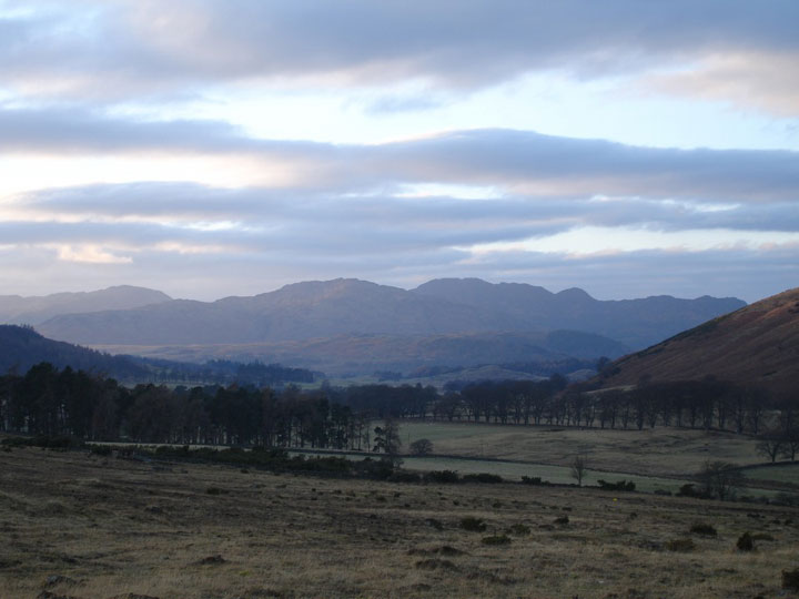
The views from up on the moor were fantastic, and as the sun started to go down behind the hills around Glen Artney it bathed the whole area in a soft light.

With the light fading, I made my way back down off the moor, past the cows that were busy eating, to the car, and drove home with a fiery sky in my mirrors.

Like this:

Like Loading...

Latest blog posts

The lost tower of Rakestonleis
23rd of July 2022 •
The three castles of Tolibothwell
7th of April 2020 •
Where to buy beer in Scotland during the Coronavirus lockdown
26th of March 2020 •
Cherry blossom in Edinburgh
23rd of April 2019 •
A dreich day of Dumfriesshire castles
13th of March 2019 •
Tweed Valley walks and Elibank Castle
30th of April 2018 •
Red squirrels at Eskrigg Reserve (and some castles)
6th of April 2018 •
Old and new Comiston Houses
29th of March 2016 •
Quintinshill rail disaster parade
23rd of May 2015 •
Cycling along Silverknowes Esplanade in Edinburgh
5th of April 2015 •
more blog posts....

Blog categories

art & design

15 posts

castles

88 posts

cycling

24 posts

Edinburgh

67 posts

Edinburgh Festival

7 posts

food & drink

4 posts

general

41 posts

history

143 posts

music

2 posts

sport

4 posts

walking

57 posts

whisky

1 posts

wildlife

41 posts

Follow us on bloglovin'

Stravaiging around Scotland Stravaiging around Scotland
  • advertisement

Most popular posts

Yester Castle and the Goblin Ha’
19th of June 2011 •
West Highland Way 2006 – Day 1
16th of July 2006 •
Ancient sites on Lewis
15th of June 2006 •
Calton Hill and the Scottish National Portrait Gallery
19th of May 2013 •
Loch Turret and Ben Chonzie
21st of October 2006 •
Standing stones in Edinburgh
28th of August 2010 •
Doors Open Day Edinburgh 2012
24th of September 2012 •
Castles and Pictish stones in the north of Scotland
13th of April 2013 •
Hot air ballooning over Scotland
2nd of April 2009 •
Walking around Gosford House and gardens
20th of June 2014 •
more blog posts....

Blogroll

Ailish Sinclair

BikELove Scotland

Edinburgh Drift

From Hill to Sea

isleofronalog

Jardine's Book of Martyrs

Kelsey Jackson Williams

Marc Calhoun

Scotland with The Wee White Dug

Scottish Crannogs

Senchus

The Hazel Tree

The History Girls Frae Scotland

The Urban Prehistorian

Walkhighlands

  • advertisement
  • advertisement
  • advertisement

Related pages

A trek to the top of Schiehallion
Walking in the woods above Pitlochry
Stormy Portobello and birdlife on the River Tyne
An underground adventure in southern Midlothian
Baby squirrels at Callendar House
Exploring the Carmichael estate
Published on the 4th of February 2006 at 10:03 pm. Updated on the 13th of March 2011 at 2:06 am.

Leave a comment

back to the top of the page

Connect with us

Like us on Facebook

Receive our newsletter

Follow us on Twitter

Tweets by Stravaig_Aboot

Quick links

Stay in a Scottish castle
Edinburgh Festival accommodation
Hotels in Scotland
Car hire in Scotland
Places to eat and drink in Scotland
Castles in Scotland
Trace your Scottish ancestors
Scottish clans
Standing stones in Scotland
The Picts
Pictish symbol stones
Pictish placenames
Scottish bands and musicians
Scottish films
Scottish TV shows
West Highland Way

About

Andy Sweet above Fast Castle

Stravaiging around Scotland is written, photographed and researched by Andy Sweet.
read more....

Cookies

To make this site work properly we use cookies to store information on your computer. Click here to read more.

Affiliate links

This site includes affiliate links and adverts. If you click on these links we may receive a small commission at no cost to yourselves. As an Amazon Associate we earn from qualifying purchases. This modest income goes towards funding the site.
© 2003 - 2025 Andy Sweet / Stravaiging around Scotland. Powered by WordPress. Hosted by Tsohost.
%d