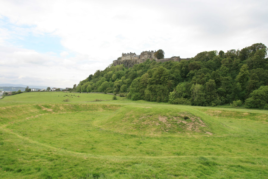
Stirling Castle
Where is Stirling Castle?
Stirling Castle is in the parish of Stirling and the county of Stirlingshire.
Grid reference: NS 79064 94043
Lat / long: 56.123874, -3.947976
Stirling Castle is in the parish of Stirling and the county of Stirlingshire.
Grid reference: NS 79064 94043
Lat / long: 56.123874, -3.947976

Enter a starting point


