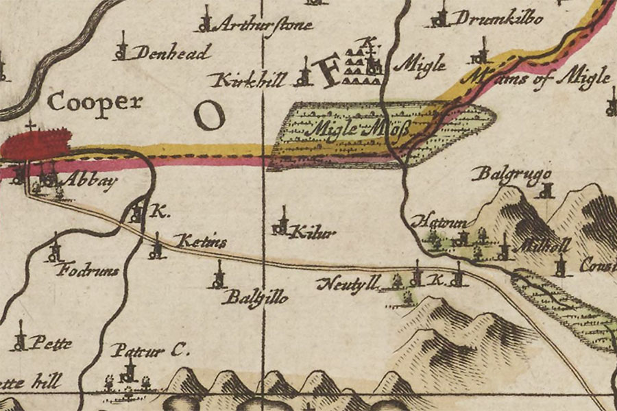
Kirkhill of Meigle


Alternative names for Kirkhill of Meigle
Belmont Castle; Kirkhill; Kirkhill Tower; Kirklands Tower
Where is Kirkhill of Meigle?
Kirkhill of Meigle is in the parish of Meigle and the county of Perthshire.
Grid reference: NO 28614 43926
Lat / long: 56.58189, -3.163706