Clach na h' Iobairt
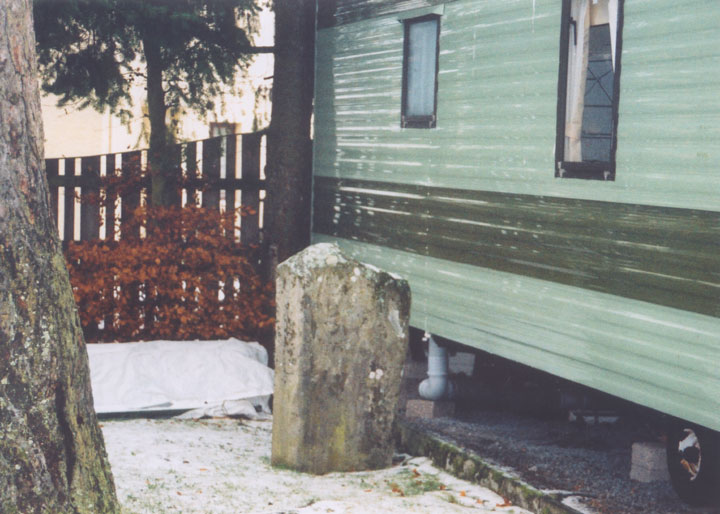
This stone is around 1m high by 0.5m wide by 0.2m thick, and is a fairly regular block which is apparently natural rather than shaped by tools. It stands on the banks of the River Tilt, although its once no doubt atmospheric surroundings are spoiled somewhat by it now having being swallowed up within a caravan park.


Alternative names for Clach na h' Iobairt
Bridge of Tilt
Where is Clach na h' Iobairt?
Clach na h' Iobairt is in the parish of Blair Atholl and the county of Perthshire.
Grid reference: NN 8762 6526
Lat / long: 56.76495633, -3.83899869
OS Map for Clach na h' Iobairt

Directions to Clach na h' Iobairt
Enter a starting point
Get directions
Weather at Clach na h' Iobairt
15°C
max 16°C / min 14°C
max 16°C / min 14°C
11km/h SE
1007mb
60%
73%
04:22 20:01
1007mb
60%
73%
04:22 20:01
Broken clouds
Weather observed at Pitlochry at 17:12
References (websites)
Ancient sites near Clach na h' Iobairt
Castles near Clach na h' Iobairt
Pictish stones near Clach na h' Iobairt

Pictish sites near Clach na h' Iobairt
Accommodation near Clach na h' Iobairt
River Tilt Park
0.1km away
Bridge of Tilt Hotel
0.3km away
Atholl Arms Hotel, Blair Atholl
0.6km away
Killiecrankie House
4.3km away
Loch Tummel Inn
7.9km away
Green Park Hotel
8.6km away
Tigh na Cloich Hotel
8.6km away
Craigatin House & Courtyard
8.9km away
Pine Trees Hotel Pitlochry
8.9km away
Moulin Hotel
8.9km away
Accommodation search
Cafés, restaurants & bars near Clach na h' Iobairt
Atholl Arms Hotel, Blair Atholl
0.6km away
House of Bruar
5.8km away
Moulin Hotel
8.9km away
The Auld Smiddy Inn
9.1km away
Strathgarry Restaurant & Rooms
9.2km away
McKays
9.2km away
The Old Mill Inn
9.3km away
Kingfisher Bar
9.4km away
Scotland's Hotel & Spa
9.5km away
Victoria's Restaurant
9.6km away


