skip to main content
Menu
  • Blog
    • Art & design
    • Castles
    • Cycling
    • Edinburgh
    • Edinburgh Festival
    • Food & drink
    • General
    • History
    • Music
    • Sport
    • Walking
    • Whisky
    • Wildlife
  • Castles
    • Glossary
    • Mottes
    • Stay in a castle
    • Castle blog posts
    • Alphabetical list of castles
    • Castles divided by county
    • Photos of castles
    • Castles we've visited
  • History
    • Castles
    • Ancient history
      • barrows
      • brochs
      • cairns
      • caves
      • chambered cairns
      • cists
      • crannogs
      • cursus monuments
      • forts
      • henges
      • rock art
      • sacred sites
      • souterrains
      • standing stones
      • stone circles
    • Pictish history
      • Pictish stones
      • Pictish sites
      • Pictish placenames
    • Clans
      • Surnames
      • Trace your ancestors
      • Tartan
    • Trace your ancestors
  • Culture
    • Music
      • Bands & musicians
      • Music links
    • Film
    • Television
    • Placenames
      • Pictish placenames
  • Eat
  • Drink
    • Scottish beer
    • Scottish gin
    • Scottish vodka
  • Stay
  • Travel guide
    • City guides
    • Car hire
    • Airports
  • Walking
    • Munros
    • West Highland Way
  • Photos
  • Offers
  • Home
  • history
  • castles
Tom an Tigh Mhoir

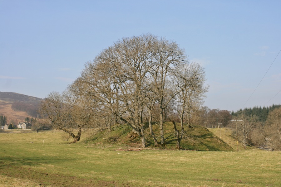
Tom an Tigh Mhoir, meaning “mound of the big house”, is a motte standing on a flat promontory created by the confluence of the River Garry and Errochty Water.

Little is known about Tom an Tigh Mhoir, however the area around Struan has a strong association with Clan Donnachaidh – specifically the Robertsons of Struan – and it may be that they were responsible for building it.

The nearby Struan kirk is built on the site of an early medieval church dedicated to St Fillan, possibly dating back to the 9th century. The church and the motte are around 140m apart and both stand on a flat area of land bounded to the north by the River Garry and to the south by the Errochty Water, giving the motte a good defensive position. The land drops away steeply on the north side of the motte to the river below, further enhancing its defendability.

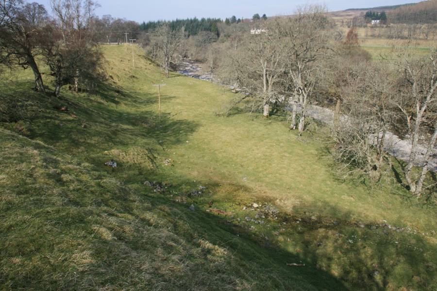
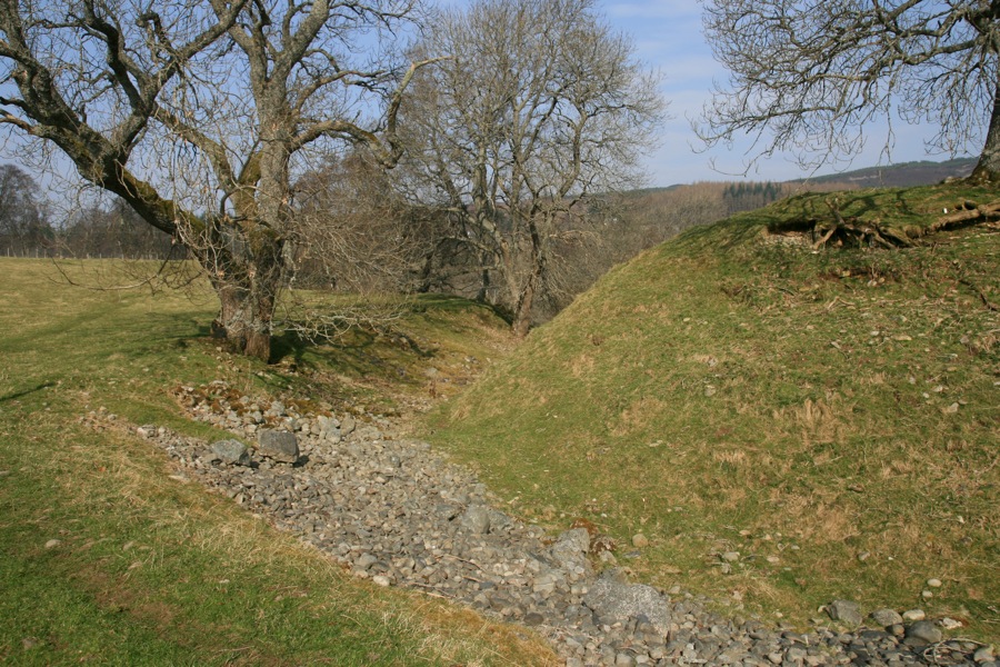
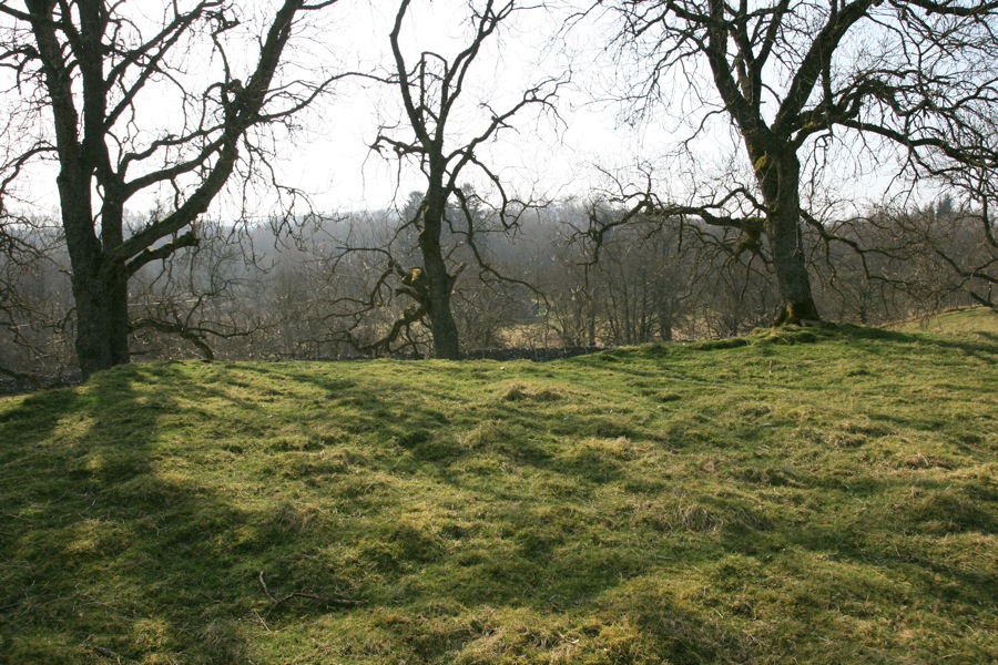
The south and west sides are defended by a substantial ditch which runs from a rounded terminal at the middle of the south side up to the north-west corner where it meets the drop down to the river. There is no visible evidence of a ditch on the east side, but it’s conceivable that it may have been filled in during agricultural improvements to the land.

The motte rises to a height of around 5.2m at the north-east corner and around 4.6m on the west side.

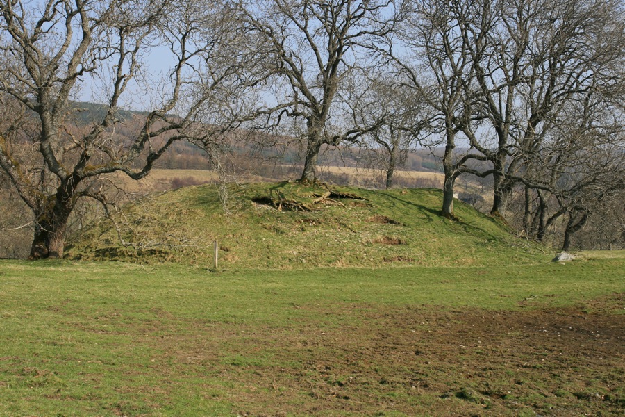
The top of the motte is flat and of irregular quadrilateral shape, measuring approximately 19m across.

The footings of a rectilinear building or enclosure can be seen on the summit, but these have been interpreted as relatively modern structures post-dating any defensive building.

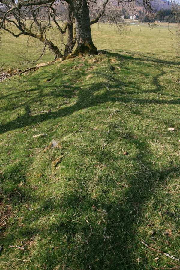
A wall running down the south slope may date to a similar period and is unlikely to be contemporary with the motte. A legend states that a local laird began building a house on the summit but abandoned construction when a neighbour built a higher castle on the other side of the River Garry.

Interestingly maps of the late 18th and early 19th centuries show a substantial house belonging to the Robertsons sited to the west of Struan kirk, although this was presumably not on the motte itself but to the west of it (possibly being related to the footings of building noted by the RCAHMS at NN 8057 6543).

It has been suggested that this may not be a mound at all but a moot hill or meeting point. However it does compare in shape and size with several mottes across Scotland, so it seems likely that that is what it is.

stay in a castle
  • advertisement/

Alternative names for Tom an Tigh Mhoir

Struan

Clans associated with Tom an Tigh Mhoir

Robertson

Surnames associated with Tom an Tigh Mhoir

Robertson

Robertson of Struan

Where is Tom an Tigh Mhoir?

Tom an Tigh Mhoir is in the parish of Blair Atholl and the county of Perthshire.

Grid reference: NN 8073 6536

Lat / long: 56.764515, -3.952476

Bing Maps | Google Maps | Historic maps (NLS) | OpenStreetMap | Ordnance Survey | PastMap | Streetmap | Wikimapia

OS Map for Tom an Tigh Mhoir

OS map OL49
Pitlochry & Loch Tummel (Aberfeldy, Kinloch Rannoch & Schiehallion)
OS Explorer map OL49


  • advertisement

Directions to Tom an Tigh Mhoir

Enter a starting point

  • advertisement/
  • advertisement

Weather at Tom an Tigh Mhoir

10°C
max 10°C / min 10°C
3km/h W
1026mb
87%
74%
03:22 21:11

Broken clouds
Weather observed at Pitlochry at 00:29

References (books)

Anglo-Norman Castles
Robert Liddiard
Woodbridge, 2002

References (websites)

Canmore

Castles near Tom an Tigh Mhoir

Blair Castle

5.9km away

Dunalastair (site of)

11.6km away

Edradynate Castle

15.1km away

Caisteal Dubh

15.3km away

Derculich (site of)

15.3km away

Garth Castle

15.6km away

Weem Castle (site of)

15.9km away

Castle Menzies

16.0km away

Bunrannoch (possible)

16.3km away
more castles....
  • advertisement

Ancient sites near Tom an Tigh Mhoir

Clach na h-Iobairt standing stone

1.5km away

Na Clachan Aoraidh stone circle

4.6km away

Clach na h' Iobairt standing stone

6.9km away

Upper Gaskan stone circle and rock art

7.4km away

Queen's View fort

7.7km away

Claverhouse's Stone standing stone

10.3km away

Braes of Foss rock art

11.4km away

Craigiedun stone circle

13.4km away

Faskally Cottages stone circle

14.0km away
more ancient sites....

Pictish stones near Tom an Tigh Mhoir

Struan Class I symbol stone

0.1km away

Priest's Stone Class III cross-slab

12.4km away

Dunfallandy Stone Class II cross slab

16.4km away

Logierait Class II cross-slab

20.8km away

Dunkeld 1 Class I symbol stone

30.3km away

Pittensorn Class III slab

38.2km away

Murthly 1 Class III stone

38.6km away

Murthly 2 Class II cross slab

38.7km away

Dunachton Class I symbol stone

39.2km away
more Pictish stones....
  • advertisement

Pictish sites near Tom an Tigh Mhoir

Torvean silver chain

79.5km away

Norrie's Law hoard

83.1km away

Burghead fort

108.0km away

Dunnicaer fort

109.1km away

Haddington silver chain

115.3km away

Traprain Law silver chain

118.5km away

Nigg silver chain

119.8km away

Parkhill silver chain

120.5km away

Borland silver chain

121.7km away
more Pictish sites....
  • Sixt Car Rental

Accommodation near Tom an Tigh Mhoir

Loch Tummel Inn
hotelStrathtummel
5.3km away
Atholl Arms Hotel, Blair Atholl
hotel, bar, restaurantBlair Atholl
6.3km away
Bridge of Tilt Hotel
hotelBridge of Tilt
6.8km away
River Tilt Park
campsiteBlair Atholl
6.9km away
Killiecrankie House
hotelBridge of Tilt
10.8km away
Green Park Hotel
hotelPitlochry
14.1km away
Tigh na Cloich Hotel
hotelPitlochry
14.2km away
Craigatin House & Courtyard
hotelPitlochry
14.4km away
Pine Trees Hotel Pitlochry
hotelPitlochry
14.5km away
Strathgarry Restaurant & Rooms
restaurant, hotel, self-catering cottagePitlochry
14.8km away

Accommodation search

(leave blank to view all)
Accommodation type
bed and breakfasts
campsites
castles
holiday parks
hostels
hotels
self-catering apartments
self-catering cottages
self-catering lodges
spas
  • advertisement
more accommodation....

Cafés, restaurants & bars near Tom an Tigh Mhoir

House of Bruar
restaurant, caféBlair Atholl
1.3km away
Atholl Arms Hotel, Blair Atholl
hotel, bar, restaurantBlair Atholl
6.3km away
The Auld Smiddy Inn
bar, restaurantPitlochry
14.7km away
Strathgarry Restaurant & Rooms
restaurant, hotel, self-catering cottagePitlochry
14.8km away
McKays
bar, restaurantPitlochry
14.8km away
Moulin Hotel
hotel, pubPitlochry
14.9km away
The Old Mill Inn
hotel, bar, restaurantPitlochry
14.9km away
Kingfisher Bar
barPitlochry
15.0km away
Scotland's Hotel & Spa
hotel, restaurant, barPitlochry
15.1km away
Victoria's Restaurant
restaurant, caféPitlochry
15.1km away
more food.... / more drink....

Related pages

Dirleton Castle in East Lothian
Garden of Cosmic Speculation plus castles
Inveraray Castle and standing stone
A doocot, a castle and a beach in East Lothian
A pair of castles on the River Tweed
Dunbar harbour and castle
Published on the 3rd of July 2011 at 4:52 pm. Updated on the 24th of March 2015 at 11:10 pm.

Leave a comment

back to the top of the page

Connect with us

Like us on Facebook

Receive our newsletter

Follow us on Twitter

Tweets by Stravaig_Aboot

Quick links

Stay in a Scottish castle
Edinburgh Festival accommodation
Hotels in Scotland
Car hire in Scotland
Places to eat and drink in Scotland
Castles in Scotland
Trace your Scottish ancestors
Scottish clans
Standing stones in Scotland
The Picts
Pictish symbol stones
Pictish placenames
Scottish bands and musicians
Scottish films
Scottish TV shows
West Highland Way

About

Andy Sweet above Fast Castle

Stravaiging around Scotland is written, photographed and researched by Andy Sweet.
read more....

Cookies

To make this site work properly we use cookies to store information on your computer. Click here to read more.

Affiliate links

This site includes affiliate links and adverts. If you click on these links we may receive a small commission at no cost to yourselves. As an Amazon Associate we earn from qualifying purchases. This modest income goes towards funding the site.
© 2003 - 2025 Andy Sweet / Stravaiging around Scotland. Powered by WordPress. Hosted by Tsohost.