Bachilton
Alternative names for Bachilton
Bachilton Farm; Skelfie
Where is Bachilton?
Bachilton is in the parish of Methven and the county of Perthshire.
Grid reference: NO 0015 2411
Lat / long: 56.3986729, -3.618728556

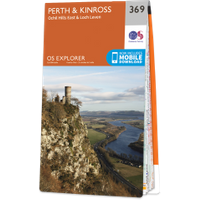
OS Map for Bachilton
Directions to Bachilton
Enter a starting point
Get directions


Weather at Bachilton
8°C
max 9°C / min 7°C
max 9°C / min 7°C
5km/h E
1007mb
57%
79%
04:39 19:44
1007mb
57%
79%
04:39 19:44
Broken clouds
Weather observed at Methven at 10:43
References (websites)
Ancient sites near Bachilton
Castles near Bachilton
Pictish stones near Bachilton

Pictish sites near Bachilton
Accommodation near Bachilton
Huntingtower Hotel
7.4km away
At The Willows
7.4km away
The Rowans
7.4km away
Huntingtower Apartment
8.2km away
Holiday Inn Express Perth
9.7km away
Symphony Lovat Hotel
10.4km away
Aaron Guest House
10.4km away
Almond Villa B&B
11.0km away
Grampian Hotel
11.0km away
Best Western Queens Hotel & Leisure Club
11.1km away
Accommodation search
Cafés, restaurants & bars near Bachilton
Huntingtower Hotel
7.4km away
Holiday Inn Express Perth
9.7km away
Best Western Queens Hotel & Leisure Club
11.1km away
Breizh
11.8km away
Crieff Hydro Hotel and Leisure Resort
13.6km away
Knock Castle Hotel & Spa
14.2km away
Famous Grouse Experience
14.5km away
Murrayshall House Hotel
15.5km away
Atholl Arms Hotel, Dunkeld
18.6km away
The Famous Bein Inn
19.3km away


