
Little seems to be known about the origins of Redbraes Castle, however it dates back to at least the late 16th century, and most probably earlier.
Redbraes Castle is thought to have been built by the Humes of Polwarth, although exactly when is unclear. In the 15th century the barony of Polwarth was owned by the Sinclair family, but following the marriage of Margaret Sinclair, daughter of John Sinclair, of Herdmanston, Polwarth and Kimmerghame, to Patrick Hume in 1451, Polwarth passed into the Hume family.
The Humes of Polwarth seem to have lived in two other properties in the area prior to Redbraes. First was the old tower of Polwarth Castle near the village of the same name, followed by Mains House, and then Redbraes itself.
The Humes are said to have moved permanently to Redbraes following the destruction of Polwarth Castle during the Rough Wooing of the 1540s, however “the towre of Red Brayes” was also burned by an English army led by Edward Seymour, Earl of Hertford, in September 1545. One of the earliest mentions of Redbraes is when Sir Patrick Hume of Polwarth and Redbraes, a courtier and makar, inherited Redbraes Castle in 1599 upon the death of his father, also Patrick Hume.
A picture of Redbraes Castle from their later home of Marchmont House shows a substantial building that, while it displays styling cues from the 17th century, looks as though it could well have grown from a simpler square keep. It faced approximately south-east, looking over the Howe Burn, and was apparently surrounded by a moat.
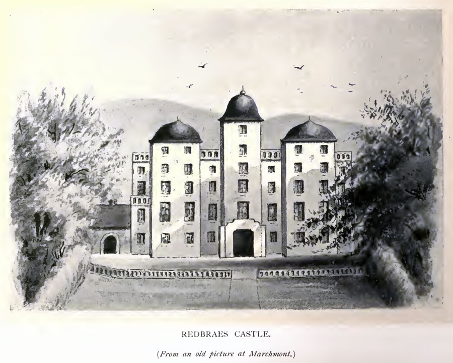
At the centre is a tall and narrow six storey tower with a single line of windows running up from an entrance at ground level. Flanking it are two wider towers, each with pairs of windows rising to five storeys. Within the basement of the east tower were the kitchens, while the west tower contained the laundry. Behind these three towers is a wide four storey main block. Attached to the edges of this block are single storey wings.
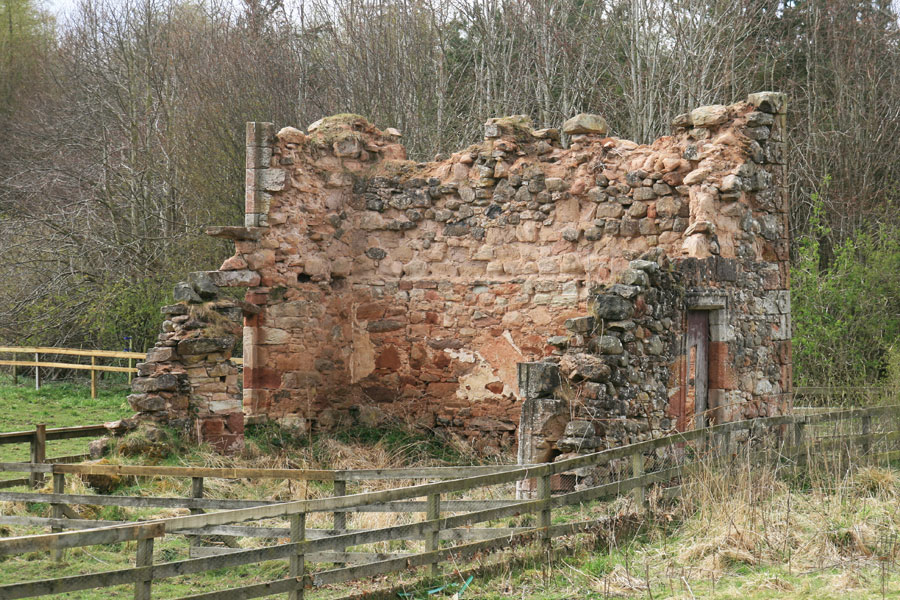
Today, only the north end of what has been described as the west wing still stands. However, rather than being one of the single storey wings, this would appear to be the remains of the back of one of the flanking towers with the twin windows.
The north wall of this section stands complete to first floor height, and while there are no windows in the ground floor part, on the first floor the bottoms of a pair of window surrounds can just be seen. Attached to this wall are fragments of walls to the west and east returning south.
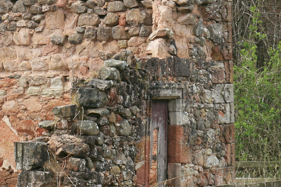
The west wall features a window at ground floor level, with carved surround, and the partial remains of a second window above it on the first floor. The east wall has a complete doorway, again with carved surround. The corner stones of these walls are carved with a bell-shaped detail.
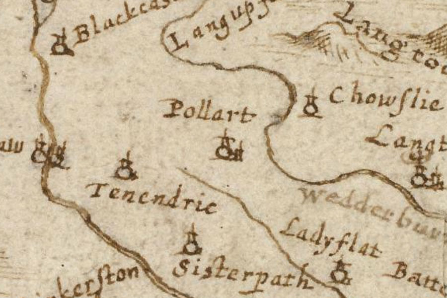
On Robert Gordon’s map “A description of the province of the Merche”, published in the mid-17th century, there is no mention of Redbraes Castle, but there is a castle marked at Pollart. This is presumably the old tower of Polwarth, although I have seen Redbraes Castle referred to as Polwarth House.
In Joan Blaeu’s Atlas of Scotland, published in 1654 but based in part on Timothy Pont’s maps of the late 16th to early 17th century, Redbraes Castle appears as Ridelbraes. Interestingly it is shown as two castles side by side, each within their own enclosure. One appears to be in the known position of Redbraes, while the other appears to be further to the east, standing closer to a river – possibly the Howe Burn. The second castle may perhaps be Mains House.
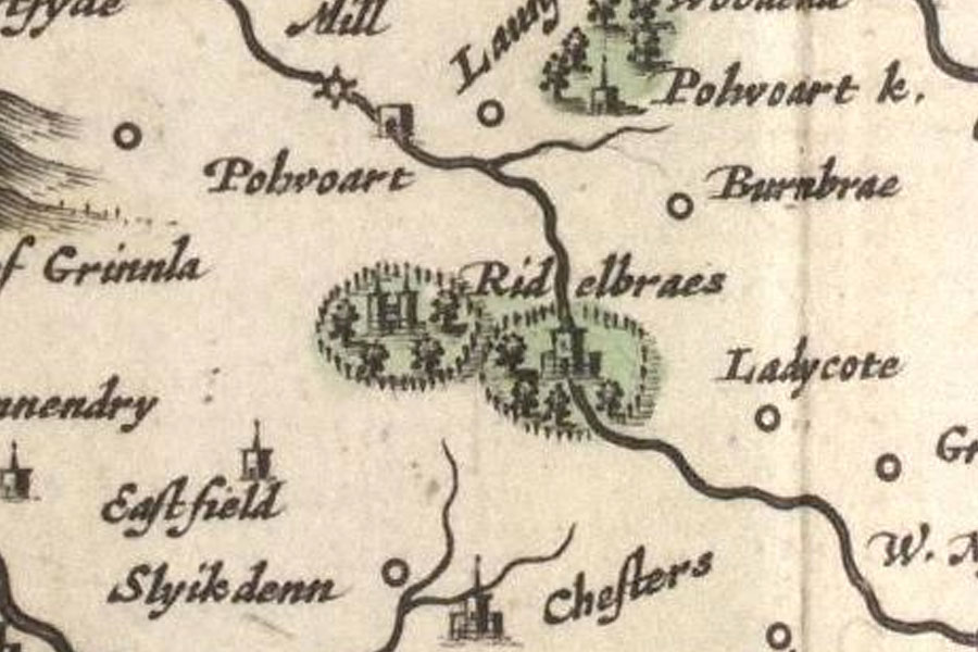
By the 17th century the family’s wealth and power was increasing, and the aforementioned Sir Patrick Hume of Polwarth and Redbraes’ son, another Patrick, was created the 1st Baronet Hume of Polwarth in the Peerage of Nova Scotia by Charles I.
In 1690 his son, another Patrick Hume, the 2nd Baronet, was created the 1st Lord Polwarth, and in 1697 he became the 1st Earl of Marchmont. He served as Lord Chancellor from 1696 to 1702.
In the autumn of 1709 alterations were made to Redbraes. In 1724 Alexander Hume-Campbell, the 2nd Earl of Marchmont, commissioned William Adam to design a new house, and make improvements to Redbraes Castle.
However the Earl decided against the new house due to the expense, and only went ahead with remodelling Redbraes and improving the surrounding lands over the period 1726 to 1735. Whether or not this was to the designs of Adam or someone else is not known. In 1726 the Great Avenue was begun. Stretching some 1.3 miles (2.1km), making it the longest avenue in Scotland, it was planted with 10,000 Dutch elm trees.
On Herman Moll’s map of The Shire of Berwick, drawn some time before 1732 and published in 1745, it appears once again as Ridelbraes, with two enclosed castles shown.

Following the death of the 2nd Earl in 1740, his son, Hugh Hume-Campbell, the 3rd Earl, employed the architect Thomas Gibson to build a new house, which took from 1750 to 1754.
William Roy’s Military Survey of the Lowlands, published between 1752 and 1755, shows both the new house and the old castle, and names the whole estate Redbraes, with the Great Avenue and planned landscape shown extending from the house.
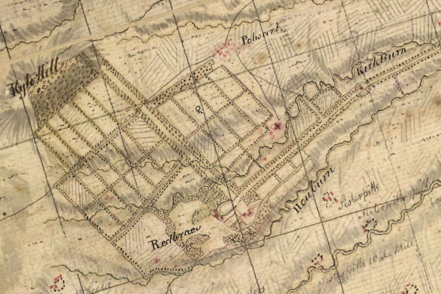
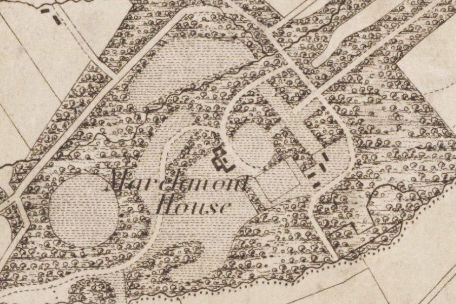
It isn’t until the 19th century that maps for this area show accurate representations of buildings, and a map by William Crawford and William Brooke, published in 1843, shows buildings to the south-west of the site of the castle, but none to the north-east.
On the Six Inch 1st edition OS map, published in 1862, as well as the moat being marked, to the north-west of the castle, a building to the north-east of the castle site mirrors that of the west wing to the south-west. It has been supposed by some that this is the east wing of the old castle. However, given that this isn’t shown on the 1843 map, it would appear that the cottages that stand in this position today are what are shown, and were built some time between 1843 and 1862.
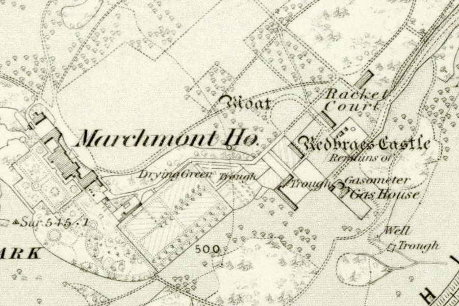
It has been suggested that they are built on the site of the east wing, but if the proportions in the drawing of Redbraes Castle are approximately correct then the cottages are too far to the north-east to be in the position of the old east wing. More likely perhaps is that the east wing stood on the opposite side of the road from the cottages.
On the Six Inch OS map from 1899 the buildings to the south-west and north-east of the old castle are again clearly marked, with the remains of a moat marked to the north west. On the same map from 1908 both buildings are again shown, but the reference to the moat has disappeared.
In 1913 the Hume-Campbells sold Marchmont House and the estates to Robert Finnie McEwen of Bardrochat, ending more than three centuries of Hume association with Redbraes Castle. During the Second World War it was requisitioned for use by Edinburgh’s John Watson’s School.
Following the death of McEwen’s grandson Sir James McEwen in 1983, Marchmont House was bought by Sue Ryder Care and turned into a care centre for young, physically disabled people, opening in 1989.
In 2008 the care home closed, and Marchmont House was sold to a private buyer, apparently with the intention of restoring it as a family home.
Alternative names for Redbraes Castle
Marchmont House; Polwarth House; Red Braes; Red Brayes; Redbraes House; Redbraes Tower; Reidbrayis; Ridelbraes


