Clinthill
Annandiae praefectura, Vulgo, The Stewartrie of Annandail
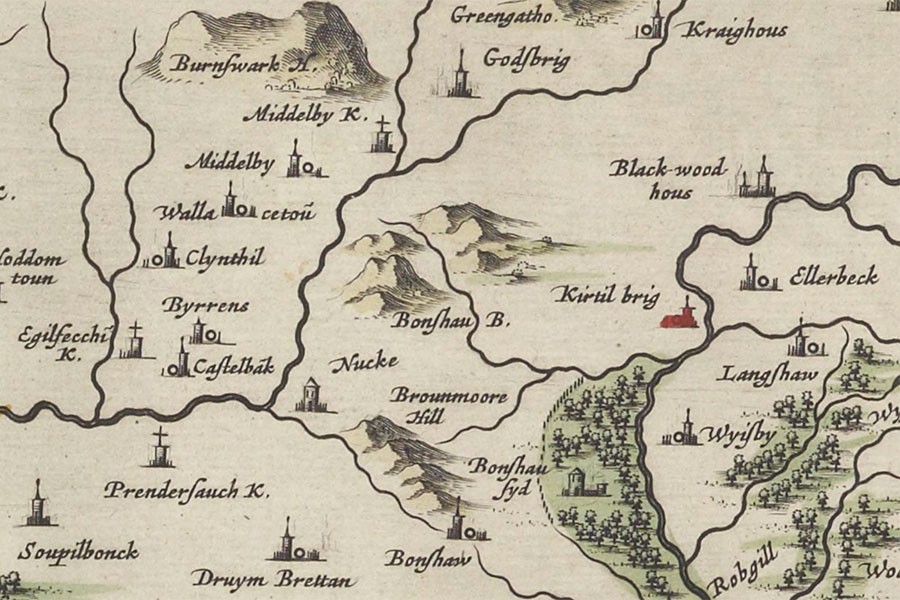
Joan Blaeu, Amsterdam, 1654map image courtesy of NLS
Joan Blaeu, Amsterdam, 1654map image courtesy of NLS
Clinthill is marked as a tower named Clynthil on Blaeu’s mid-17th century map of Annandale.
I have placed the location of the tower at an enclosure at Castlefield pending further research.


Alternative names for Clinthill
Castlefield; Clint Hill; Clynthil; Scalewood
Where is Clinthill?
Clinthill is in the parish of Hoddom and the county of Dumfriesshire.
Grid reference: NY 19665 75822
Lat / long: 55.070336, -3.259587


