Harestanes
This stone circle – which stands in the corner of a private garden – originally consisted of five low boulders. Four of them range in height from 0.60m to 1.20m, while a fifth is broken off at ground level, all standing on a circle of 3.00m in diameter.
A sixth stone lies 1.50m to the East of the damaged stone, and is probably the remainder of the fifth stone.

Alternative names for Harestanes
Old Harestanes
Where is Harestanes?
Harestanes is in the parish of Kirkurd and the county of Peeblesshire.
Grid reference: NT 1240 4432
Lat / long: 55.68427141, -3.393418662
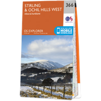
OS Map for Harestanes
Directions to Harestanes
Enter a starting point
Get directions


Weather at Harestanes
0°C
max 3°C / min -1°C
max 3°C / min -1°C
4km/h NNE
1006mb
93%
72%
04:41 19:41
1006mb
93%
72%
04:41 19:41
Broken clouds
Weather observed at West Linton at 03:18
References (websites)
Ancient sites near Harestanes
Castles near Harestanes
Pictish stones near Harestanes


Pictish sites near Harestanes
Accommodation near Harestanes
Drochil Castle Farmhouse
3.9km away
Stobo Castle
9.0km away
Toftcombs Mansion House
9.0km away
Barns Tower
10.4km away
Elphinstone Hotel
10.4km away
Cringletie House
11.0km away
Barony Castle
11.5km away
Horseshoe Inn
12.1km away
Shieldhill Castle Hotel
12.4km away
Castle Venlaw Hotel
13.1km away
Accommodation search
Cafés, restaurants & bars near Harestanes
Stobo Castle
9.0km away
Whitmuir The Organic Place
9.5km away
Dawyck Café
10.1km away
Elphinstone Hotel
10.4km away
Cringletie House
11.0km away
Barony Castle
11.5km away
Horseshoe Inn
12.1km away
Shieldhill Castle Hotel
12.4km away
Castle Venlaw Hotel
13.1km away
County Inn
13.3km away


