Dumgoyach
Alternative names for Dumgoyach
Blanefield; Duntreath
Where is Dumgoyach?
Dumgoyach is in the parish of Strathblane and the county of Stirlingshire.
Grid reference: NS 5328 8072
Lat / long: 55.99679719, -4.354059355

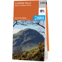
OS Map for Dumgoyach
Directions to Dumgoyach
Enter a starting point
Get directions

Weather at Dumgoyach
8°C
max 11°C / min 7°C
max 11°C / min 7°C
6km/h SW
1021mb
97%
23%
04:11 20:16
1021mb
97%
23%
04:11 20:16
Few clouds
Weather observed at Strathblane at 03:10
References (websites)
Ancient sites near Dumgoyach
Castles near Dumgoyach
Pictish stones near Dumgoyach

Pictish sites near Dumgoyach

Accommodation near Dumgoyach
The Kirkhouse Inn
3.3km away
Killearn Hotel
5.3km away
Premier Inn Glasgow (Milngavie)
7.3km away
Premier Inn Glasgow (Bearsden)
8.7km away
Foxglove Suites and Cottages
9.1km away
West Park Hotel
9.1km away
Loaninghead Farm Bed and Breakfast
9.4km away
Best Western Buchanan Arms Hotel & Spa
9.6km away
Boulevard Hotel Complex
9.7km away
The Hawthorns Bed & Breakfast
9.7km away
Accommodation search
Cafés, restaurants & bars near Dumgoyach
The Beech Tree Inn
2.9km away
The Kirkhouse Inn
3.3km away
Killearn Hotel
5.3km away
Premier Inn Glasgow (Milngavie)
7.3km away
Premier Inn Glasgow (Bearsden)
8.7km away
Best Western Buchanan Arms Hotel & Spa
9.6km away
The Winnock Hotel
9.8km away
Culcreuch Castle Hotel
11.2km away
Mar Hall Golf & Spa Resort
11.5km away
Glasgow Pond Hotel
12.8km away


