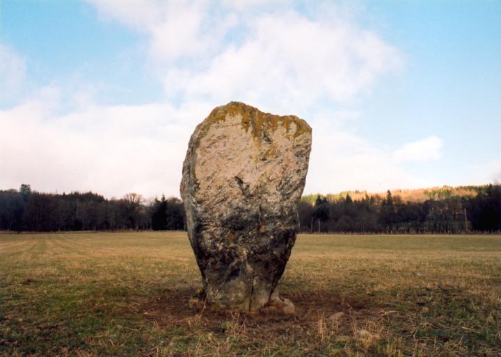
Dane's Stone
This large stone stands just to the north-west of the village of Moulin, in the field where the Moulin Market used to be held in days gone by. The stone stands some 2.1m tall by 1.3m wide at it’s widest point. The stone is 0.6m thick at the top, increasing to 0.9m thick at the base.
Coles reported in 1908 that several more stones were said to have stood in the field, all smaller than the existing stone, but were now half buried. However no trace of these other stones has been found.


Alternative names for Dane's Stone
Pitfourie
Where is Dane's Stone?
Dane's Stone is in the parish of Moulin and the county of Perthshire.
Grid reference: NN 9425 5942
Lat / long: 56.714414, -3.72867871
OS Map for Dane's Stone

Directions to Dane's Stone
Enter a starting point
Get directions

Weather at Dane's Stone
0°C
max 1°C / min -0°C
max 1°C / min -0°C
6km/h NW
1007mb
88%
97%
04:38 19:46
1007mb
88%
97%
04:38 19:46
Overcast clouds
Weather observed at Pitlochry at 04:34
References (books)
Pitlochry district: its topography, archaeology and history

Hugh Mitchell
Pitlochry, 1923
Pitlochry, 1923
Pitlochry Past and Present
John Dixon
Pitlochry, 1925
Pitlochry, 1925
References (websites)
Ancient sites near Dane's Stone
Castles near Dane's Stone
Pictish stones near Dane's Stone
Pictish sites near Dane's Stone

Accommodation near Dane's Stone
Moulin Hotel
0.2km away
Craigvrack Hotel
0.7km away
Craigmhor Lodge
0.9km away
Pitlochry SYHA Hostel
1.0km away
Pine Trees Hotel Pitlochry
1.1km away
Tigh na Cloich Hotel
1.1km away
Scotland's Hotel & Spa
1.2km away
The Old Mill Inn
1.2km away
Carra Beag Guest House
1.2km away
Kinnaird House & Woodland Lodges
1.3km away
Accommodation search
Cafés, restaurants & bars near Dane's Stone
Moulin Hotel
0.2km away
Scotland's Hotel & Spa
1.2km away
The Old Mill Inn
1.2km away
McKays
1.3km away
The Auld Smiddy Inn
1.3km away
Strathgarry Restaurant & Rooms
1.3km away
Kingfisher Bar
1.3km away
Victoria's Restaurant
1.4km away
Atholl Palace Hotel
1.5km away
Atholl Arms Hotel, Blair Atholl
9.3km away


