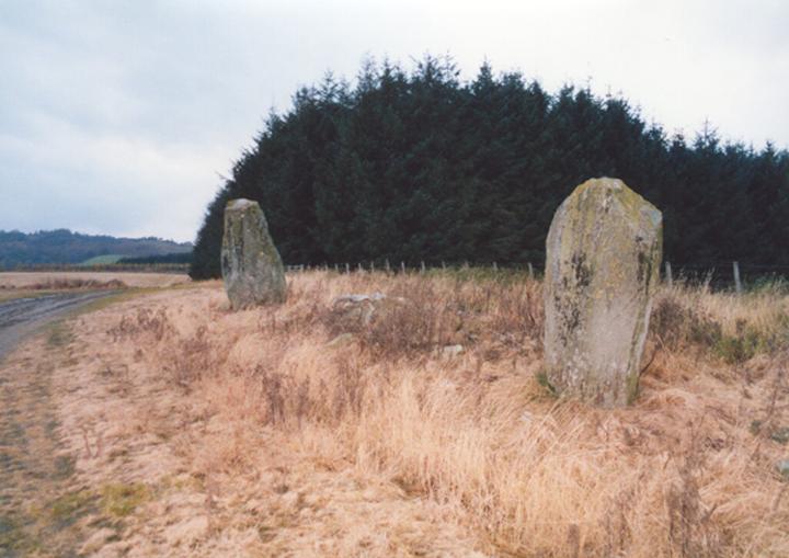

The East Cult stones stand proud on a high ridge above the River Tay that extends E from Dunkeld. Aligned E-W, the two huge standing stones are approximately 9.0m apart, while a similar distance to the E is a third prostrate stone, profusely decorated with cup-marks. In 1986 the RCAHMS counted some 130 cup-marks and a dumb-bell on the upper face, and a further 3 cup-marks on the E face. However, weathering has taken its toll since, and it’s difficult to make out so many today. Field clearance or possibly cairn material is scattered around the stones.
The prostrate stone may originally have stood upright, and if it did, Coles suggests that the stones may have been part of a circle with a diameter of 78′ (24m). But considering their E-W alignment, I believe the stones are unlikely to have ever formed part of a circle. However, in the Old Statistical Account, and repeated in the New, the site is described like this:
“About a mile and a half north-west from the church, in a very elevated situation, there is a small Druidical circle. Beside it are two large stones, deeply sunk in the ground; the top of the lowest is artificially formed into an inclined plane, facing the south, and contains a number of small cavities; which may have been used by the Druids in the performance of religious rites.”
This makes me think that perhaps the cairn mentioned by the RCAHMS as being 185m S of the standing stones, and which was removed before 1865 for building material, could in fact have been the site of the “small Druidical circle.” If the Statistical Accounts are accurate, then one of the three stones now at East Cult may have been moved from its original position as part of the circle, and the remaining two been outliers for the circle to the S.
W stone – 1.80m tall
E stone – 2.15m long
recumbent stone – 1.25m wide x 1.90m long
Alternative names for East Cult
Caputh Church
Where is East Cult?
East Cult is in the parish of Caputh and the county of Perthshire.
Grid reference: NO 0725 4216
Lat / long: 56.56179552, -3.510138361


