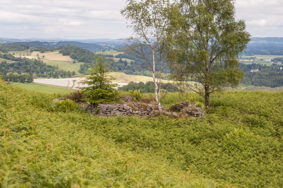
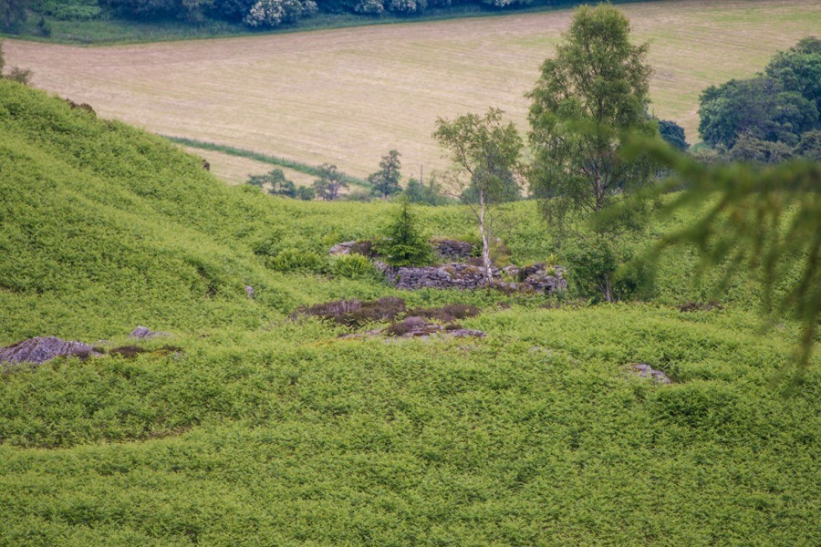
Rohallion Castle
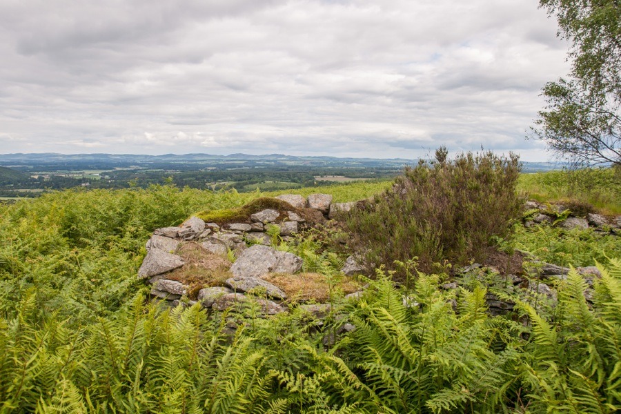
Rohallion Castle is a small ruined castle on the south-east slopes of Birnam Hill, high above the River Tay.
The castle is said to have been built in the 16th century, although who built it doesn’t seem to be known. Birnam Hill was part of the royal forest, made famous by Shakespeare, which was granted in 1160 by Malcolm IV to Duncan, Earl of Fife (also known as Donnchad II), upon his marriage to the king’s niece Ada. It was later incorporated into the barony of Dunkeld by George Brown, Bishop of Dunkeld, in the late 15th century. By the 16th century the Ruthven family seem to have owned Rohallion, possibly as a result of the Reformation in the 1560s, so it may have been a Ruthven who was responsible for building the castle.
Following the Raid of Ruthven in 1582 it served as a hiding place for William Ruthven, 1st Earl of Gowrie and 4th Lord Ruthven. Ruthven was beheaded for treason in 1584 and his titles and lands, including Rohallion Castle, Huntingtower Castle (then known as Ruthven Castle) and Dirleton Castle, were forfeited.
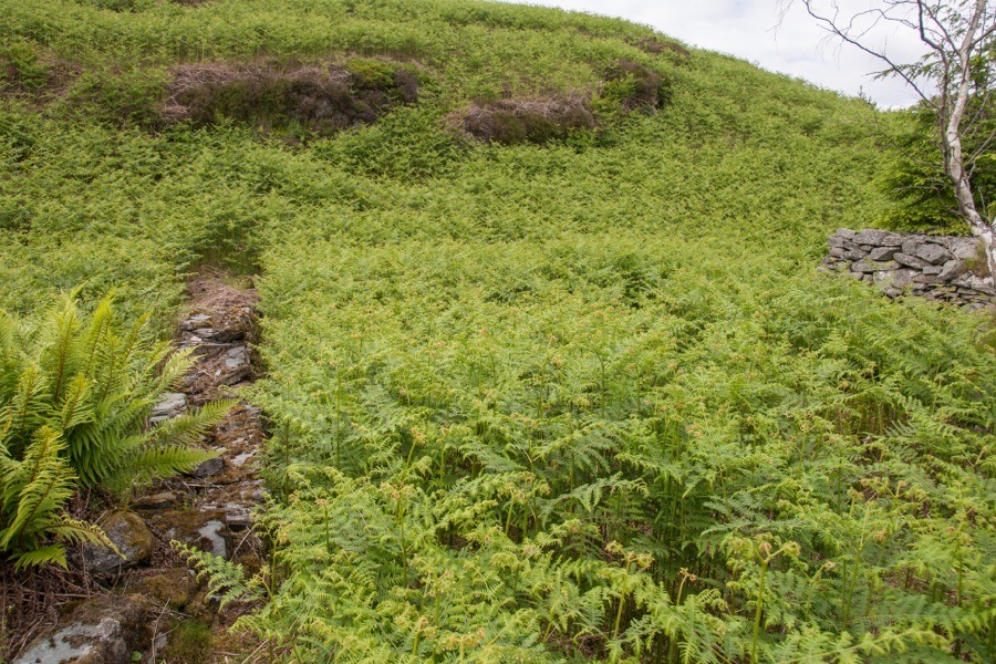
Its position is a curious one, sitting in a hollow just back from the edge of a ridge and overlooked by the rocky crags of Craig Ruenshin. It’s almost as if it was built to be hidden from view. However Grandtully bought Murthly Castle is visible from Rohallion, and the views from the ridge are extensive across the strategically important valley of the Tay and beyond.
If Rohallion Castle was built in the 16th century then it doesn’t seem to have been lived in for long, with some sources stating that it was last occupied during the period after the Reformation.
Despite its size it appears to have been built for defence and was constructed on a Z-plan with a round tower projecting from each of the north-east and south-west corners of the main rectangular block. The castle is aligned approximately east to west and measures around 8.3m long by around 6.2m with the width of the walls ranging from 0.9m to 1.4m.
The round towers are around 3.6m in diameter with thinner walls than the main block and open into the main block at ground floor level. Both of the towers feature a small window opening although these may not be original. Both are also said to have gun loops although if these still exist they were obscured by bracken on the day of our visit. It’s possible that the windows are in fact remodelled gun loops.
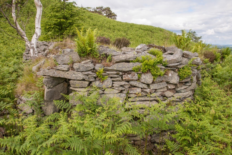
A doorway on the east side, immediately south of the north-east tower, gives access to the main block. It measures around 0.9m across and has carved square jambs.
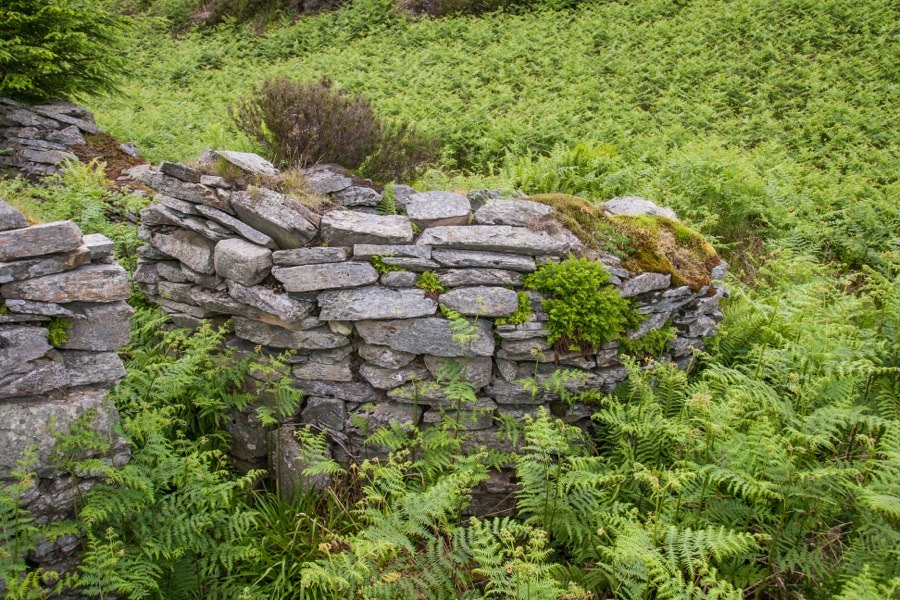
Within the west wall, almost opposite the entrance, is a recess measuring around 1.1m across and extending around 0.7m into the thickness of the wall with splayed edges. It has the appearance of a fireplace.
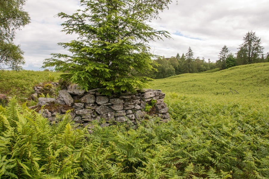
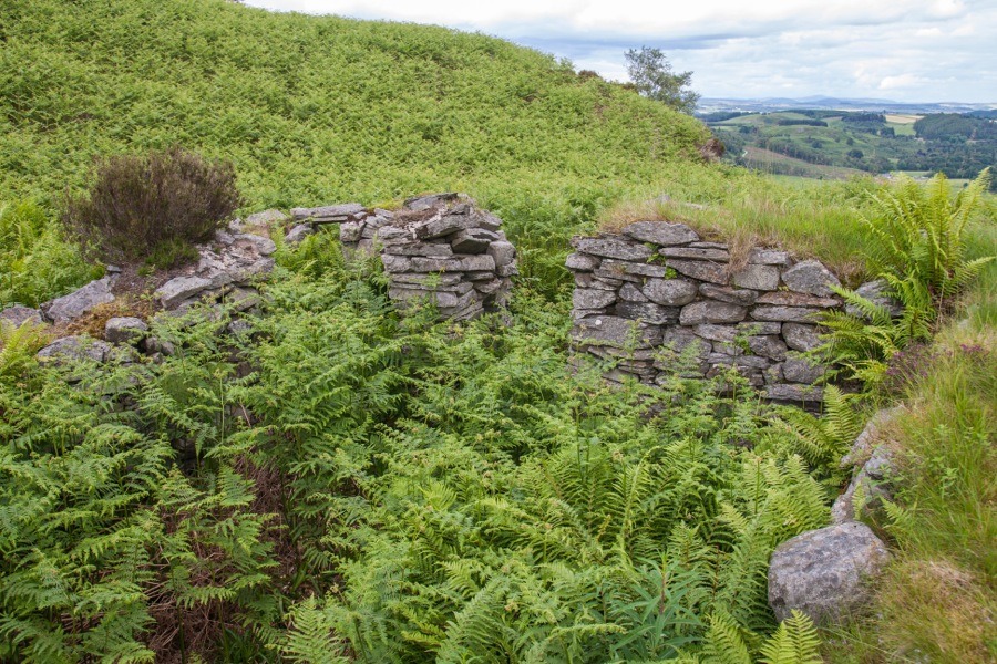
The walls now only stand to a maximum height of around 1.2m so it is difficult to draw many conclusions as to the appearance of the original castle. There is no evidence of any vaulting or a staircase, although both of these could have existed above the current level of the walls.
Rohallion Castle is similar in design and size to Terpersie Castle in Aberdeenshire, the central block of which is around 8.5m by around 5.5m although its corner towers are larger at around 5.5m in diameter.
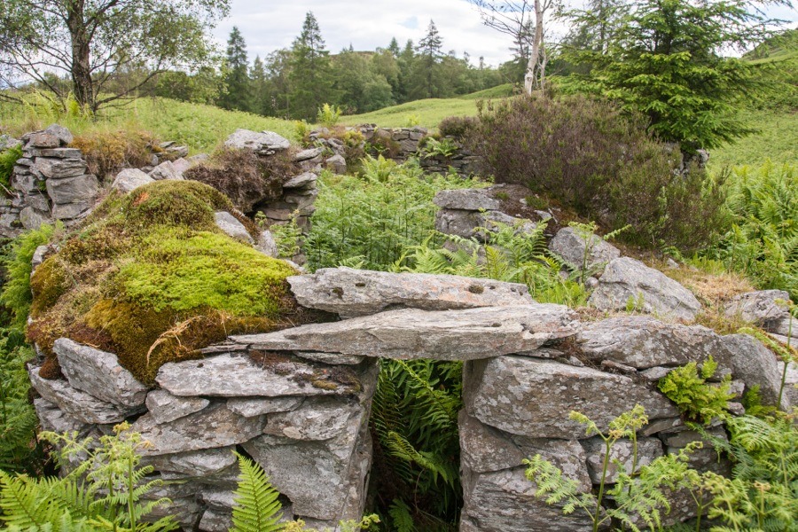
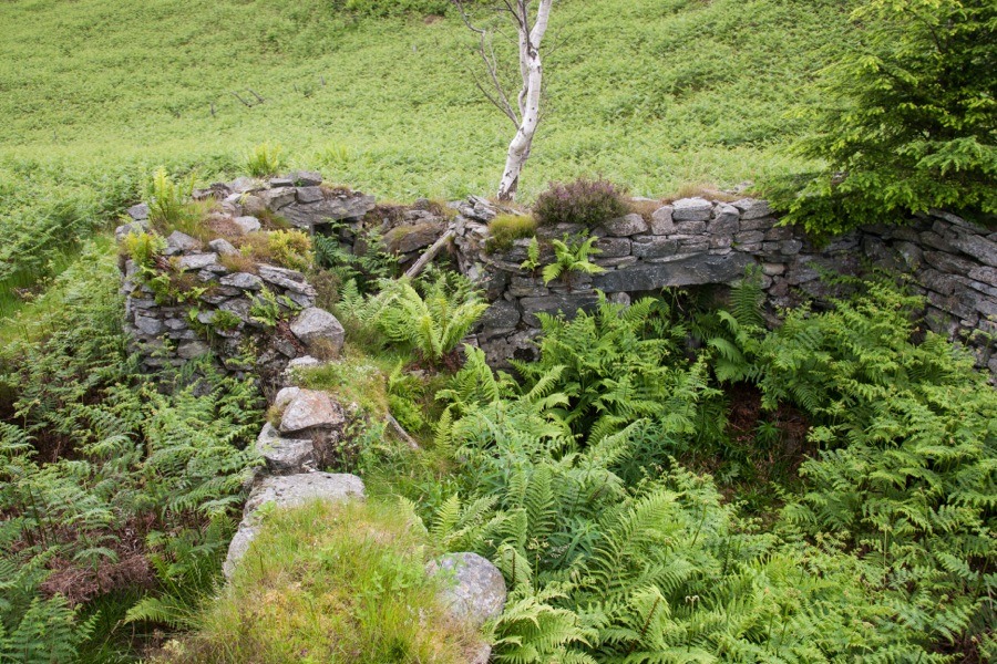
When Thomas McLaren visited in 1919 prior to writing his report in the Proceedings of the Society of Antiquaries of Scotland he observed a wall around 7.0m to the west of the castle running parallel to its west wall. The footings of a corresponding wall to the east, but only around 0.5m from the edge of the north-east tower, were also found along with the footings of returning walls at the north and south ends of the east wall.
This suggests an outer wall which may have been added later for extra protection since it seems unlikely to have been built so close to the castle as part of the original design. The footings of a small section of wall was identified around 10.0m east of the east wall’s footings, and projecting south from that is a raised narrow bank which turns west and then returns north towards the castle. This may be the remains of an outer courtyard wall. Not long after McLaren’s visit the castle and its walls were damaged by falling trees.
Rohallion Castle is currently a part of the Murthly estate, owned by the Steuart Fothringham family. Sir William Stewart of Grandtully bought Murthly Castle in 1615, presumably including Rohallion, from the Abercrombie family who had in turn acquired it in 1611.
In 1974 the ruins were apparently consolidated with some rebuilding occurring at this time.


Alternative names for Rohallion Castle
Castle of Old Rohallion; Forhaillon
Where is Rohallion Castle?
Rohallion Castle is in the parish of Little Dunkeld and the county of Perthshire.
Grid reference:NO 0387 4008
Lat / long:56.542794,-3.564854