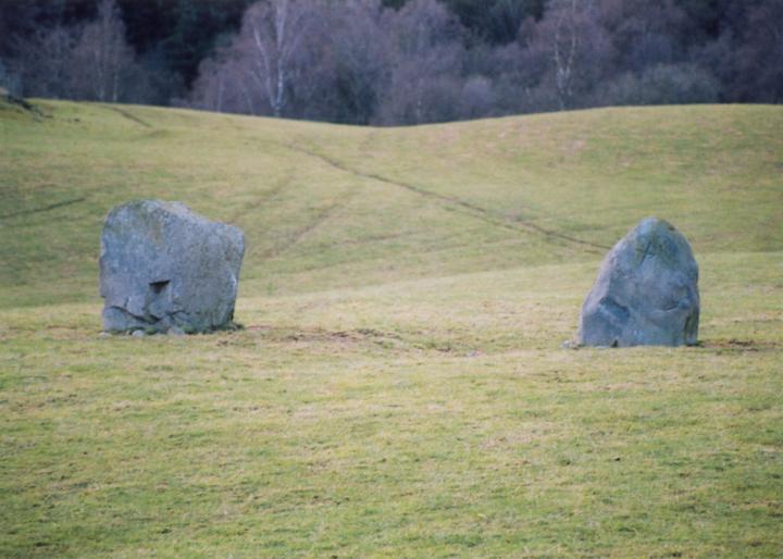
Staredam
This pair of stones sit in the middle of a field, half way between the track to Muirheadstone farm on the left, and Staredam cottage on the right. They don’t appear ever to have formed part of a circle, being as they are orientated SW-NE, and about 5m apart. The NE stone is particularly interesting, as it has an inscribed cross on it, supposedly carved by a passing missionary.
NE stone – 1.4m tall
SW stone – 1.3m tall


Alternative names for Staredam
Muirheadston; Muirheadstone; Stare Dam
Where is Staredam?
Staredam is in the parish of Auchtergaven and the county of Perthshire.
Grid reference: NO 0499 3828
Lat / long: 56.52630687, -3.546122525

Directions to Staredam
Enter a starting point
Get directions

Weather at Staredam
9°C
max 10°C / min 7°C
max 10°C / min 7°C
5km/h WNW
1005mb
55%
100%
04:38 19:44
1005mb
55%
100%
04:38 19:44
Overcast clouds
Weather observed at Bankfoot at 12:32
References (websites)
Ancient sites near Staredam
Castles near Staredam
Pictish stones near Staredam

Pictish sites near Staredam
Accommodation near Staredam
The Bankfoot Inn
3.4km away
Wester Caputh Lodge
3.9km away
Birnam Hotel
4.2km away
Atholl Arms Hotel, Dunkeld
4.9km away
Ballathie House Hotel
5.3km away
Meikleour Hotel
11.0km away
Huntingtower Hotel
12.7km away
Holiday Inn Express Perth
13.1km away
Huntingtower Apartment
13.8km away
Altamount Country House Hotel
14.5km away
Accommodation search
Cafés, restaurants & bars near Staredam
Atholl Arms Hotel, Dunkeld
4.9km away
Huntingtower Hotel
12.7km away
Holiday Inn Express Perth
13.1km away
Altamount Country House Hotel
14.5km away
Murrayshall House Hotel
16.0km away
Breizh
16.2km away
Best Western Queens Hotel & Leisure Club
16.3km away
Habitat Café
22.2km away
Alyth Hotel
22.2km away
Atholl Palace Hotel
22.2km away


