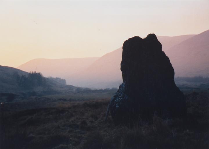
Clach na Tiompan
At a quick glance, one standing stone and some cairn material is all that remains of the Clach na Tiompan stone circle. Considerable damage was apparently done to the neighbouring chambered cairn when the road (on either side of which the cairn and circle sit) was driven through Glen Almond in the 19th century, and it was probably at this time that most of the circle was destroyed. The circle was originally a four-poster, enclosing a low cairn at the centre.
Excavation in 1954 revealed the stump of a second stone, and the holes belonging to the remaining two. The cairn was found to be made up of boulders, amongst which were found more than one hundred quartz pebbles. At the centre of the cairn there was evidence of burning, with pieces of wood and charcoal. The cairn material extends to a diameter of about 6.0m, spreading beyond the edge of the circle. One of the missing stones was found lying 5.0m to the S.
remaining stone – 1.3m tall
Four-poster with 3 sides of 3.1m and the NW side 2.5m in length


Alternative names for Clach na Tiompan
Clach na Tiom-pan; Clach na Trom Pan
Where is Clach na Tiompan?
Clach na Tiompan is in the parish of Monzievaird and Strowan and the county of Perthshire.
Grid reference: NN 8301 3281
Lat / long: 56.47287645, -3.899542423
OS Map for Clach na Tiompan

Directions to Clach na Tiompan
Enter a starting point


Weather at Clach na Tiompan
max 10°C / min 7°C
1006mb
59%
100%
04:40 19:45
Light rain
Weather observed at Perth and Kinross at 13:38
References (books)
London and New Haven, 1976


