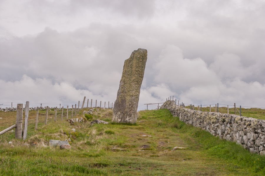
Clach an Trushal
Clach an Trushal is the tallest standing stone in Scotland at an impressive 5.8m tall. It stands on an artificially-flattened platform looking out to sea, and was once surrounded by a circle of smaller stones (probably around 1.5m in height).
The remains of these stones can be seen built into the nearby field walls. The last erect stone was taken down and used as a lintel in a local house around 1914. The circle would probably have measured around 30m in diameter, with Clach an Trushal off-centre.
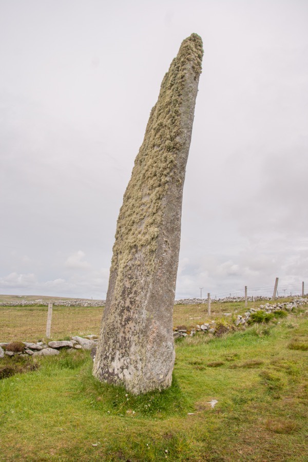
Around 35m to the north-east of the stone is a prostrate slab measuring 1.50m long by 0.75m wide and 0.20m thick which may once have stood as an outlier.


Alternative names for Clach an Trushal
Clach an Truiseil; Thrushel Stone; Truiseil
Where is Clach an Trushal?
Clach an Trushal is in the parish of Barvas and the county of Ross and Cromarty.
Grid reference: NB 3756 5377
Lat / long: 58.393441, -6.492915
OS Map for Clach an Trushal
Directions to Clach an Trushal
Enter a starting point


Weather at Clach an Trushal
max 12°C / min 10°C
1014mb
91%
87%
04:28 20:17
Overcast clouds
Weather observed at Eoropie at 00:45


