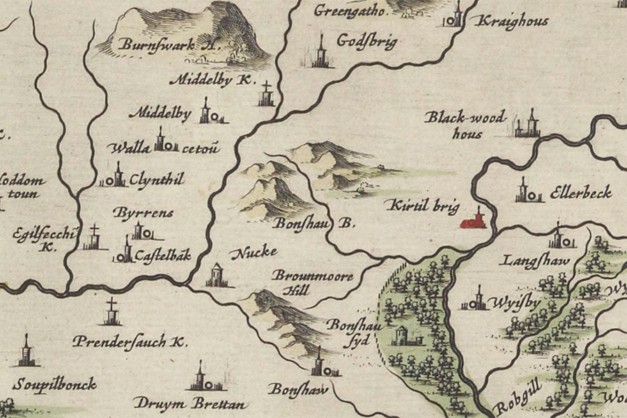

Joan Blaeu, Amsterdam, 1654map image courtesy of NLS
A tower named Bonshausyd is marked on Blaeu’s mid-17th century map, based on Pont’s late 16th century work, although no trace of it remains.
The tower is given more prominence than the nearby Bonshaw Tower and is shown as a large tower with courtyard set within extensive parkland along the west bank of the Bonshaw Burn.
Bonshawside was burned in 1586.
On the 7th of October 1668 David Murray, 5th Viscount of Stormont, received a grant of the barony of Lochmaben which included Bonshawsyde.
Bonshawside is marked on Roy’s mid-18th century map as what appears to be a farmstead with no formal gardens.
I have placed the location of the tower at Bonshawside farmhouse pending further research.
Alternative names for Bonshawside
Bonshausyd; Bonshawhead; Bonshawsyd; Bonshawsyde
Where is Bonshawside?
Bonshawside is in the parish of Annan and the county of Dumfriesshire.
Grid reference: NY 23020 72358
Lat / long: 55.039754, -3.206111


