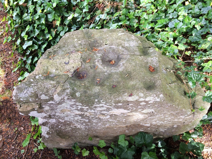
Fortingall churchyard
This stone bears 9 cup marks, and was found buried at a depth of 2.40 metres, close to the famous yew tree (approximately 8 metres from its current location).
It measures 0.9m tall by 0.9m wide and 0.5m deep.


Where is Fortingall churchyard?
Fortingall churchyard is in the parish of Fortingall and the county of Perthshire.
Grid reference: NN 7417 4703
Lat / long: 56.59808796, -4.050818818
OS Map for Fortingall churchyard
Directions to Fortingall churchyard
Enter a starting point
Get directions

Weather at Fortingall churchyard
11°C
max 11°C / min 11°C
max 11°C / min 11°C
7km/h SW
1024mb
92%
100%
04:13 20:11
1024mb
92%
100%
04:13 20:11
Light rain
Weather observed at Aberfeldy at 21:25
References (websites)
Ancient sites near Fortingall churchyard
Castles near Fortingall churchyard
Pictish stones near Fortingall churchyard

Pictish sites near Fortingall churchyard
Accommodation near Fortingall churchyard
The Kenmore Hotel
3.5km away
Coshieville House
4.1km away
Ben Lawers Hotel
9.7km away
Aberfeldy Weem Hotel
10.4km away
Moness House Hotel & Country Club
12.5km away
Ardeonaig Hotel and Restaurant
13.5km away
Dunalastair Hotel
14.2km away
Macdonald Loch Rannoch
14.8km away
Loch Tummel Inn
15.1km away
The Bridge Of Lochay Hotel
21.4km away
Accommodation search
Cafés, restaurants & bars near Fortingall churchyard
House of Menzies
9.2km away
Aberfeldy Weem Hotel
10.4km away
The Watermill
11.5km away
Habitat Café
11.6km away
Dunalastair Hotel
14.2km away
Macdonald Loch Rannoch
14.8km away
Glenlyon Tearoom
16.0km away
House of Bruar
20.5km away
The Courie Inn
22.1km away
Atholl Arms Hotel, Blair Atholl
22.4km away


