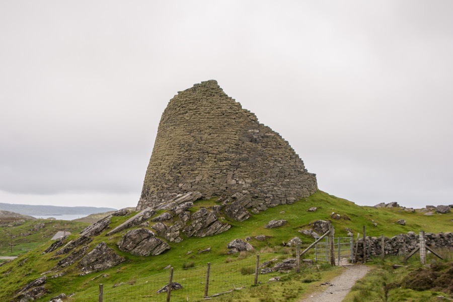
Dun Carloway
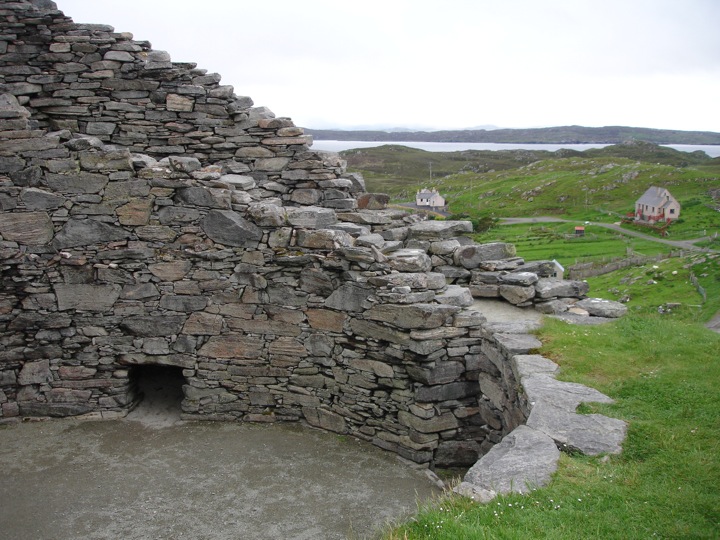
Dun Carloway is one of the best preserved brochs in the Western Isles, with one side of it still reaching a height of nearly 10m.
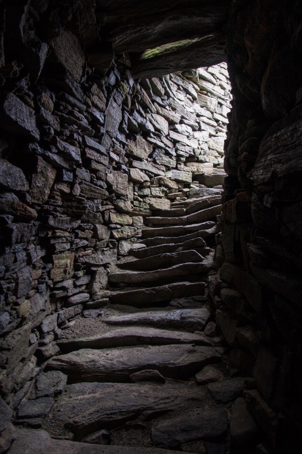
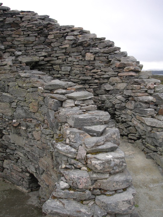
Inside the 4m thick walls there are still inter-mural passageways and the remains of a staircase which can be climbed.
The broch stands on a small hillock high above Loch an Duin and commands great views over the landscape below.
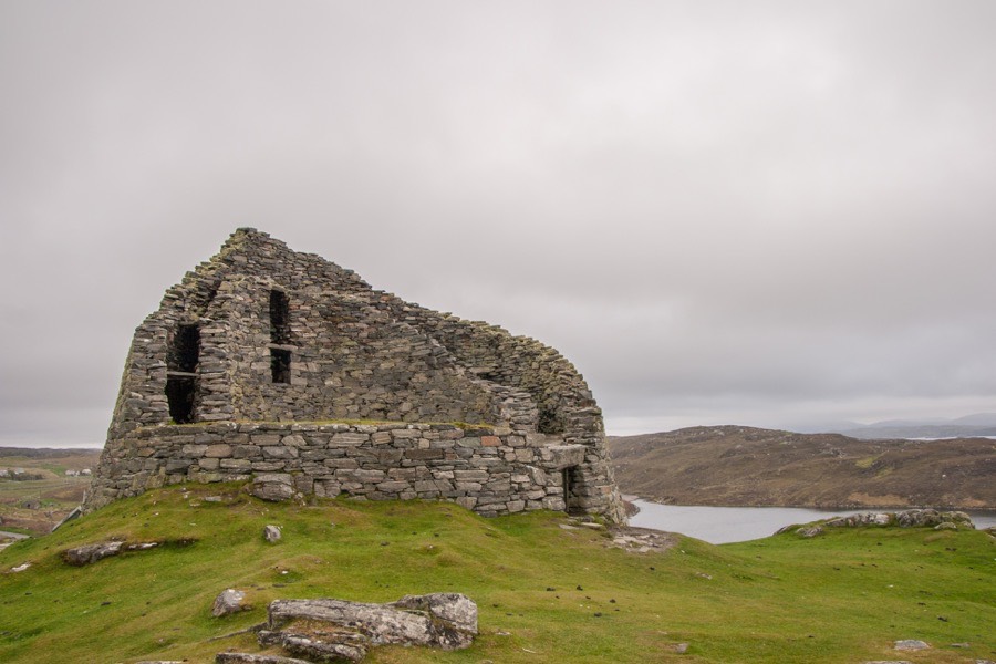
It is thought to date from the 1st century BC.


Alternative names for Dun Carloway
Charlabhaigh; Doune Carloway; Dun Charlabhaigh; Dùn Chàrlabhaigh
Where is Dun Carloway?
Dun Carloway is in the parish of Uig and the county of Ross and Cromarty.
Grid reference: NB 1900 4123
Lat / long: 58.269548, -6.794046
OS Map for Dun Carloway
Directions to Dun Carloway
Enter a starting point
Get directions

Weather at Dun Carloway
5°C
max 6°C / min 5°C
max 6°C / min 5°C
15km/h NNE
1008mb
70%
100%
04:45 20:04
1008mb
70%
100%
04:45 20:04
Overcast clouds
Weather observed at Stornoway at 07:06

References (websites)
Ancient sites near Dun Carloway
Castles near Dun Carloway
Pictish stones near Dun Carloway
Pictish sites near Dun Carloway
Accommodation near Dun Carloway
Garenin SYHA Hostel
2.9km away
Valasay Self Catering Holidays
5.6km away
Heb Hostel
24.7km away
Cairn Dhu Apartment
24.8km away
Solas
24.8km away
Kershader SYHA Hostel
25.8km away
Holm View Guest House
29.1km away
Amhuinnsuidhe Castle
36.1km away
Rhenigidale SYHA Hostel
39.6km away
Hotel Hebrides
41.4km away
Accommodation search
Cafés, restaurants & bars near Dun Carloway
Hotel Hebrides
41.4km away
The Old Inn
90.0km away
Ullinish Lodge Hotel
104.0km away
Ullapool Hotel
104.9km away
Duisdale House Hotel
136.6km away
The Old Forge
151.7km away
Ben Wyvis Hotel
152.3km away
Tulloch Castle Hotel
156.4km away
Cluanie Inn
157.4km away
Ord House Hotel
158.9km away


